
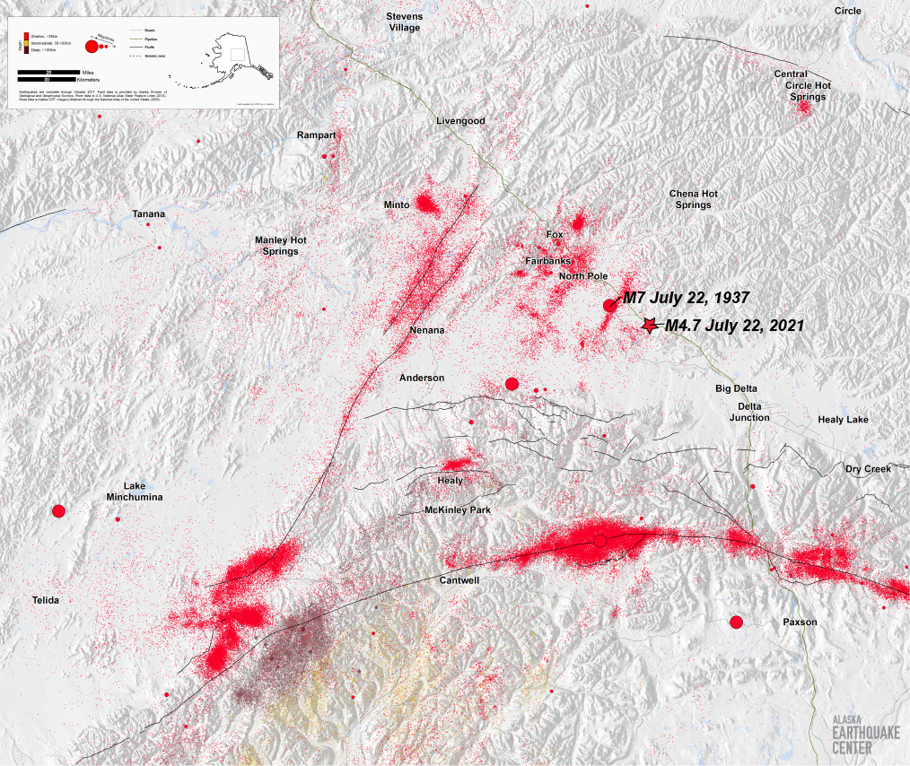


Many people in Interior Alaska felt the M4.7 earthquake near Salcha tonight, July 22, 2021, at 8:20 pm AKDT (Figure 1). This earthquake occurred in the Salcha Seismic Zone, a well-known area of seismicity with no notable fault traces on the surface. This zone has produced many earthquakes, including a M7 on July 22, 1937, exactly 84 years ago, to the day (Figure 1). Tonight’s earthquake is quite close to the estimated location from 1937. The fact that they both occurred on the same day 84 years apart is a statistical quirk, there is no scientific meaning behind tonight’s event happening on the anniversary of the 1937 M7, but it is, nevertheless, interesting.
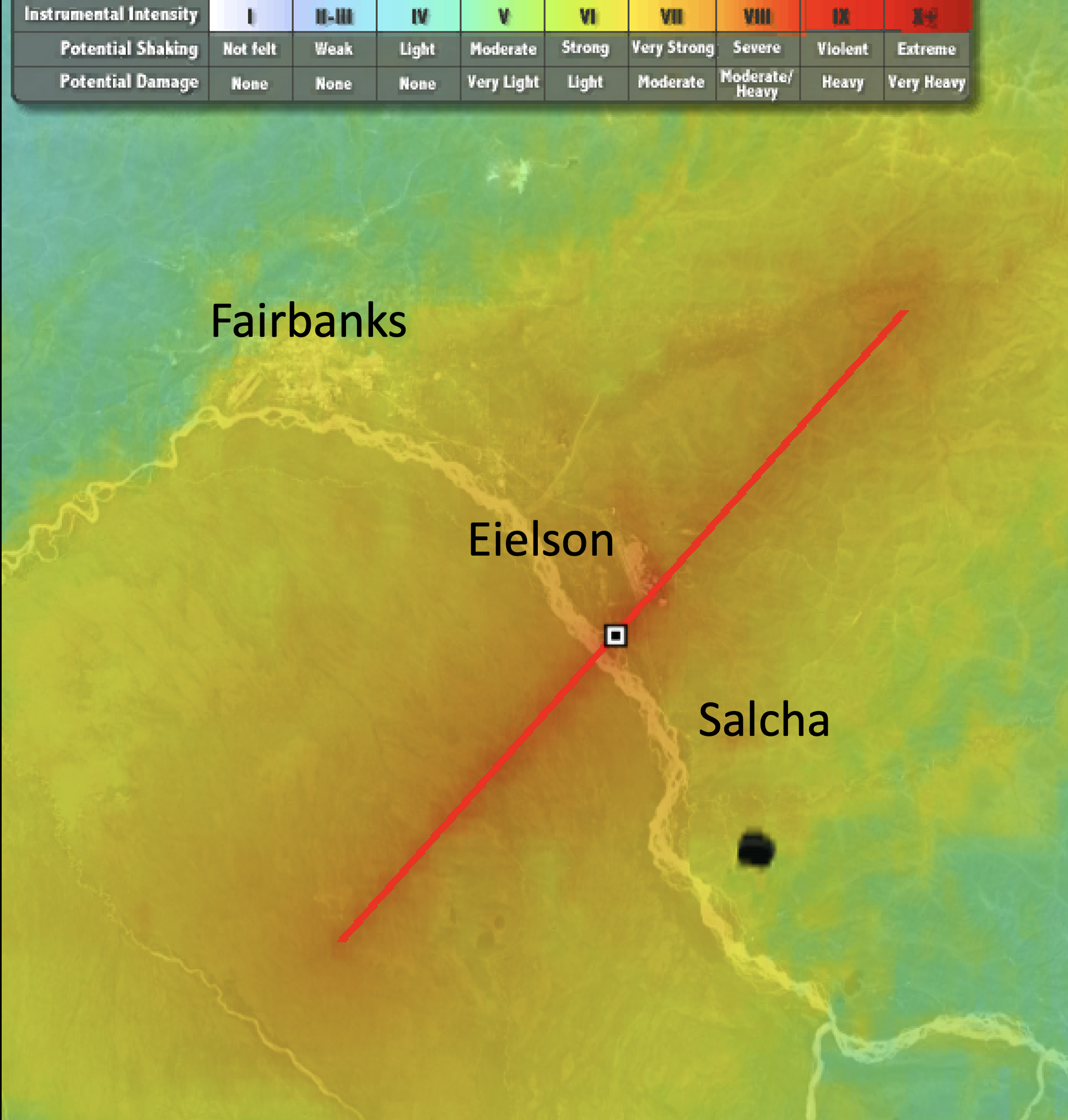
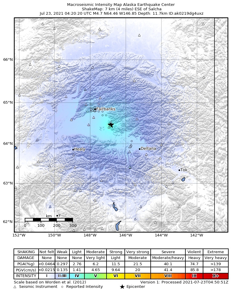
What is most interesting is how far the science of seismology has come since 1937. For instance, the location of the 1937 event was not known until three years after it occurred (Adkins, 1940). There were only two seismic stations in the entire state of Alaska at this time, and neither of them could be used for the location because of discrepancies in timing (Adkins, 1940). Maps of estimated shaking at the time were extremely rudimentary. Questionnaires were mailed to people to be filled out and returned, and thus took many months to produce. We can attempt to reconstruct what shaking intensity might have been like using modern techniques (Figure 2), but due to limited instrumental recordings, the location, magnitude, and depth are all estimates. The map produced for tonight's earthquake (Figure 3) took less than 5 minutes to create, corroborate, and adjust the estimates based on recordings from the hundreds of seismic stations now operating in Alaska.
Earthquakes like tonight’s M4.7 are not unexpected and serve as reminders that larger-magnitude earthquakes can occur in the Interior. In fact, ShAKe, a virtual exhibit at the University of Alaska Museum of the North, is dedicated to a century of Interior Alaska earthquakes. The exhibit contains newspaper clippings, photos, interviews and more, including those from the 1937 M7 Salcha earthquake.