


Scientists assessing tsunami threats throughout Alaska recently modeled the flooding scenario of the 1964 Great Alaska Earthquake and discovered that a tsunami could reach upper Cook Inlet, countering a long-held public belief that the region has no tsunami risk.
A new report by the University of Alaska Fairbanks and Alaska Division of Geological & Geophysical Surveys reveals an updated understanding of how tsunamis interact with tides and of the region’s potential tsunami hazard.
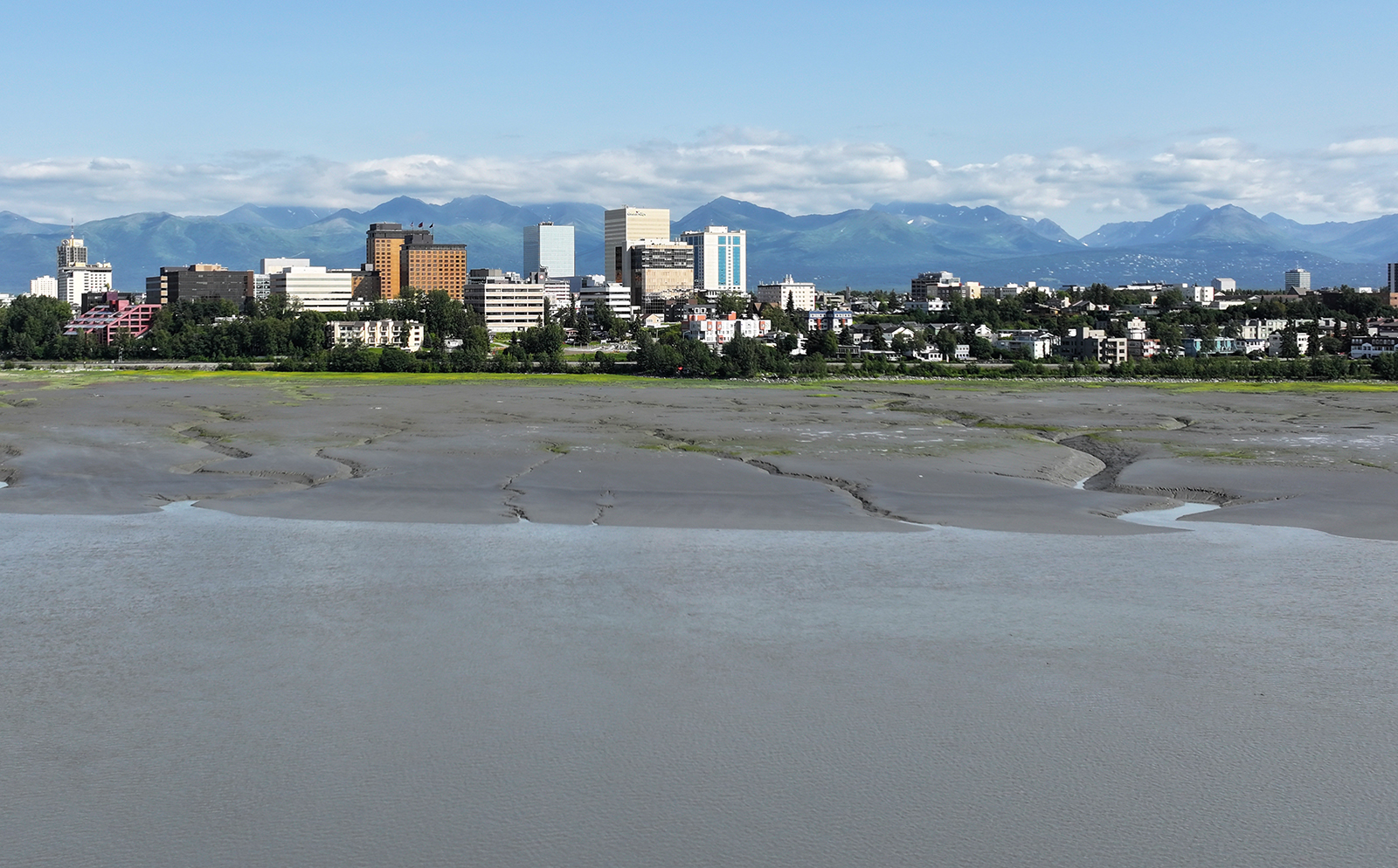
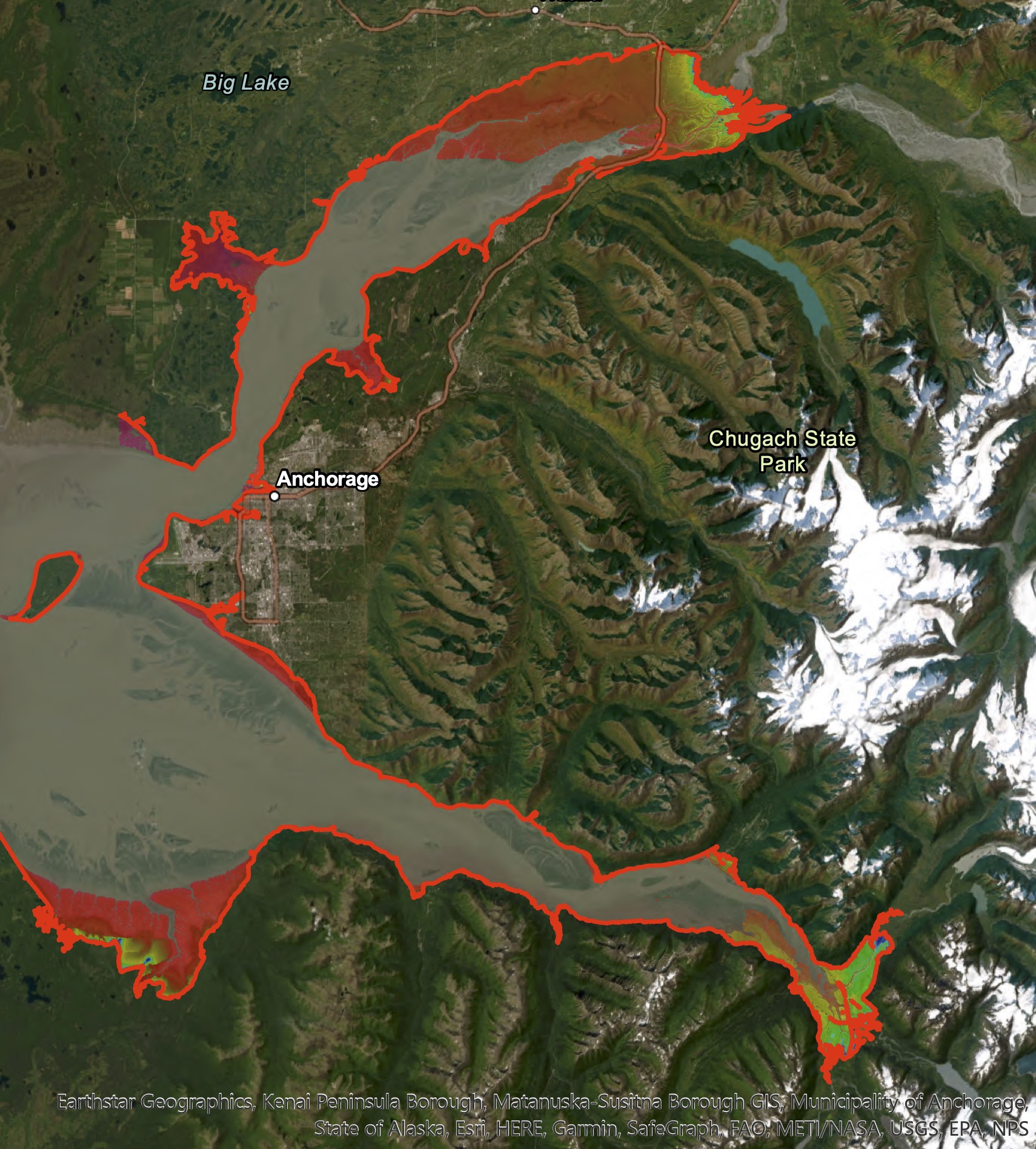
The report indicates that flooding could follow about four hours after an earthquake similar to that of 1964 that ruptured in the Gulf of Alaska off the Kenai Peninsula. Affected areas could include low-lying parts of Anchorage, as well as Knik Arm up to the mouths of the Matanuska and Knik rivers and past the Glenn Highway crossings. Turnagain Arm, Hope and Girdwood could also experience flooding.
Associated coastal currents could be several knots faster than normal tidal currents and could persist for up to 72 hours.
For decades, public perception has been that upper Cook Inlet, including Alaska’s biggest city, Anchorage, has virtually no tsunami risk. This belief has persisted because many, including scientists, thought wave energy dissipates as it travels Cook Inlet’s length along the shallow, gently sloping floor.
“When I looked at all the arguments about why Anchorage is immune to tsunamis, I couldn’t find a single good argument,” said Elena Suleimani, a tsunami modeler with UAF’s Alaska Earthquake Center and member of a three-person team that has been investigating tsunami threat throughout Alaska.
Suleimani worked with Dmitry Nicolsky, research associate professor with the UAF Geophysical Institute, and Barrett Salisbury, Earthquake and Tsunami Hazards Program manager at the Alaska Division of Geological & Geophysical Surveys. Their full report was released today on the division’s website.
Although it was generally believed that no tsunami reached Anchorage from 1964’s magnitude 9.2 earthquake, the computer modeling shows a tsunami likely did occur.
“How was this wave not noticed by people?” Nicolsky said. The answer: It arrived hours later at low tide, according to the modeling results.
The impact could have been extensive had the tsunami arrived at high tide. It turns out that assessing potential tsunami impacts in upper Cook Inlet is much more complicated than simply considering its length and depth.
This new comprehensive tsunami hazard study for upper Cook Inlet was funded by NOAA’s National Tsunami Hazard Mitigation Program. It is part of a wider campaign, begun in 1998, to assess the flooding hazard to all coastal Alaska communities. The program’s scientists prioritized communities with a history of significant tsunami damage, so it wasn’t until around 2018 that they began examining upper Cook Inlet.
The scientists combined three significant tsunami hazard components to produce the upper Cook Inlet tsunami hazard assessment:
A tsunami arriving during high tide could cause significant flooding and damage. At high tide, upper Cook Inlet’s water level is, on average, 40 vertical feet higher than it is at low tide. The extent of flooding depends on how — and for how long — a tsunami navigates such a dynamic tidal regime.
The 1964 quake struck at 5:36 p.m. on March 27, at high tide in Anchorage, but according to the model it would take a tsunami wave more than eight hours to traverse the inlet and reach Anchorage. At its 2 a.m. landfall, the tsunami would have encountered empty shores at low tide. Despite being 10 feet high, according to the model, the wave was lower than high-tide level in upper Cook Inlet, so it caused no flooding.
“A rare combination of earthquake magnitude, location and timing must be satisfied for tsunami wave energy to reach upper Cook Inlet at the same time as a natural high tide,” Salisbury said.
While the risk of this exact confluence of events is rare, upper Cook Inlet residents should still be aware and prepared.
A story map about Anchorage tsunami hazard is available here.
Interactive tsunami hazard maps for coastal Alaska communities are available here.
View the full, peer-reviewed report, including GIS data and map sheets and a simulation video of a hypothetical earthquake–tsunami dynamics here.