


Though I was awake in bed at 6:32am on Sunday morning (June 11, 2023) and did not feel it, folks across a swath of the Interior felt a M5 earthquake that occurred about 20 miles south of Circle. No damage has been reported. We would generally consider this a relatively light earthquake. It is significant, however, because of the clues it provides into the source of earthquakes in this region of Alaska, and specifically, the Tintina Fault.
Alaska is being slowly compressed north-south by the motion of the Alaska-Aleutian subduction zone that runs along our southern coast (see animations here). Many of the faults that crisscross the interior are a response to that compression. The best known of these is the Denali fault that runs through the Alaska Range and spawned the 2002 M7.9 earthquake—the largest inland earthquake in North America in 150 years. Through the years the Denali fault has produced thousands of tiny earthquakes. While each of these little earthquakes is inconsequential on their own, together they paint a detailed picture of the fault. I am not very knowledgeable of art, but I recall the technique of Pointillism I learned in college. The way these tiny earthquakes combine to paint a picture of the fault system remind me of this.
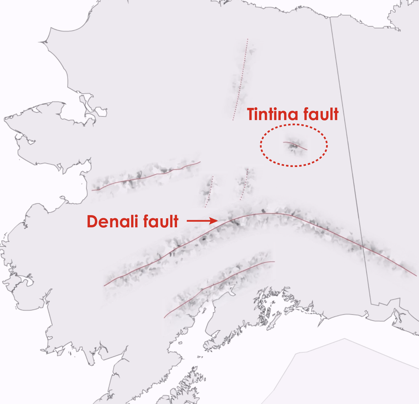
Two hundred miles to the north of the Denali fault, there is a much more enigmatic fault system called the Tintina. If you look on our Earthquakes in Alaska page, the Tintina fault is the small segment near the Canadian border (Fig. 1). There is good reason to theorize that this fault may extend further west. But we lack clear evidence.
The Tintina fault shows clear geologic evidence of movement over the past 15,000 years. But it does not produce the steady stream of tiny earthquakes that would help reveal itself. As a consequence, we know little about it. We don’t have a good sense of what size earthquakes it can produce, nor how often we should expect them. These parameters are important when we try to update estimates of regional seismic hazard, an effort that the US Geological Survey is leading throughout 2023.
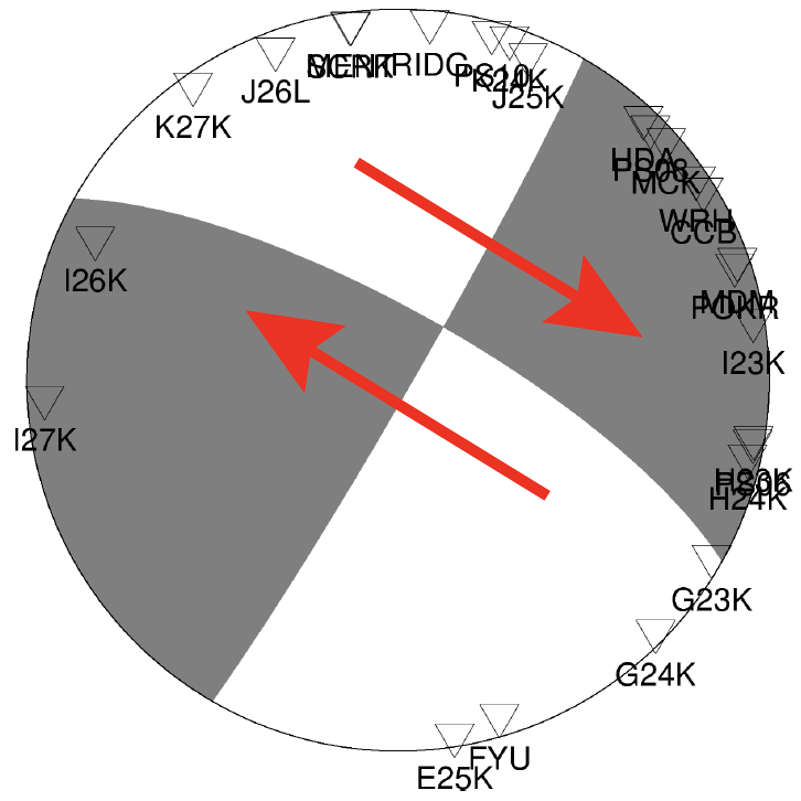
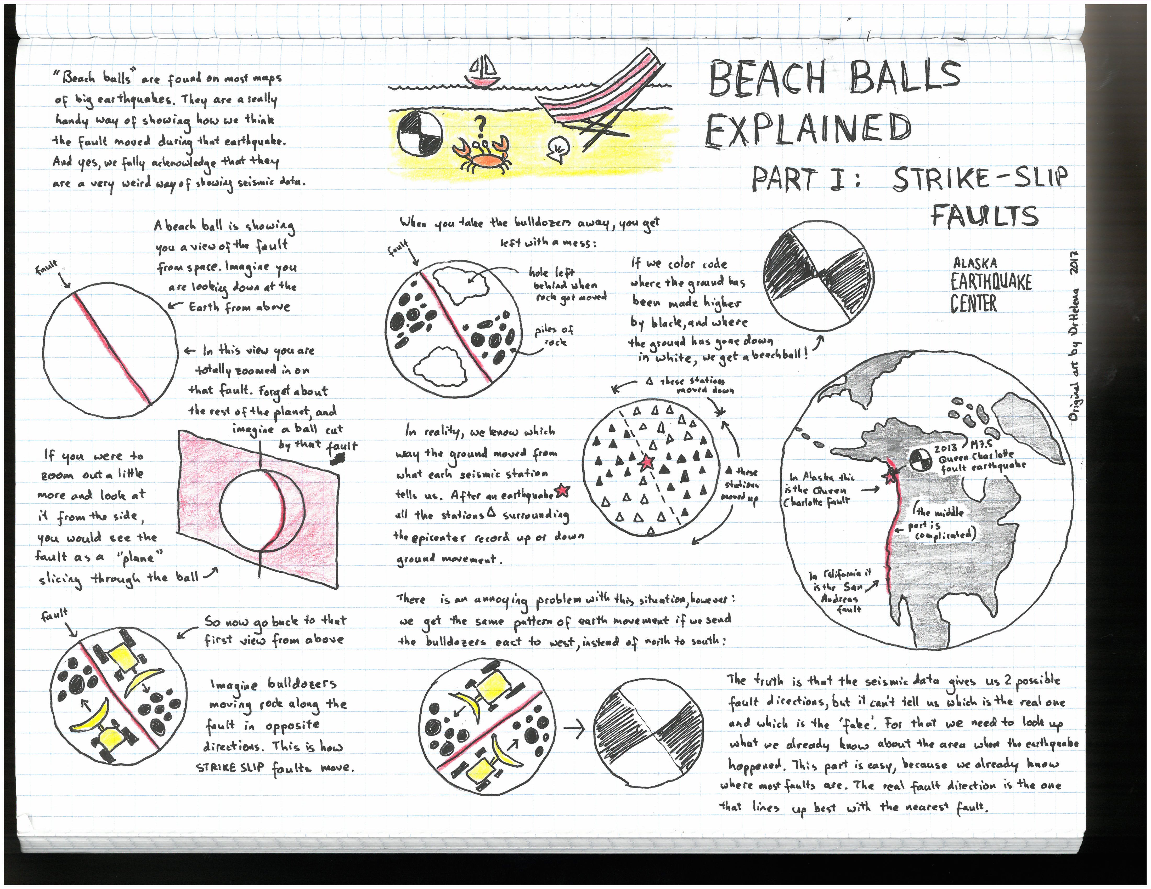
This morning’s earthquake appears to have occurred on the Tintina fault itself. We infer this from its location, and also the direction of motion. The "beachball" figure shown at right (Fig. 2) is a technical way of representing the motion of a fault. The arrows, added by me, show the direction of motion of the strike-slip earthquake that we believe happened today. This motion aligns precisely with what we might expect on the Tintina. (For more on how to interpret focal mechanism beachball figures, see Fig. 3). Together, this evidence supports that this earthquake is part of the Tintina fault. A quick look shows just four previous earthquakes in this area that were at least M4. All were smaller than today’s earthquake (M4.0 1993, M4.3 1998, M4.3 2013, M4.0 2016).
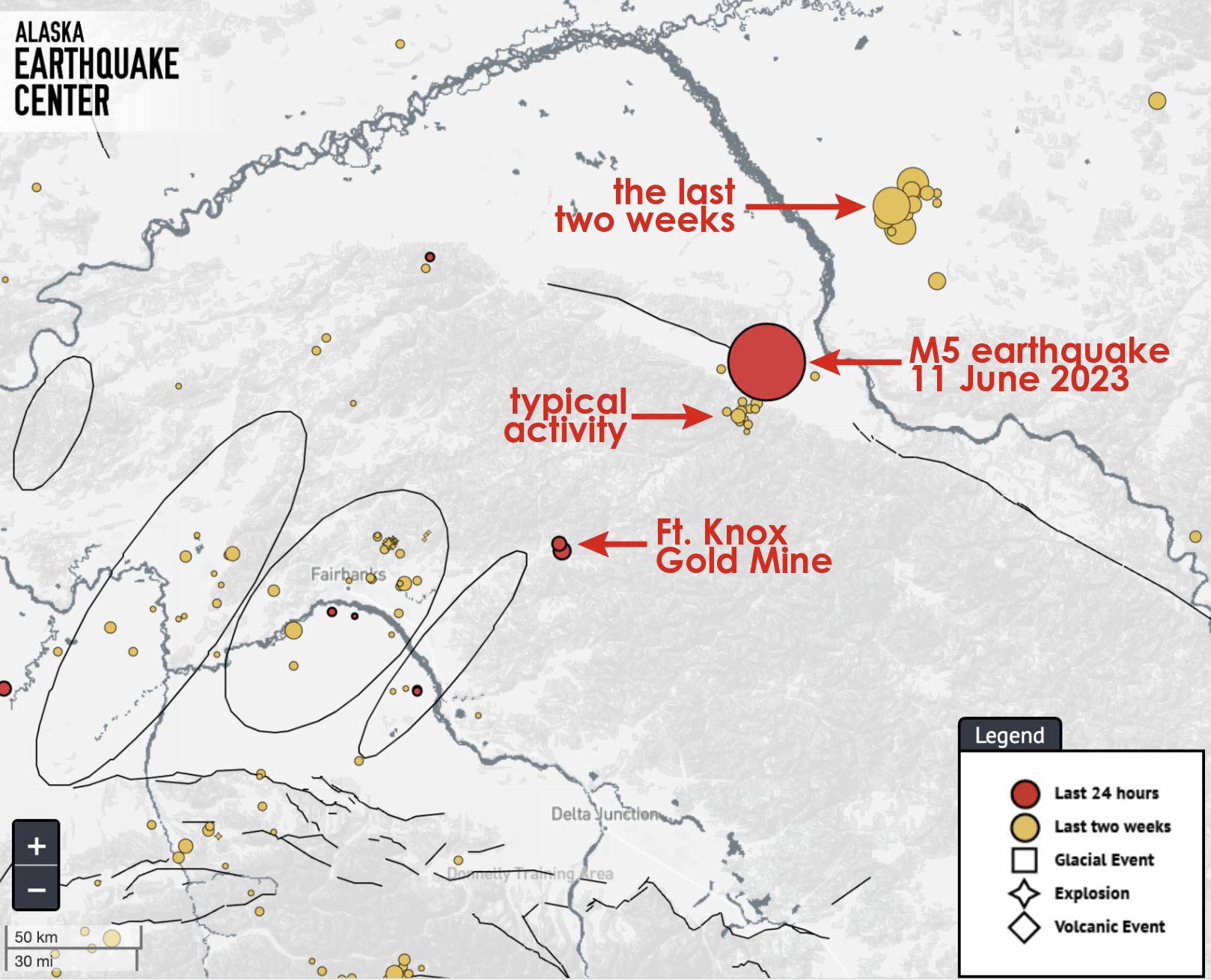
There has been minor seismic activity in the days prior (Fig. 4). The cloud of earthquakes to the southwest is typical seismic activity. But 40 miles or so the northeast there have been several magnitude 2 and 3 earthquakes over the past couple of weeks. How are these related? I don’t know. But understanding these connections is precisely why we care about, and research, unusual earthquakes such as the one today.