


1964 M9.2 Great Alaska Earthquake
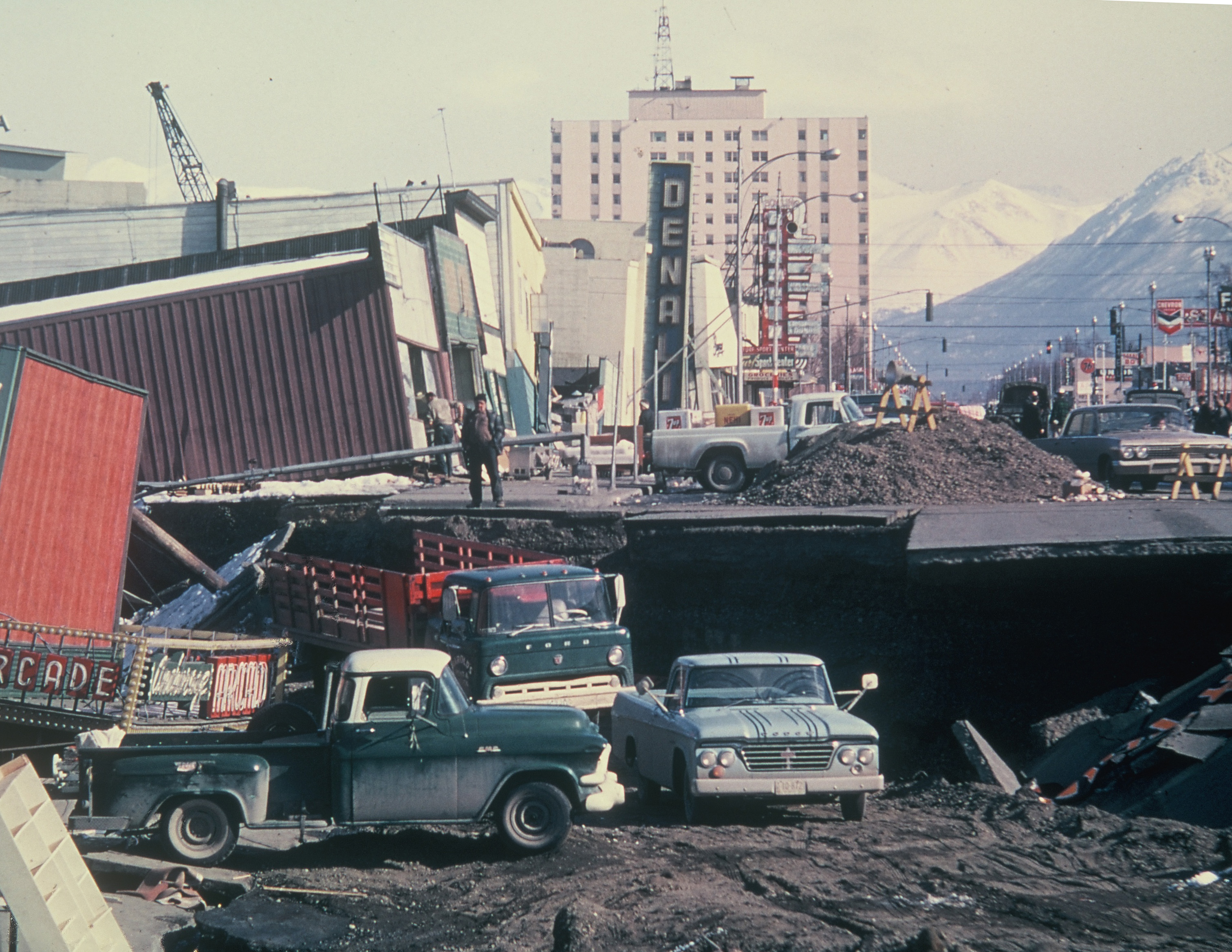
The impacts from the Great Alaska Earthquake were far-reaching. Widespread damage occurred across southcentral Alaska spanning an area of 130,000 square kilometers, or more than 32 million acres.
There were 131 fatalities linked to the earthquake; 115 in Alaska, 16 in Oregon and California, of which 90% were due to tsunamis. The earthquake was felt far and wide, across all of Alaska, parts of Canada and as far south as Washington. It swayed the Space Needle in Seattle and sloshed water out of pools in New Jersey.
The earthquake occurred early on a Friday evening that also happened to be Good Friday. As a result, many people were awake and at home, not gathered in businesses or schools.
The majority of damage to Anchorage has been linked to weak soil. Turnagain Heights lost approximately 200 acres and 75 homes when the bluff collapsed.
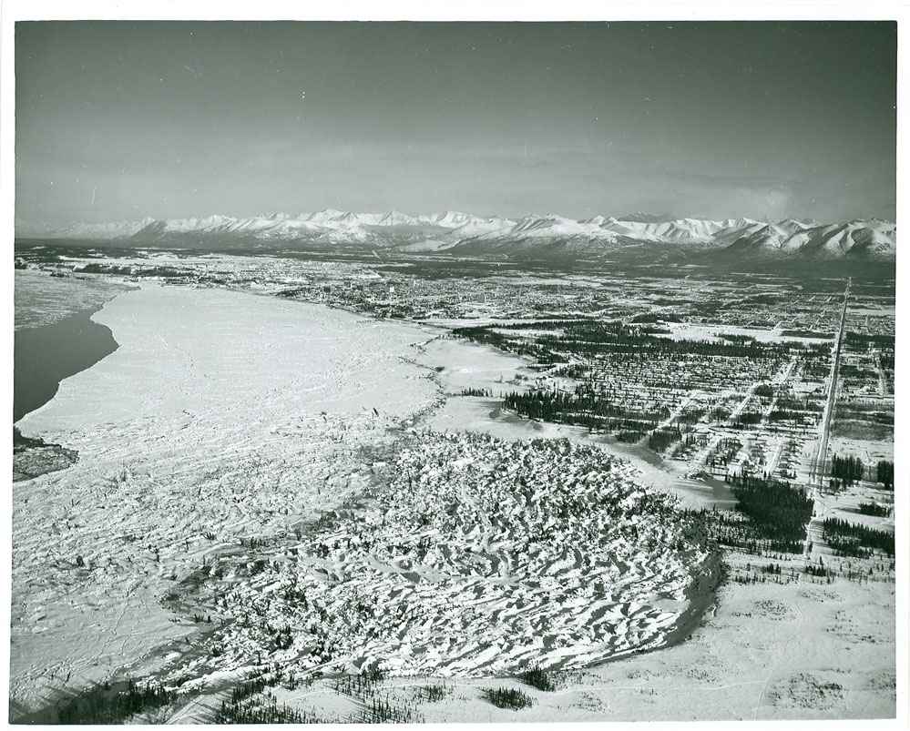
Some portions of southern Alaska dropped several feet (subsidence), while others were uplifted. Permanent subsidence created the “ghost forests” seen in Turnagain and Knik arms. In other coastal regions, evidence of the pre-earthquake shorelines can be seen.
Since the earthquake, Alaska has rebuilt stronger and more informed. Anchorage adopted strong building codes. Valdez rebuilt four miles away on sturdier ground. Seward repurposed parts of its waterfront.
In 1987, the Alaska legislature established the Alaska Earthquake Center as a partnership between the USGS and the University of Alaska Fairbanks (Alaska Statute 14.40.075). With the establishment of the Alaska Earthquake Center, a seismic monitoring began.
In 2002, the Alaska legislature established the Alaska Seismic Hazards Safety Commission (AS 44.37.067).
Many coastal communities have participated in tsunami inundation studies and generated evacuation routes and safe zones.
Frequent drills are now used to prepare people for future earthquakes.