
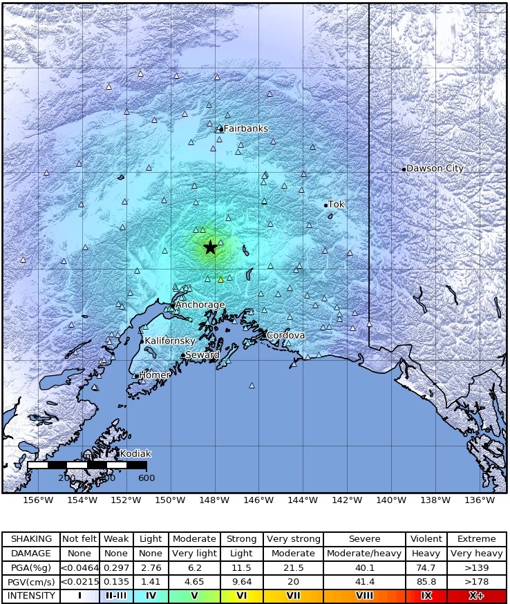


The magnitude 6.1 earthquake late in the evening on Sunday May 30 occurred about 100 km, or 60 miles, east of Talkeetna and was felt across much of mainland Alaska. In our shakemap for this event (Figure 1) the region that experienced shaking corresponds roughly to the areas marked in light blue, including everything from the Kenai, to Fairbanks, to Cordova and east. Most people who experienced this earthquake were a considerable distance away. As a result, the shaking was mostly experienced as long rolling motions and not the sharp jolt experienced by people close to the epicenter. The triangles in Figure 1 show the locations of instruments we used to measure the shaking. The closest stations registered shaking equivalent to about 5% of the acceleration of gravity (or ‘’5% g”) Though generally not enough to cause significant damage in Alaska, it certainly woke up a lot of folks who had turned in for the evening. Though aftershocks are occurring and should continue, the location makes it unlikely that many of these will be felt, except by folks living quite close to the epicenter.
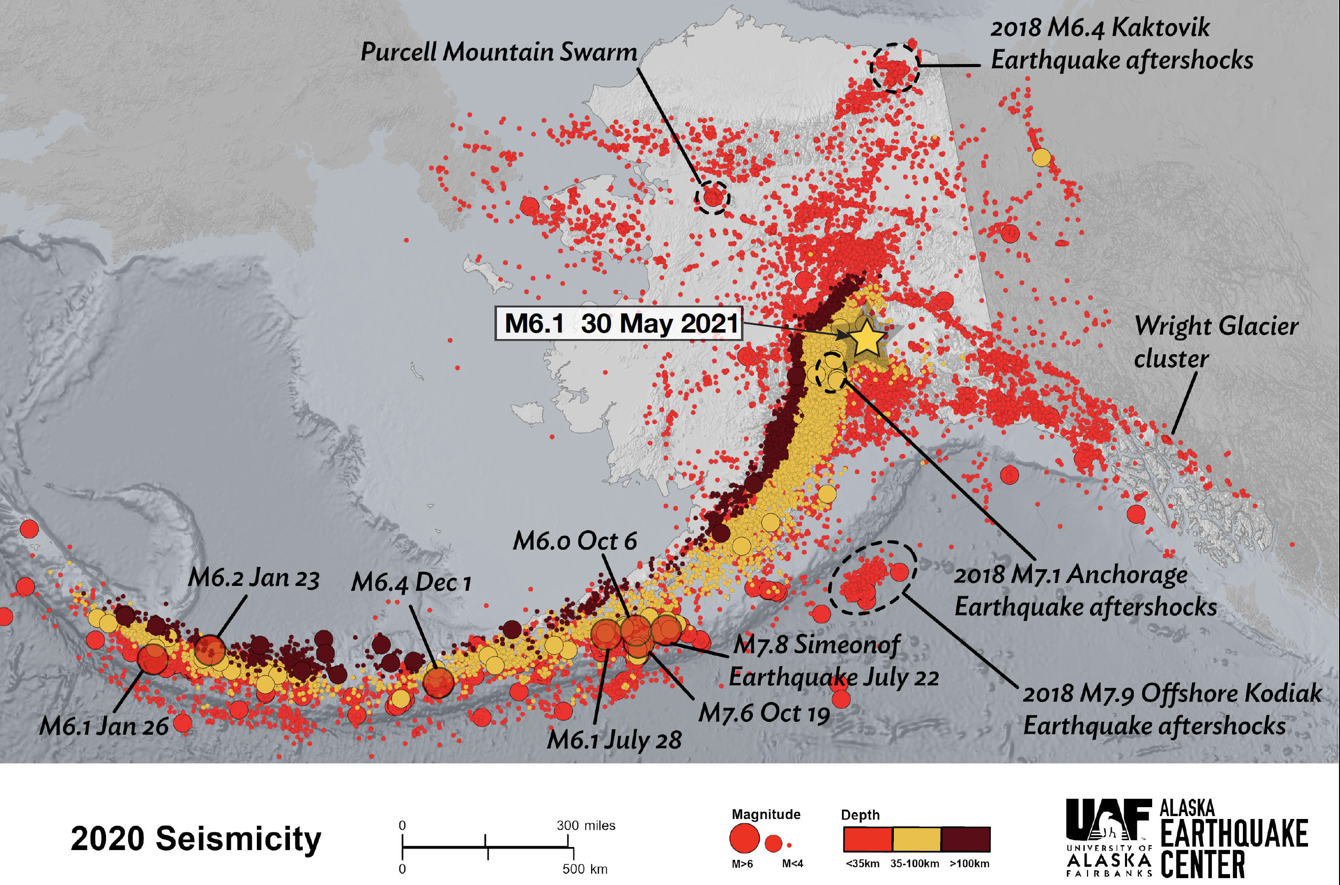
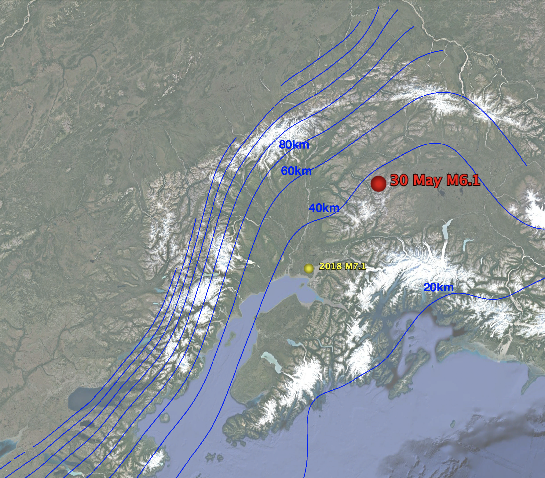
This earthquake was not a surprise (geologically speaking). Figure 2 is a map of all earthquakes that occurred in 2020 with this earthquake annotated on top. Like many earthquakes in southern and central Alaska, this one was caused by the process of subduction that occurs along our southern coast where the Pacific tectonic plate is being thrust under Alaska. Figure 3 shows the contours of this tectonic plate underneath Alaska becoming progressively deeper to the north. Sunday’s earthquake occurred about 44km deep, suggesting that the earthquake technically occurred inside the Pacific Plate. This is further proven by the direction and motion of the fault. The motion suggests that the earthquake resulted from the tremendous tension that the plate experiences as it is pulled downward into the earth. This is a common source of earthquakes. In fact, so far the source of this earthquake looks extremely similar to the 2018 Anchorage earthquake, marked in Figure 3 in yellow. Both earthquakes occurred 40-50 km beneath the surface, inside the Pacific plate, in response to tension in the subduction process. This animation on our Youtube channel illustrating the source of the 2018 earthquake seems entirely appropriate to Sunday's quake as well.
This style of earthquake occurs in a great swath across the subduction zone (Figure 2) extending from mainland Alaska beyond the Aleutian Islands toward Russia. One thing that is notable about this earthquake, however, is that we have few records of similar earthquakes occurring east of this. This is an enigmatic region of the subducting Pacific Plate thought to be much thicker and stronger (search ‘Yakutat Block’ for more on this). I find Sunday’s earthquake interesting because it demonstrates that the same basic processes that operate elsewhere in the subduction zone are at work here too, regardless of whether or not the downgoing plate has a different structure in this region. So was it a surprise to see this type of earthquake? Not in the least. But like most earthquakes, there is something to learn here if we are willing to pay attention.