


K13K
Kusilvak Mountain, AK, USA
Operated by: Alaska Earthquake CenterLatitude: 61.9331 N
Longitude: -164.6555 W
Elevation: 669.9 feet (204.2 meters)
Installed: 2017
Instrumentation at this station includes:
broadband seismometer
meteorological package
Infrasound sensor
Soil temperature probe
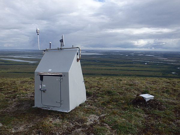
K13K was installed in 2017 as part of the temporary USArray project and integrated in 2020 into the permanent Alaska network as part of the National Science Foundation-sponsored Alaska Geophysics Arctic Observing Network project. Located on top of a rise in the foothills of the Kusilvak Mountains, K13K overlooks the Black River. This small, isolated mountain range is surrounded by pond-riddled tundra. At one site visit the field team noted, "Corrosion was noteworthy on external metal components and cables. Courtesy of Bering Sea influence." Wildlife can be a challenge: previously at this site some wires were severed, possibly by a fox, and a bird had removed one of the weather sensors. Ice on the equipment can add an extra challenge in early spring. Photo courtesy of Array Network Facility.
The Last 24-Hours
UTC times are 9 hours ahead of Alaska time (8 hrs during daylight savings). Seismogram view is courtesy of the IRIS Data Management Center. For additional views of this stations data:
4-day seismogramlong-term spectogram
noise PDF viewer