


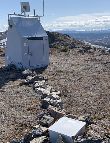
M16K
Timber Creek, AK, USA
Operated by: Alaska Earthquake CenterLatitude: 61.0224 N
Longitude: -158.9593 W
Elevation: 1292.6 feet (394 meters)
Installed: 2017
Instrumentation at this station includes:
broadband seismometer
meteorological package
Infrasound sensor
M16K was installed in 2017 as part of the temporary USArray project and integrated in 2020 into the permanent Alaska network as part of the National Science Foundation-sponsored Alaska Geophysics Arctic Observing Network project. M16K sits on a rocky hilltop along the southwestern edge of the Kuskokwim Mountains. The rocky tundra gives way to boreal forest hugging the bottoms of the drainages. Timber Creek flows into the Aniak River, a tributary of the Kuskokwim River. This site is generously hosted by our partners at the Alaska Department of Natural Resources. Photo courtesy of Array Network Facility.
The Last 24-Hours
UTC times are 9 hours ahead of Alaska time (8 hrs during daylight savings). Seismogram view is courtesy of the IRIS Data Management Center. For additional views of this stations data:
4-day seismogramlong-term spectogram
noise PDF viewer