


Fall might not be the most prudent time for a surveying trip to the Aleutians, but Zeb Maharrey and I lucked out with some beautiful days and only a few periods of cold, blowing rain. We were in the chain to collect elevation data in False Pass, Atka, and Adak. This new data will help tie together all of the survey data we will use to create digital elevation models for tsunami inundation mapping of these communities.
Each of these places has special considerations and surveying challenges. False Pass has only about 60 residents, most living on or near the shoreline along the narrow Isanotsky Strait. We think it was a fox that chewed through our GPS receiver’s power cable at False Pass.
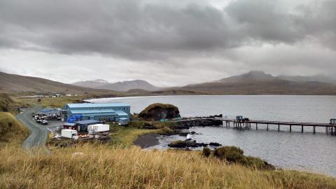
In Atka (population 70), we watched the reindeer herd from our lodgings and toured the island by 4-wheeler, taking note of high points that could be designated as “safety zones” in future pedestrian evacuation studies.
In Adak (population 247), we learned how this island came to be called “The Birthplace of the Winds.” Staying upright, let alone surveying, proved challenging as winds reached 80mph during our stay.
People everywhere were eager to learn about our mission and to share knowledge of their communities. Ultimately this work is about them. Our modeling and mapping seeks to find how far water might travel into these communities in different earthquake scenarios. Communities can use these predictions to plan evacuation routes, site tsunami shelters, and develop their communities as safely as possible.
You can find our completed inundation maps as well as progress on the overall project under the Tsunami tab.