


2018 M6.4 Kaktovik Earthquake
Seismicity in the eastern Brooks Range follows a zone of earthquake activity about 240 miles long and 120 miles wide, from the Beaufort Sea in the north to the Tintina fault in the south. We have recorded over 4,400 earthquakes in this area since 1970, though none as large as this one.
Geologically, this region is poorly understood, and the behavior of the fault or faults responsible for this earthquake are not known. The orientation of the strike-slip mechanism (GCMT, USGS) aligns perfectly with known tectonics and previous earthquakes in the region.
Interferometric analysis using data from the SARVIEWS project compares SAR images taken several days before and after the earthquake. Areas shaded blue moved in a westerly direction by up to 28 cm. Areas shaded red moved eastward by as much as 10 cm.
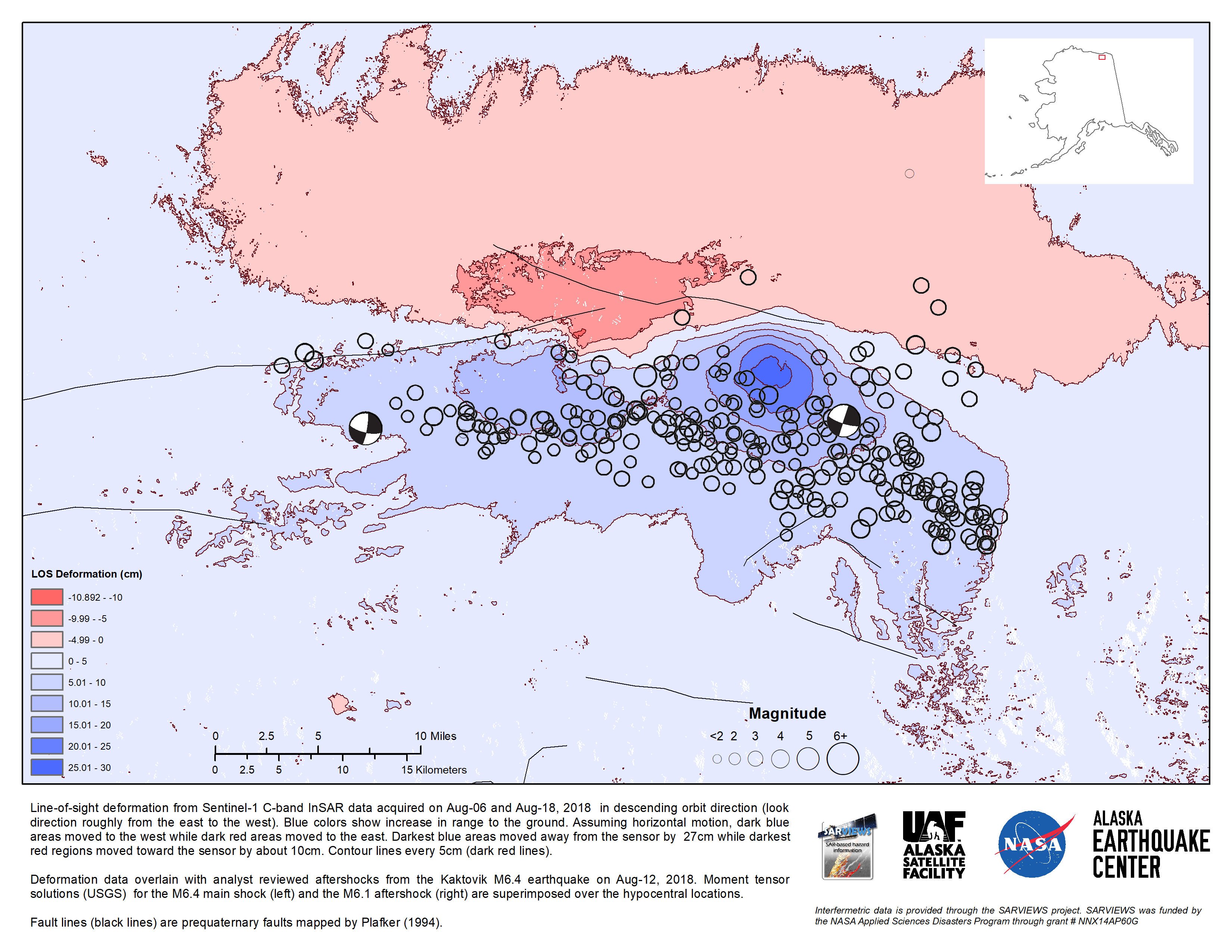
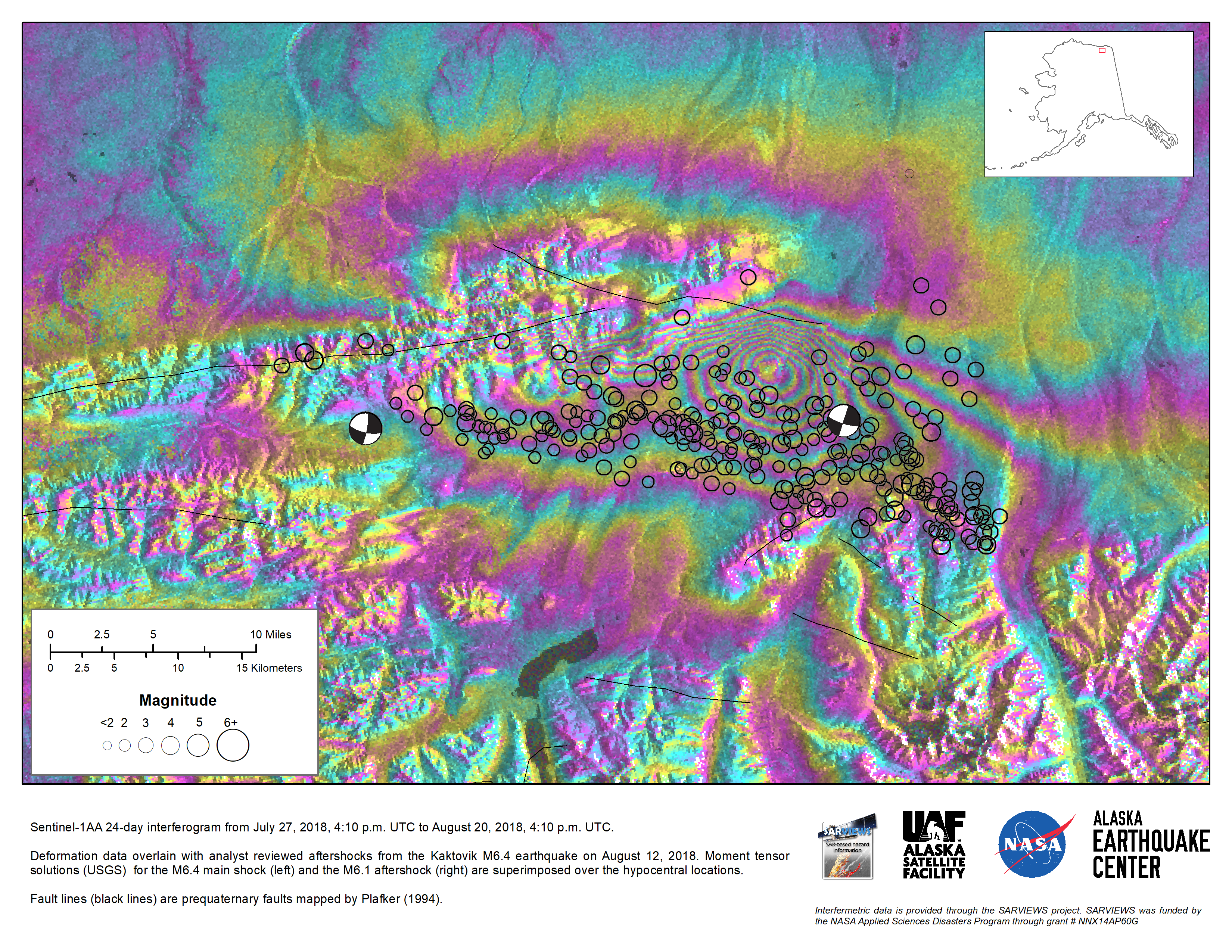
Reviewed aftershocks in the InSAR analysis demonstrate unequivocally that the main rupture was along a roughly east-west strike. The length of surface motion inferred from SAR data agrees well with the aftershock data suggesting a rupture zone of, very roughly, 25 km to 45 km. It is unclear, however, how much of this motion is due to the mainshock vs. the rather substantial aftershocks, including the M6.1 a few hours later. The aftershocks generally appear a few kilometers south of the red/blue dividing line. These locations are probably biased due to our poor understanding of seismic velocities in this area.
A remaining question is whether or not this earthquake broke the surface. If it did, the SAR suggests offsets of just a few 10s of centimeters. Tundra vegetation would mask such an offset without further geologic study.