
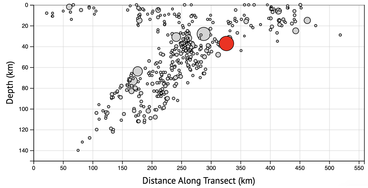
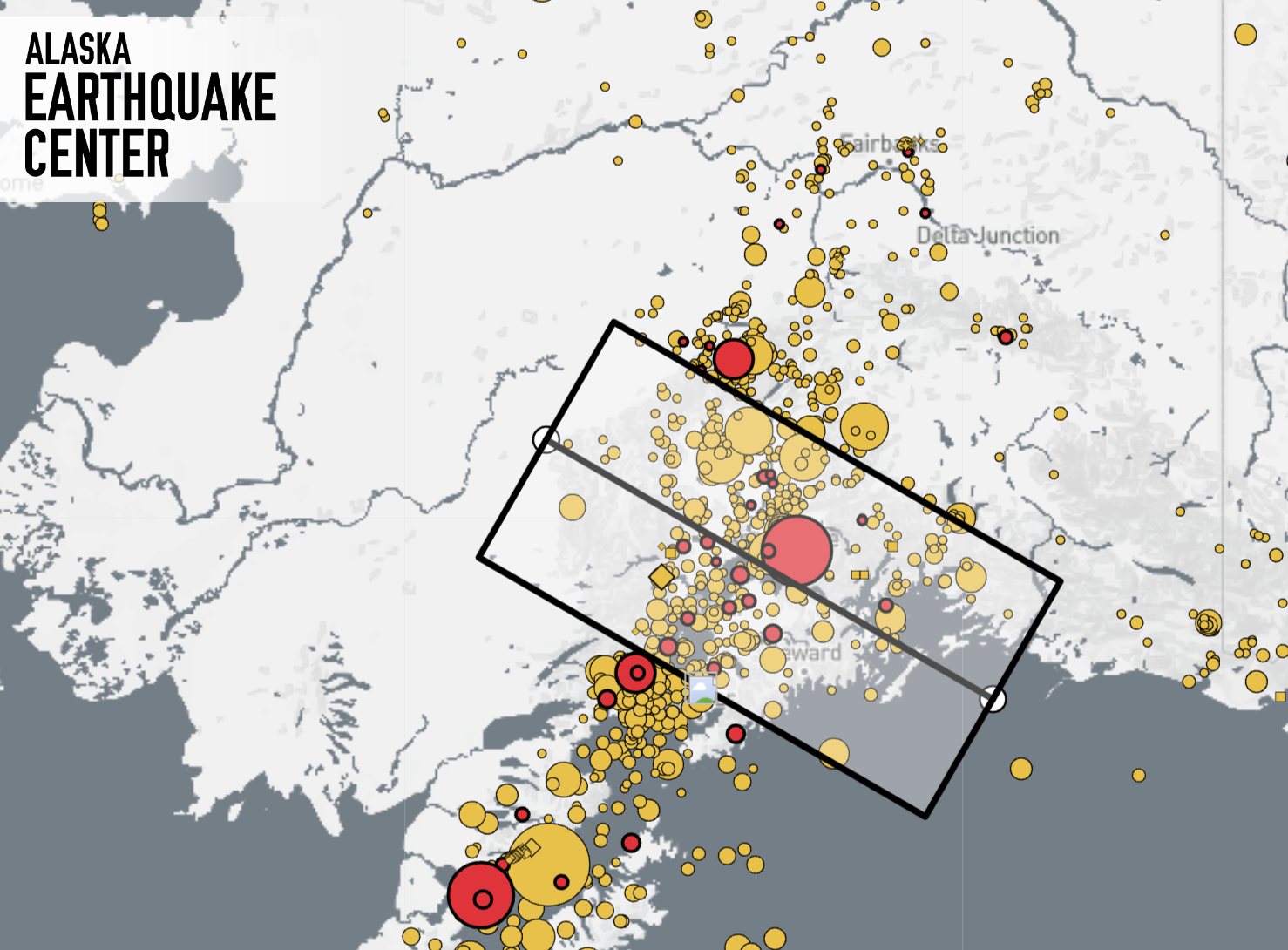


This morning’s M4.6 earthquake under Eagle River (Figures 1 & 2) at 6:47 am on July 3, 2023 woke up many people in Eagle River, Anchorage, and throughout the Mat-Su Valley. The shaking was reported as light to moderate, with reports coming from Eagle River, Anchorage, Chugiak, Wasilla, and as far away as Kenai Peninsula to the south and Talkeetna to the north. This event’s source is similar to the 2018 M7.1 Anchorage Earthquake: both were normal faulting events due to subduction of the Pacific Plate beneath Alaska.
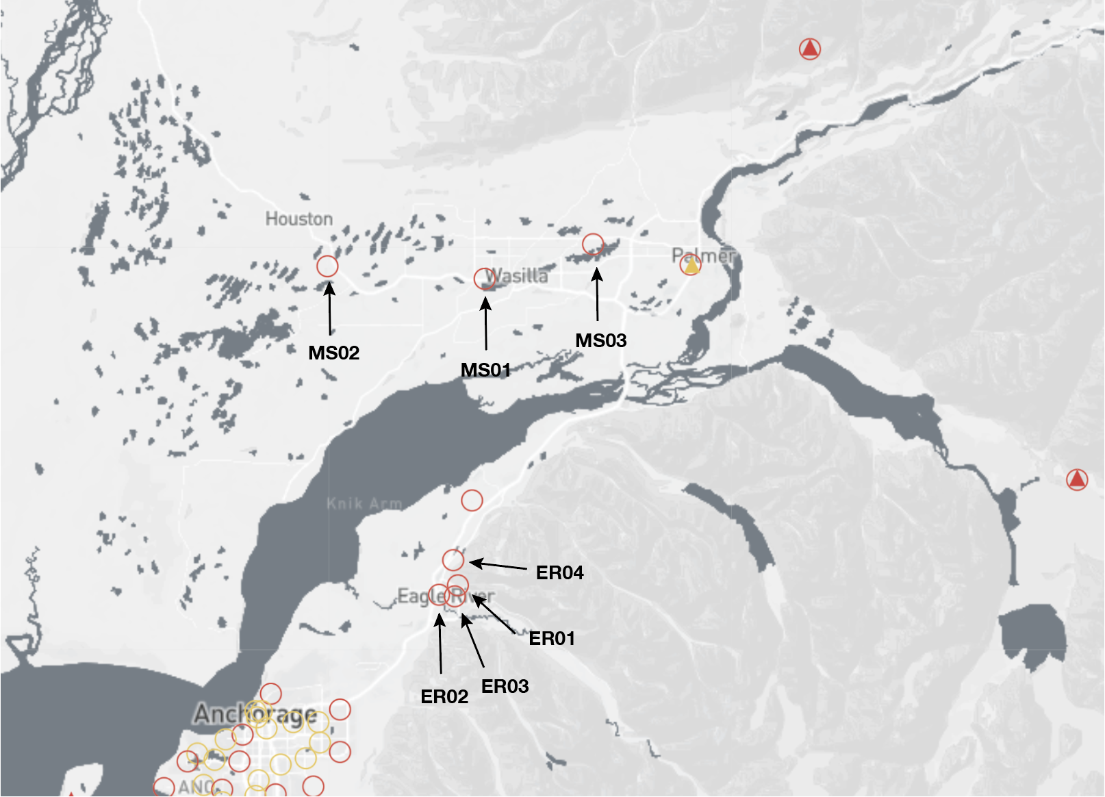
The 2018 Anchorage earthquake released 1000x more energy than this morning’s event, but in 2018, we didn’t have very many seismometers in this area that could handle very strong shaking, meaning we had few direct measurements of how strongly the ground shook in the areas of strongest shaking in Mat-Su and Eagle River. Following the 2018 Anchorage event, we deployed numerous strong motion sensors in Anchorage, Eagle River, and throughout Mat-Su. Through collaborations between the Alaska Earthquake Center at UAF and the UAA Engineering Department, we were able to install 7 new strong motion instruments (Figure 3) in Mat-Su and Eagle River, plus 2 in Bethel that allow us to actually measure strong shaking. We can now calculate peak ground acceleration and peak ground motion in these areas. Our strong motion sensor ER02 at Eagle River’s Fire Station 11 had the strongest shaking of any of our sensors for today's event, with a preliminary peak ground acceleration of 14.64% of the acceleration of gravity. While this is considered moderate acceleration, the firefighters and those nearby likely felt a good jolt.
How does this compare to the 2018 Anchorage event? The estimates of 2018 (again, we didn’t have enough strong motion seismometers to have good direct measurements of the shaking) are likely about 3-5 times stronger than today’s event. What is important for this event is that we are able to now provide measured shaking values and not just estimates, and this allows us to know how different areas shake relative to one another. This information can then be used to better engineer homes, buildings, and bridges.