




Coastal communities in Alaska face some of the most significant tsunami hazards in the United States. Tsunamis can strike within minutes of an earthquake or coastal landslide, making tsunami awareness and preparedness essential for everyone who lives, works, or recreates along Alaska’s coast.
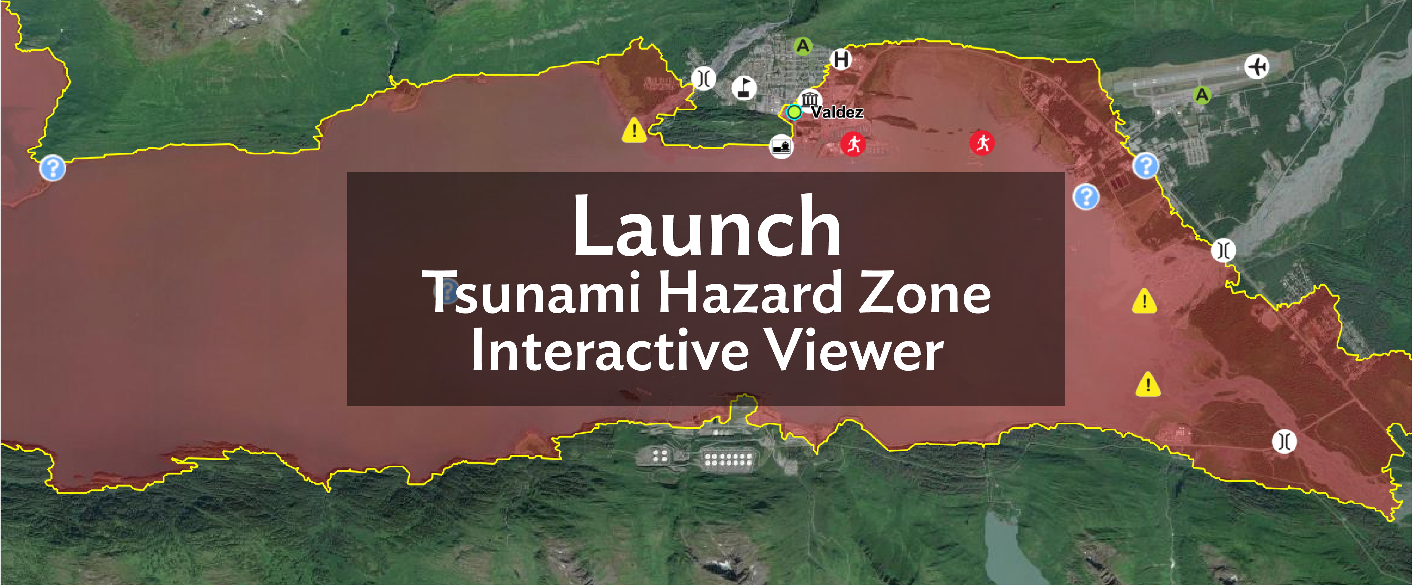
The interactive viewer above launches an ArcGIS interactive map that provides access to the most recent tsunami hazard information and resources for coastal communities across Alaska. The guidance in this app is based on decades of collaboration between state and federal partners.
How to Use the Viewer
Launch the viewer, then select a community to explore its tsunami hazard mitigation products.
Features of the Map
Every coastal Alaska community for which we have modeled tsunami inundation information is featured as a yellow dot on this map. The start page default view shows all communities.
To visit an individual community:
(1) Find it in the left-hand column of community names and click on the name once
OR
(2) Click on the community’s yellow dot once and wait a beat
Locations with the most features have worked with the Alaska Earthquake Center to map community-designated evacuation lines and assembly points. Many of these have gone through the formal process to become a designated Tsunami-Ready community.
Map Information
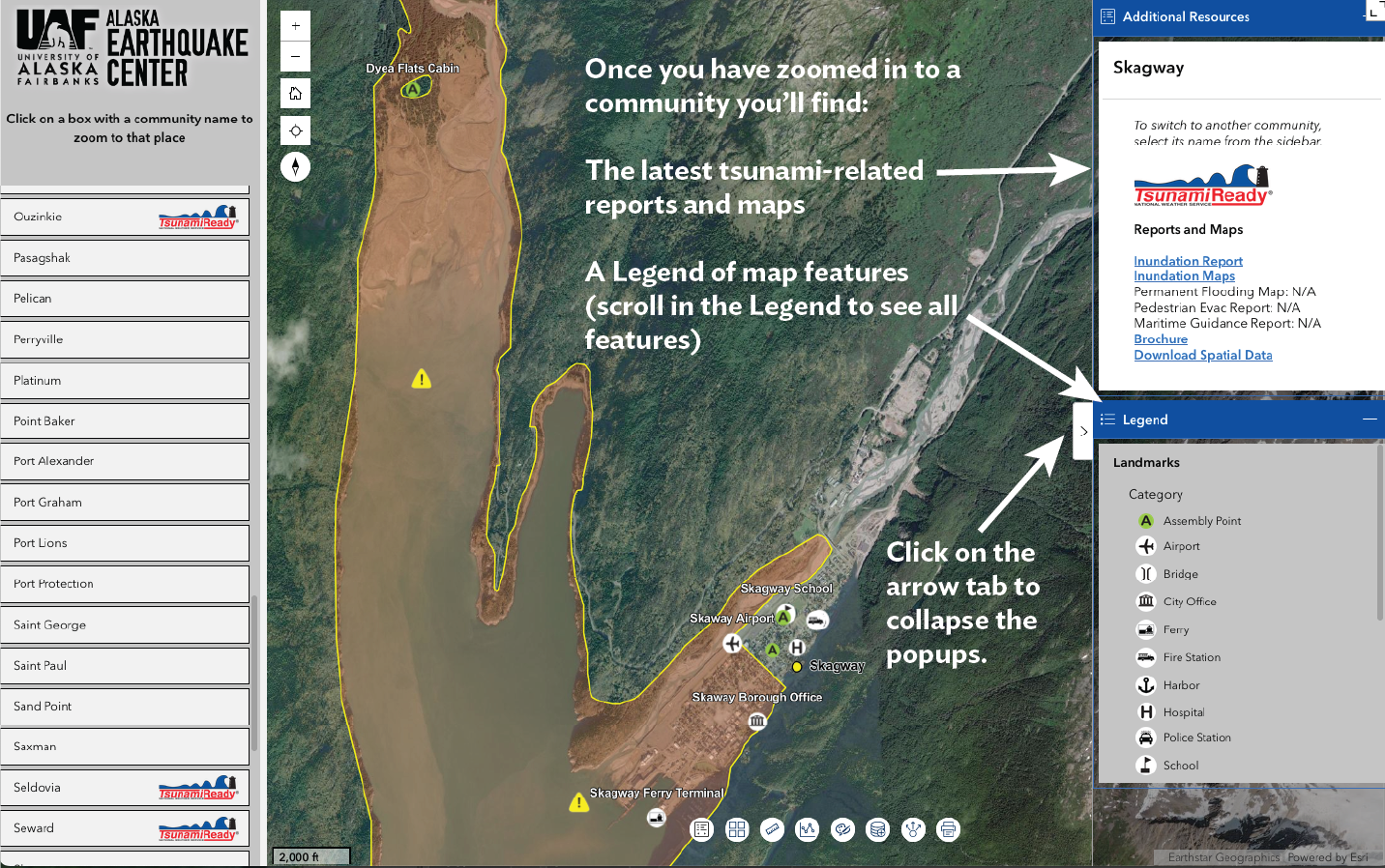
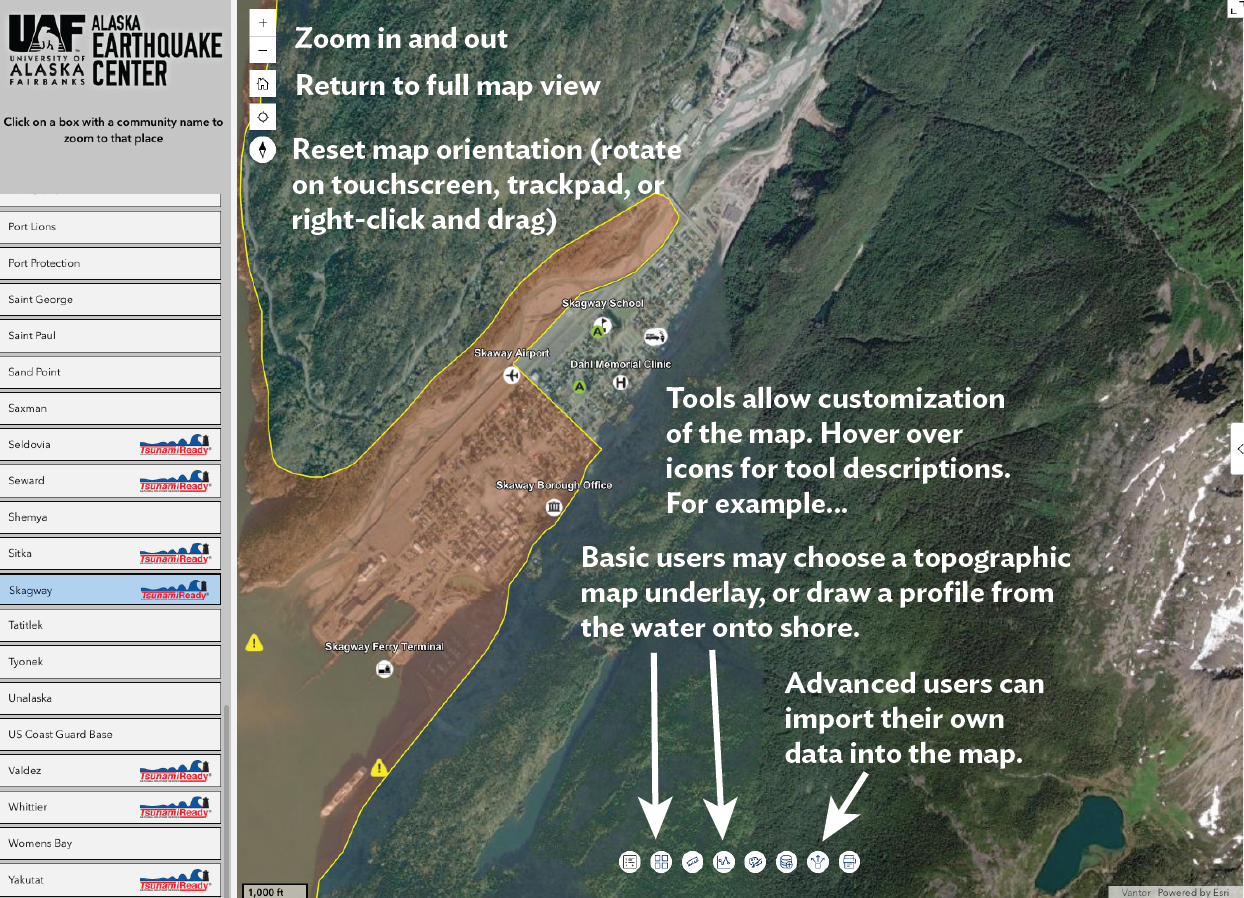
Map Tools
Tsunami Hazard Areas

Community-Designated Evacuation Line: This line is created by local emergency officials working with the Alaska Earthquake Center. They start with the Modeled Inundation Line or Tsunami Hazard Boundary and adjust it to follow local streets and other easy-to-recognize boundaries. They also add a safety buffer. The clear evacuation line shows people whether or not they are in a hazard zone and need to evacuate.
 Modeled Inundation Line: This line shows how far a tsunami could reach on land. We create it for communities where detailed information about the seafloor and land elevation is available. We use this information in a high-resolution computer model to simulate how tsunami waves could reach and flood the community.
Used when an evacuation line has yet to be designated.
 Tsunami Hazard Boundary: This line shows the estimated area that could be flooded by a tsunami. We use it for communities where detailed seafloor and land-elevation data are not available for high-resolution computer modeling. Instead, we use estimated tsunami wave heights and the best available land-elevation data to draw a safety boundary. This method is designed to make sure we do not underestimate the tsunami hazard.
Used when an evacuation line has yet to be designated.
High-risk Areas
The interactive map app showcased at the top of the page is designed to inform residents and visitors of the hazard zones in a particular coastal community.
In all hazard zones, if the ground shakes for more than 20 seconds and it is difficult to stand, and/or the tsunami siren is heard, move to higher ground or a tsunami shelter.
Pay attention to unusual sounds and sights when on or near the ocean. Tsunami impacts are greatest near ocean beaches, low-lying coastal areas, and waterways such as harbors and estuaries. Always avoid these areas during tsunamis. A tsunami wave series can last for many hours, so wait for local authorities to announce when these areas are safe. In addition to wave action, tsunamis can stir up currents that threaten harbors, facilities, and boats.
Currently, Barry Arm, Prince William Sound is actively monitored due to high potential for tsunami-generating landslides. There are many other potential landslides yet to be identified.
Learn More
A Hidden Wave Emerges: Tsunami Hazard in Upper Cook Inlet (StoryMap)
Landslide Tsunami Risks in Alaska: How Unstable Coastal Slopes Create Tsunamis (StoryMap)
Tsunami information and preparedness videos
Tsunami Hazard Mitigation Partners
The interactive ArcGIS map application was built with funding provided by FEMA Cooperating Technical Partners program. The Alaska Earthquake Center partnered with GINA, the Geographic Information Network of Alaska, a facility of the University of Alaska Fairbanks Geophysical Institute that helps build geographic information systems resources for Alaska.
The Alaska Division of Geological and Geophysical Surveys (DGGS) publishes the tsunami inundation maps and reports.
The Alaska Division of Homeland Security and Emergency Management prepares state and local first responders to prevent, protect, respond to, and recover from a variety of emergency situations.
The National Tsunami Warning Center issues tsunami advisories and warnings for Alaska (go to the website for current alerts or warnings). The center also provides educational materials, safety information, and tsunami data.
The International Tsunami Information Center helps develop and provide information on tsunami warning systems, risks and good practices by engaging with Member States and the general public across the Pacific Ocean basin.