
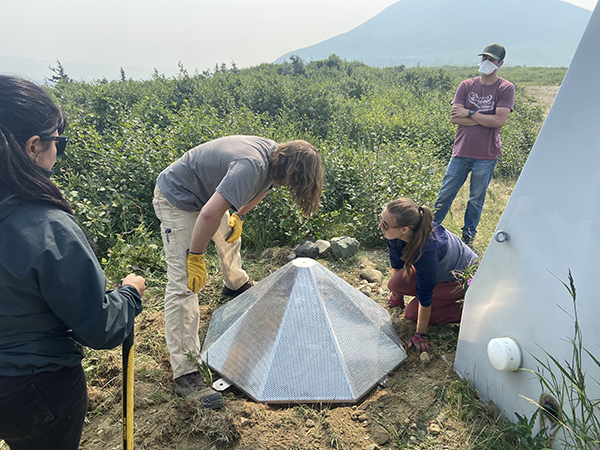
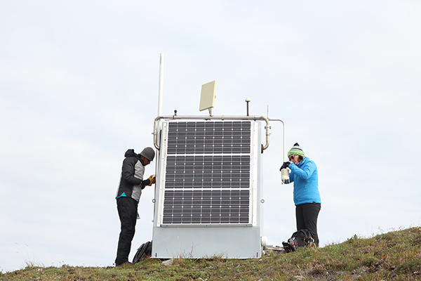


Historically, the Alaska Earthquake Center has focused on seismic data. We currently maintain more than 250 stations across Alaska with broadband and/or strong motion seismometers. But did you know that we co-locate other geophysical instruments such as weather stations, infrasound sensors, and soil temperature probes at many of our sites? These data are digitally transmitted to UAF in real-time through the Alaska Geophysics Network. All of the network’s data are publicly available, and used by our partners and other researchers to inform and answer larger questions relating to Arctic change.
The co-location of seismic instruments with weather stations, infrasound, and soil temperature instrumentation at our sites originated from the National Science Foundation USArray Project. Between 2014 and 2017, the USArray Project installed 197 sites across Alaska. This vastly expanded the amount of geophysical data available from Alaska and marked the first time seismic data had been collected in several remote regions of the state, including parts of Northern and Western Alaska. The grid-like spacing of these sites allows us to capture the variation in measurements across the state and gain a more complete picture of how climate change is affecting Alaska. After the USArray Project ended, the Alaska Earthquake Center acquired 96 of its sites to join the Alaska Geophysics Network. A portion of these sites are currently supported by the National Science Foundation Arctic Observing Network Program.
The diverse types of data collected through the Alaska Geophysics Network can work together to answer larger questions about how Alaska is changing in response to climate change. Initial observations including this data suggest that seismic activity, once thought to be largely independent of surface changes, may be impacted by thawing and decreasing permafrost and glaciers, hydrological shifts, and/or other landscape changes (Press release: Melting Glaciers May Be Playing a Subtle But Key Part in Alaska's Earthquakes). Data collected by the Alaska Geophysics Network has relevance to informing additional aspects of Arctic change, including wildland fires, changing hydrological patterns, extreme weather events, permafrost thaw, and subsequent effects relating to these and more changes.
Weather data collected as part of the Alaska Geophysics Network can be seen in real time through our partner the Alaska Climate Research Center’s weather station map. (The “Mesonet” stations represented on the map as black dots are all part of the Alaska Geophysics Network.) The meteorological stations we manage help fill in data gaps in regions of the state not covered by other weather station networks, particularly north of the Brooks Range. Through our partners at the Alaska Climate Research Center, these data contribute to several products, including climate reports, research, weather forecast maps, and wildland fire conditions forecast maps in Alaska.
If you are interested in learning more about the Alaska Geophysics Network, check out the website for the Alaska Geophysics Network or contact Joanne Heslop at jheslop@alaska.edu.
We partner with several organizations to make this project possible, including: NOAA National Weather Service - Alaska Region; the National Mesonet Program; the EarthScope Consortium; Synoptic; MesoWest; the U.S. Geological Survey; and the Defense Threat Reduction Agency. This project is funded by National Science Foundation award number 2024208 as part of the Arctic Observing Network program.