
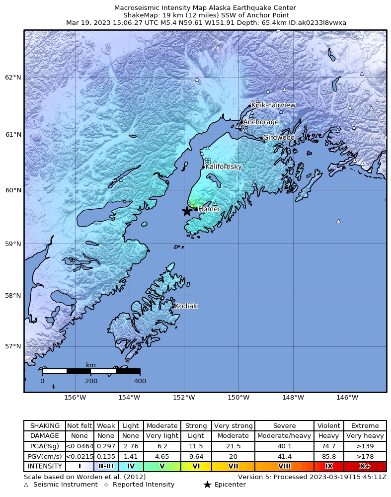


The M5.4 earthquake on Sunday morning March 19th was widely felt in Kenai Peninsula communities and as far as the MatSu valley (Fig. 1). With a depth of 40.6 miles, it is likely that this earthquake occurred in the Pacific Plate. Now, you may ask why would an earthquake in the Pacific Plate occur so deeply beneath Alaska? This is because all along the southern coast of Alaska and throughout the Aleutians, the North American Plate is colliding with the Pacific Plate in such a way that the Pacific Plate, being the denser of the two competing plates, is forced underneath the North American Plate. This process is explained in depth in our webstory here.
Once the plate is traveling downward underneath the state, there are a few ways that an earthquake can be generated. The first is when the downgoing slab of the Pacific Plate is being pulled more strongly as it goes deeper. The force of this pull causes the plate to stretch until it’s at its breaking point, where it then ruptures and causes an earthquake. This was the mechanism for the M7.1 Iniskin earthquake (2016), a process which is explained further, and with a helpful animation, here. The second is the plate bending as it’s forced inside of the earth, which creates areas of stretching as well as compression within the plate. Think about the bending you’d see if you’ve ever tried to force a book into a tight space on a bookshelf. The third is changes to the rock itself and the minerals which form the subducting slab. These changes come about with depth (increased temperature and pressure) and decreased water content in the rock. While the Iniskin ‘quake was the largest earthquake recorded from the subducting slab in Alaska, the M6.3 Skwentna Earthquake (2014), M6.4 Iliamna Earthquake (2015), and M6.8 Sutwik Island Earthquake (2015) all occurred within the slab.
Which one of these is responsible for Sunday’s ‘quake will become clear once more information has been gathered. See more information about this earthquake on the event page.