


Computer simulation of the M7.1 Iniskin quake
January 28, 2016
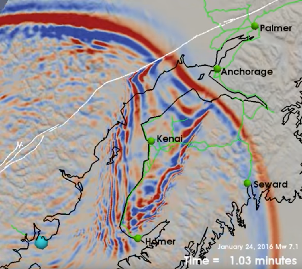
Carl Tape's simulation of the M7.1 Iniskin Earthquake is generating a lot of interest, in part because it appears to reflect many people's experience of the earthquake. Put simply, the animation shows shaking that lasts much longer in Anchorage and on the Kenai Pensula than it does elsewhere.
Tape's simulation shows movement of the earthquake's seismic wavefield through a realistic 3D earth structure model. The wavefield is complex and irregular because the speed of the waves is affected by the kinds of materials they pass through.
Here, the deep sedimentary basin in Cook Inlet slows the waves considerably, causing them to close in on both sides and converge on Knik Arm and Matanuska. These softer materials also reverberate longer than harder rock does, resulting in a longer and more intense earthquake for people living on top of those sediments.
This is more obvious in the zoomed-in version of the animation (screenshot at right).
It's important to remember that this is a simulation based on modeling rather than on seismic waveform data from the earthquake itself. Still, it is compellingly similar to how people in Southcentral Alaska have described their experiences of the earthquake.
For example, competitors in the Northern Lights 300 found harrowing experiences riding out the quake on top of heaving and shattering river ice. The course was on the western side of Knik Arm, where Carl's model shows strong shaking long after neighboring areas have settled.
Please visit our special page for figures and analysis related to this earthquake.
The simulation was performed on the high-performance computing cluster at the University of Alaska Fairbanks, Research Computing Systems. The 3D wave propagation code is called SPECFEM3D. Animations and full description can be found on Carl Tape's research page.