
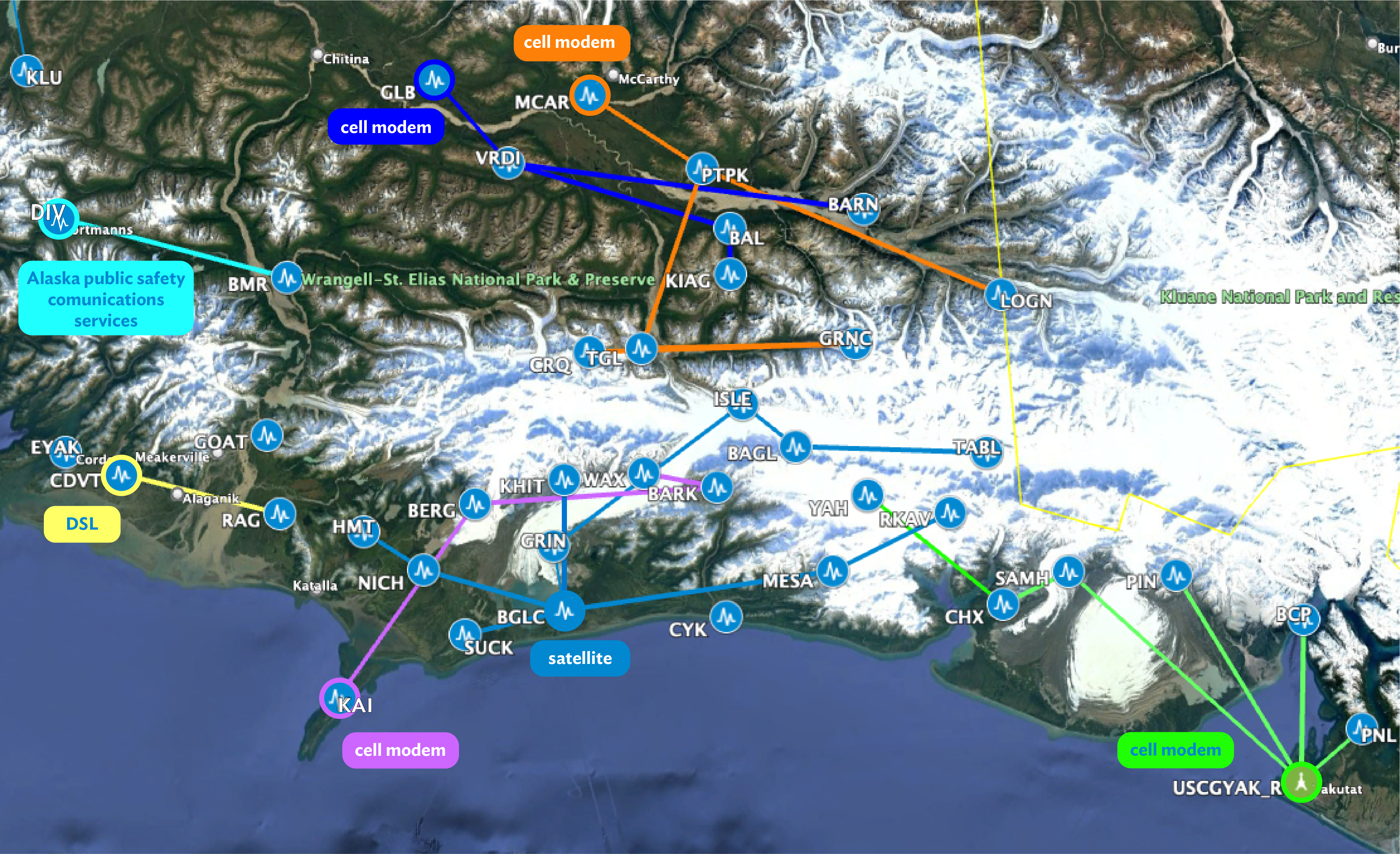


How does the Alaska Earthquake Center gather data from more than 250 seismic stations scattered across the state, some in remote locations? Any way we can! We use a complex set of radios, cell modems, routers, and satellite receiver instruments. These instruments are organized in networks (Figure 1). Inside each of those networks, the communications hub has an internet access point or direct communications connection to our servers to relay information back to the Earthquake Center. Each type of connection has pros and cons, so we select the best equipment for each site. Using a variety of connections also makes our entire Alaska Geophysical Network more resilient.
Cell modems. These modems use the same connections as a cell phone. They can provide a stable internet connection and, similar to radios, use very little power compared to other communication options. However, cell coverage is limited or absent in many areas of the state, so we can only use them in locations with cell service. We also often combine cell modems and radios for our network communication. This allows us to have stations without cell service connect via radio links to another station or community that does have available cell service.
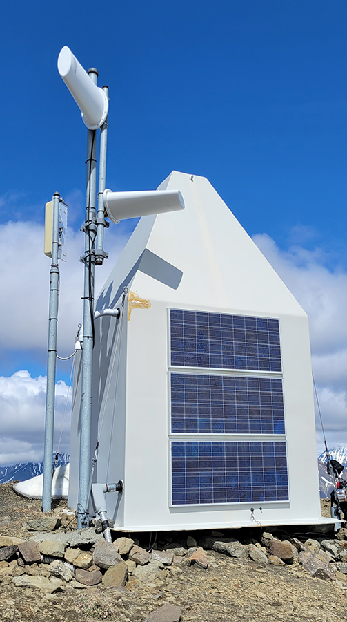
Satellite communications. We use a few different types of satellite communications. Many of our stations communicate through the BGAN (Broadband Global Area Network) satellite communication system (Figure 2). A benefit of the BGAN system, compared to many other satellite systems, is that the satellite transceiver equipment at our remote stations doesn’t use much power (less than a typical lightbulb). Just like with radios and cell modems, minimizing the power consumption at our stations is very important when a station relies on solar power and batteries to stay online during the dark and snowy Alaska winters. The BGAN satellites are in geosynchronous orbit, which means the station’s satellite dish always points in the same direction. Keeping the satellite dishes aligned can take a lot of work in the windier and stormier parts of Alaska. One of the many tasks of our field team is to visit sites to realign the BGAN dishes when they get blown or knocked out of alignment.
Low earth orbit satellite systems. In recent years, we have been testing low earth orbit satellite systems at several of our stations. This is the same technology now used by many residents and communities around Alaska. The high bandwidth (amount of data) and low latency (data travel time) of these communication systems are very useful for getting our data back quickly. The drawback is these systems often require more power than our stations can handle during the winter, so we can’t use them everywhere. We try to get around this problem by putting the satellite system on a timer: in the winter, the system turns on once a day to transmit data. The seismic station still records data the whole time, so we can backfill the data from when the satellite system was turned off. While this isn’t ideal for real-time monitoring, all seismic data is maintained for our earthquake catalog. Low earth orbit communication technologies are changing quickly right now, and we’re always watching for new technology options to use at our remote stations.
Internet access. We cooperate with a number of communities, schools, and individuals around the state who assist us with our data delivery by allowing us to piggyback on their internet connection and host our equipment in their buildings. We greatly appreciate this form of collaboration because it provides dependable internet connections for us—and someone we can call for help if something goes wrong! We are very grateful for our partnership with schools in False Pass, Chevak, Bethel, Nikolai, Galena, and Gambell, which both provide internet access and host our communication devices in the school buildings. We also receive help from a number of schools in Fairbanks, Anchorage, and the Mat-Su Borough that provide us with internet access and often host strong-motion seismic sensors. We’re also very thankful for help from municipal offices and health clinics in Atka, Old Harbor, St. George, Lake Minchumina, and Buckland that assist us with internet connections and host our equipment.
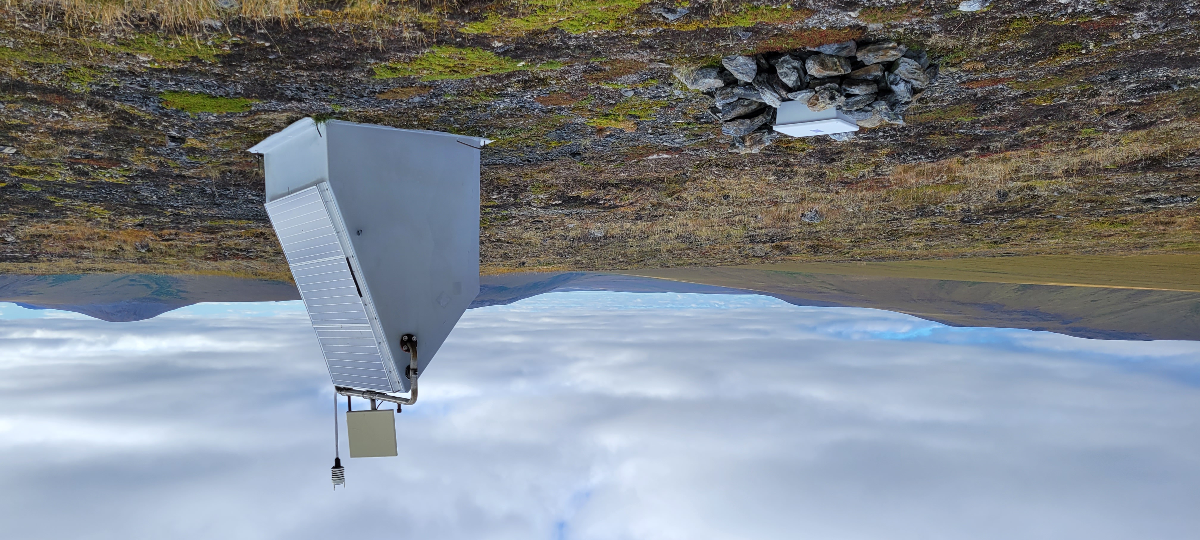
Radio relays. The Earthquake Center commonly uses 900 MHz radio relays to communicate between stations in remote areas where other communication options aren’t practical or available (Figure 3). These stations are located in areas that don’t have network connections but are easily reachable via radio transmission, making a chain of communication (Figure 1). Many of our stations are located on elevated terrain, such as on ridgelines, in order to provide line of sight to another Earthquake Center station or to a community where we can install the other end of the radio link. Radios are also very useful because they require much less power than other remote communication options, such as satellites.
One tricky part of communication is that if one station in the local network chain is down, all of the stations “downstream” of it won’t be able to transmit data to the lab. A damaged station antenna can cause a lot of data gaps. The Earthquake Center field team spends summers maintaining stations, including repairing damage to antennas twisted, displaced, or broken by Alaska's challenging weather. To minimize those types of antenna problems, our field technicians sometimes put the antennas inside the huts or high up on the towers to protect them.
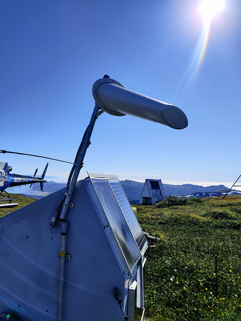
The communication systems are some of the most complex repairs to make on site as they are very sensitive to placement and setup. If anything is blocking the antenna, the radios can't communicate. A simple half a degree rotation on the BGAN dish, and the connection to the lab becomes glitchy. During the summer you will see a lot of photos of our field team climbing on the huts to reorient antennas. It’s all in a season’s work to keep the Alaska Geophysical Network’s data flowing.