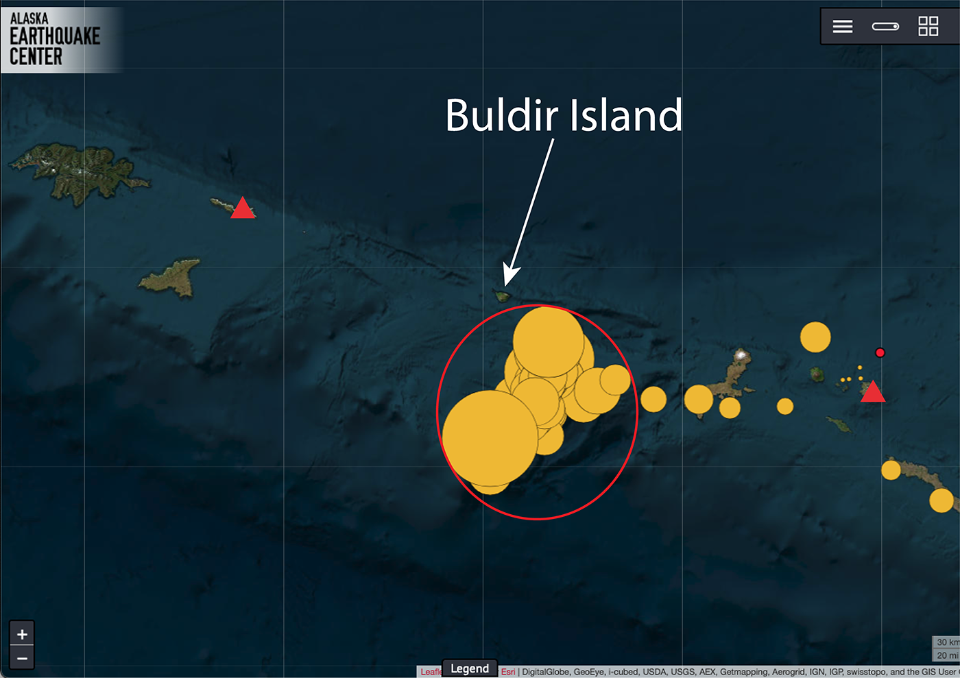
On March 4 at 8:54 a.m., a magnitude 6.4 earthquake struck the western Aleutian Islands, about 42 miles south of Buldir Island (Figure 1). No one felt it, and there were no reports of damage, landslides, or a tsunami.
But the earthquake still caught our attention.
That’s because it wasn’t the only one.
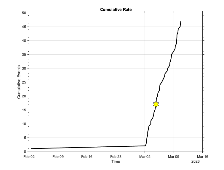
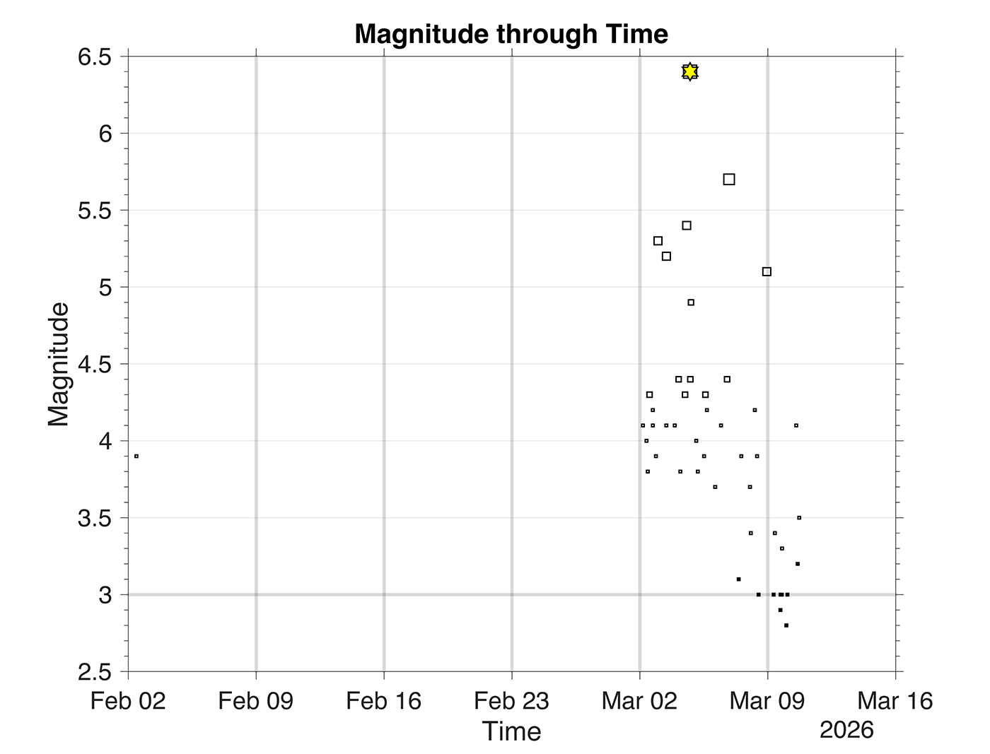
Since March 1, this remote stretch of the Aleutians has produced a total of 48 earthquakes (Figure 2), with five magnitude 5 earthquakes and 28 magnitude 4 earthquakes (Figure 3). There were almost certainly many more smaller ones that we simply couldn’t detect because of the distance to our nearest stations.
Even more intriguing, three of the magnitude 5 earthquakes happened before the magnitude 6.4 event. That means this isn’t the classic pattern in which a large earthquake happens first, and smaller aftershocks follow.
So what exactly is going on in this not-so-quiet corner of Alaska?
One of the Most Remote Places in the Aleutians
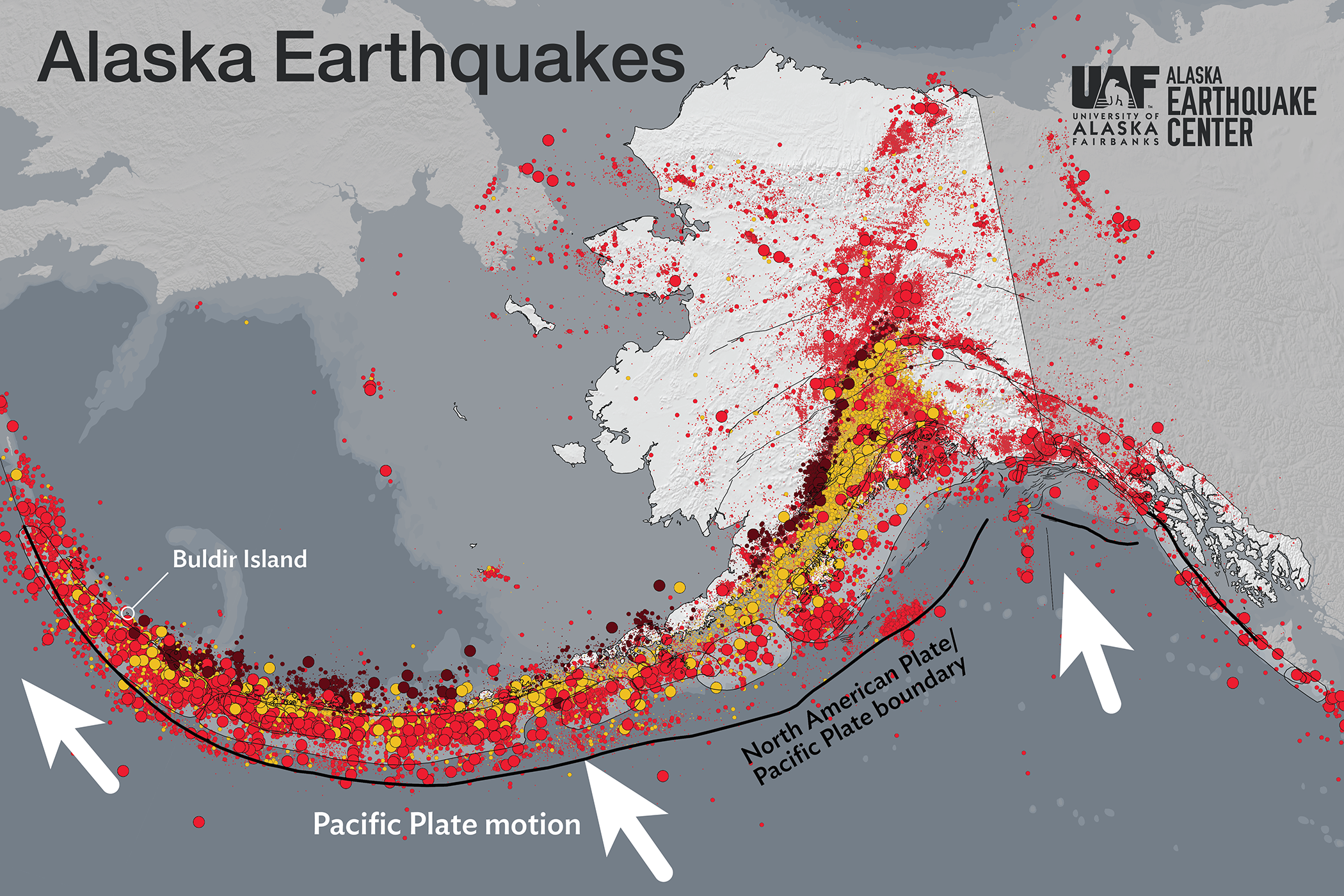
Part of the mystery comes from just how remote this area is. Buldir Island sits between the Rat Islands and the Near Islands, and it is one of the most isolated islands in the entire Aleutian chain (Figure 1). In fact, it is described as being farther from the nearest land than any other Aleutian island. The island itself is tiny, only about 7.5 square miles, and completely uninhabited.
The nearest seismic monitoring equipment isn’t on Buldir at all. Instead, the closest stations are about 100 miles away from this sequence, on Shemya Island, operated by the National Tsunami Warning Center, and on Little Sitkin Island, run by the Alaska Volcano Observatory (Figure 1).
Because there are so few instruments nearby, our view of what’s happening underground is limited. We can confidently detect earthquakes larger than about magnitude 4.0 in this area, but smaller earthquakes may go unnoticed or be difficult to locate precisely.
That means there could be dozens or even hundreds of smaller earthquakes occurring that never make it into the catalog. Without those smaller events, we are missing important pieces of the puzzle.
A Different Kind of Fault Motion
Even with limited data, we do know a few important things.
The earthquakes are shallow, occurring within about the upper 25 miles of the Earth’s crust. They also show strike-slip motion, where blocks of crust slide horizontally past one another, similar to the motion along Alaska’s Denali Fault.
That might sound surprising, because these earthquakes occur near the Alaska–Aleutian megathrust, where the Pacific Plate normally dives beneath the North American Plate.
But in the far western Aleutians, the motion between the plates begins to change direction. Instead of pushing directly beneath North America, the Pacific Plate moves more parallel to it. As a result, the stress in the crust shifts from mostly squeezing to more sideways sliding, producing the strike-slip earthquakes we’re seeing here.
Foreshocks Before the Main Event?
Another interesting clue is the timing of the earthquakes. Several magnitude 5 events happened before the magnitude 6.4 earthquake. That pattern suggests they may have been foreshocks, followed by the larger mainshock and the aftershocks that continue today.
However, because so many smaller earthquakes likely went undetected, we can’t say exactly when the sequence began or how large the aftershock zone might be. Those smaller earthquakes normally help outline the edges of the fault that slipped during a sequence, but here, much of that information is missing.
Watching From Afar
For now, we will continue monitoring the activity around Buldir Island. The earthquakes pose little risk to people because of the area’s extreme isolation.
Still, the sequence offers a reminder that even in the most remote parts of Alaska, the Earth is constantly moving, and sometimes the most interesting earthquake stories happen where almost no one is around to feel them.