
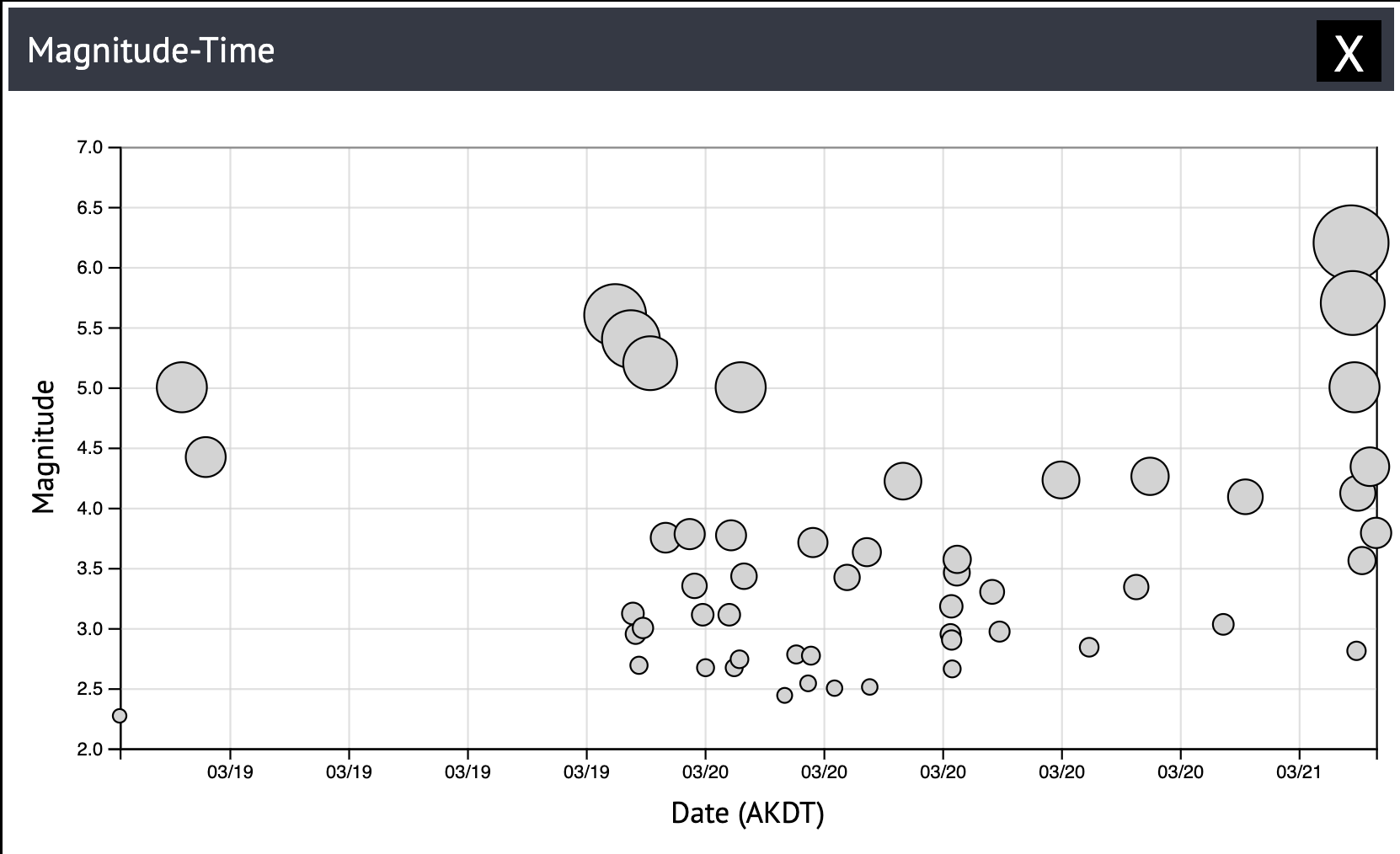


As of today, March 21, 2025, there have been eight earthquakes greater than magnitude 5 in two days in the Andreanof Islands region of the western Aleutian chain (Figure 1). With no clear singular main shock, we can confidently call this an earthquake swarm. There have been no felt reports submitted online, but Adak residents have said they feel the shaking.
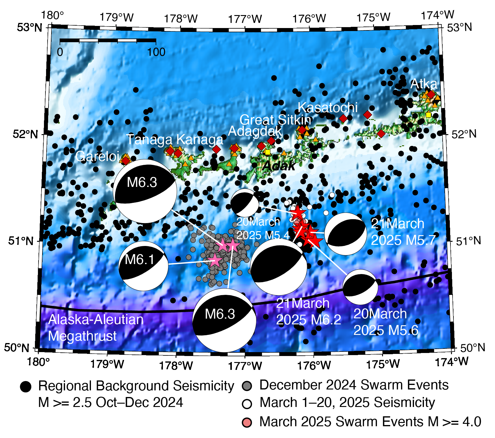
The Alaska Earthquake Center has covered swarms before, most recently in December 2024 when three earthquakes above a magnitude 6 and their aftershocks shook the Adak area (Figure 2). This swarm follows the same general behavior: a series of earthquakes in the same place with no clear single triggering event.
Since the largest event in a swarm sequence does not guide how many events there will be overall, there is nothing special about the largest event (Figure 3). In this case, so far it has been a magnitude 6.2, at about 7 a.m. on March 21st, at a depth of about 18 miles (29 km).
So why do earthquake swarms happen, and why in this part of Alaska?
Depending on the geologic setting of an earthquake swarm, the trigger could be slip on a fault, or injection of magma or some other type of fluid. In this instance, given the large magnitude of the earthquakes and their location on a major plate boundary, we can call it a tectonic swarm.
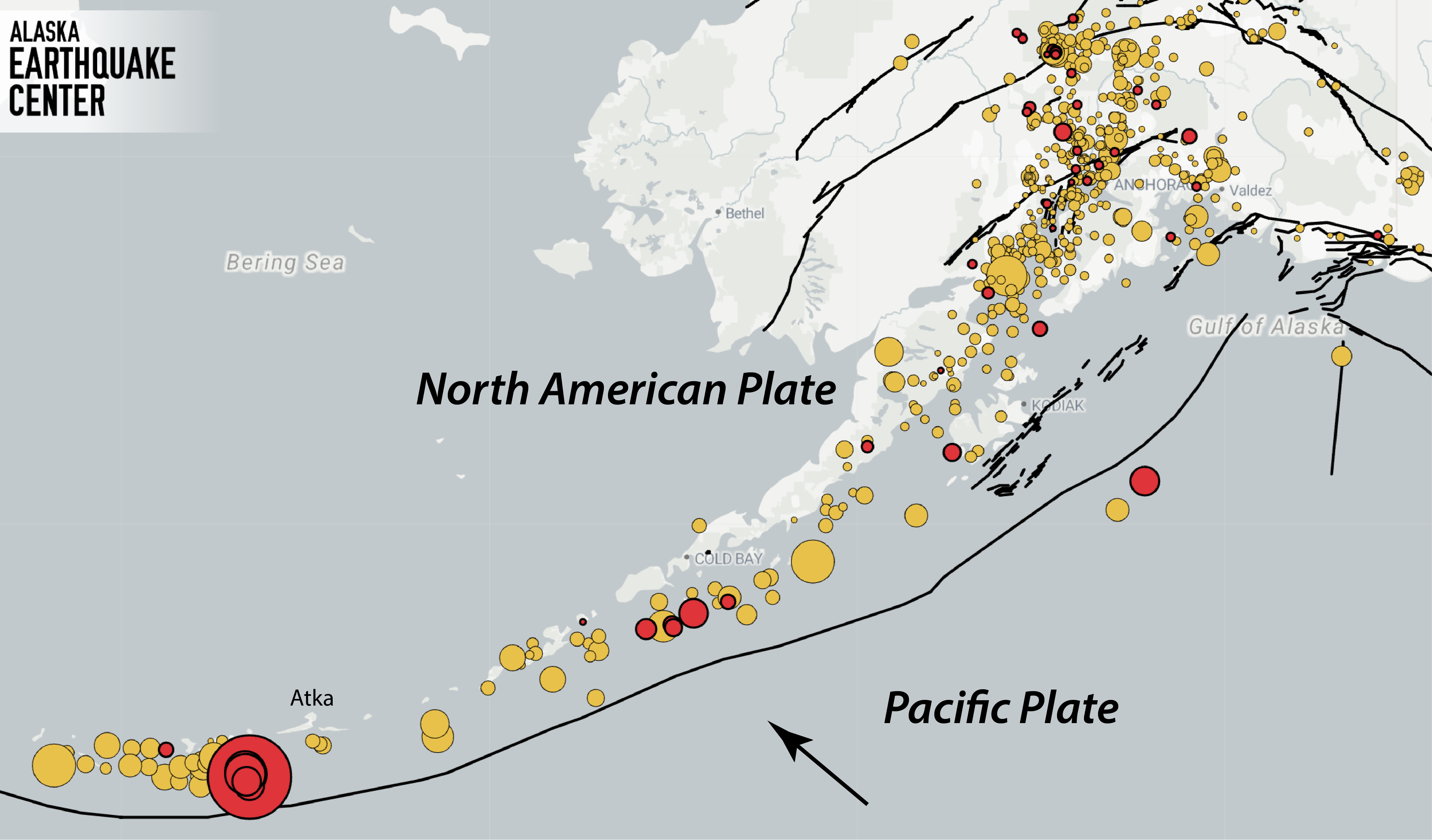
The Aleutians sit astride the boundary between the Pacific and North American plates, and the depth distribution of earthquakes indicate they are happening along the interface between these plates. Earthquake focal mechanisms that represent fault slip also all point to the convergent motion along this plate boundary (Figure 2).
Earthquake swarms are nearly ubiquitous at convergent plate boundaries worldwide, although they are not uniformly distributed along the plate boundary. An active avenue of research focuses on identifying sections of the Alaska-Aleutian megathrust that host swarm activity, which may help identify how large earthquake ruptures form.
The apparent recurrence of earthquake swarms in the same parts of a subduction zone is another research avenue open for exploration.
As this particular swarm develops, the Alaska Earthquake Center will continue tracking the activity. We expect that earthquakes will continue in the region over the coming weeks and will update this story when the activity returns to background levels.