
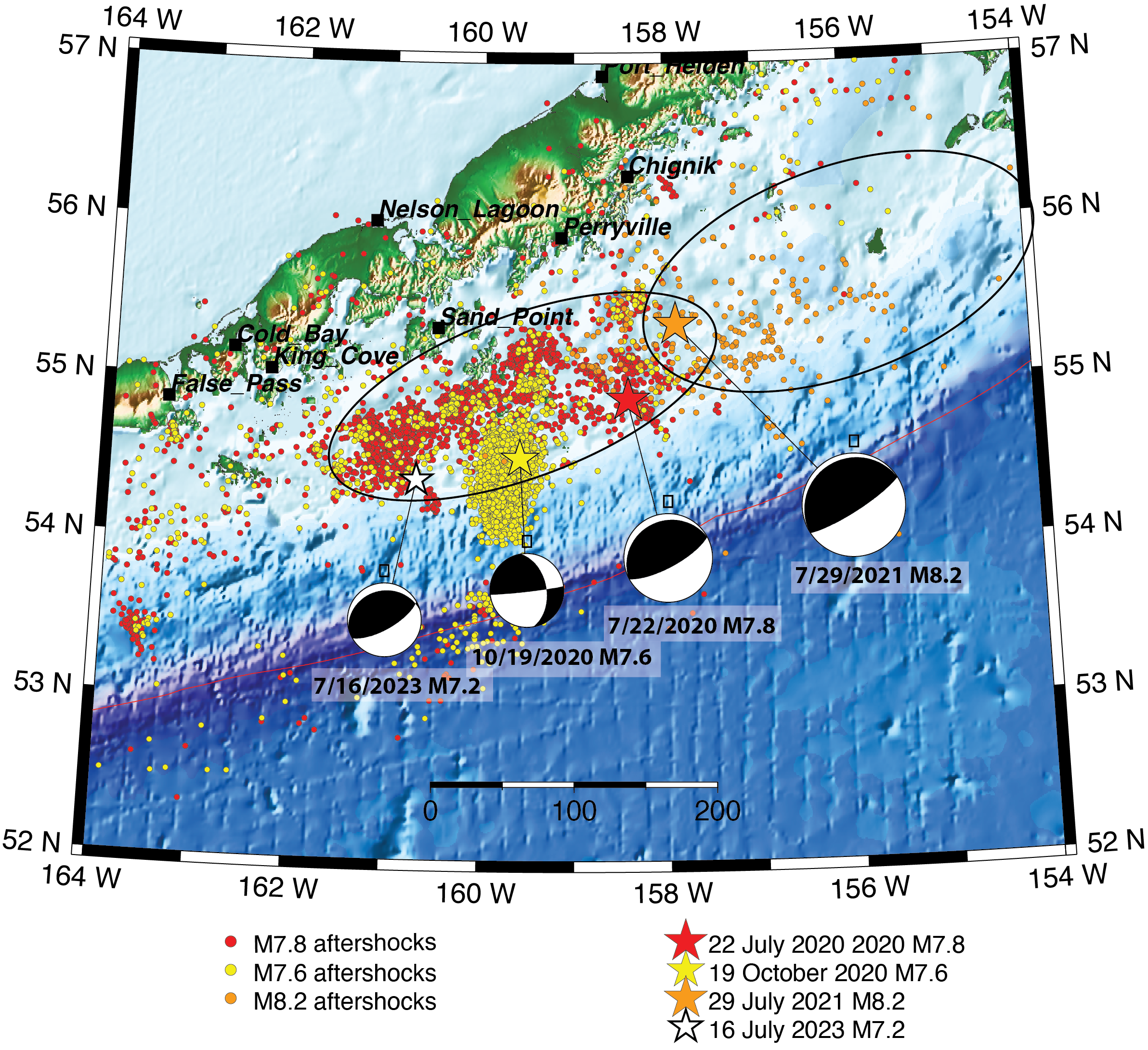
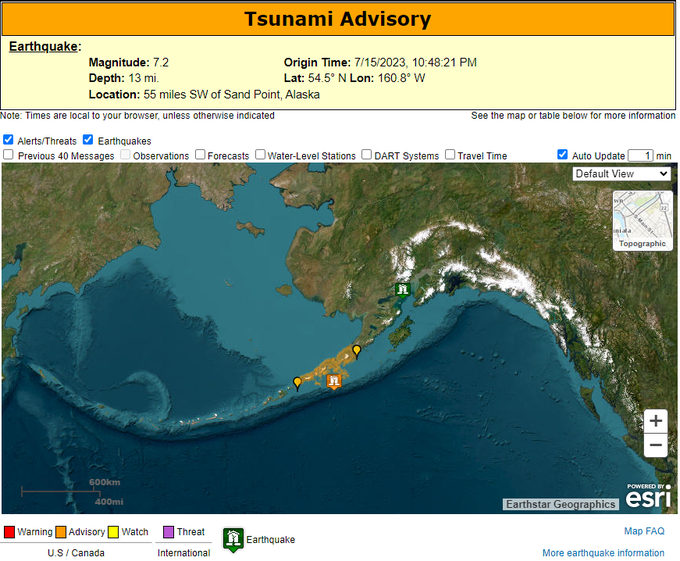


On July 15, 2023, at 10:48 pm Alaska time, a magnitude 7.2 earthquake struck the offshore Alaska Peninsula region, almost three years after the magnitude 7.8 Simeonof Earthquake occurred in the same region. The 7.2 event was located 50 miles S of Sand Point (about 100 miles SE of the M7.8 event) at about 20 miles depth. A tsunami warning was issued immediately after the earthquake, but downgraded about an hour later to advisory level and finally canceled just before 1:00 a.m. Tsunami waves with a maximum of .5 ft. were recorded in King Cove and Sand Point. Ground shaking was reported felt in multiple communities on the Alaska Peninsula and eastern Aleutian Islands, with intensity as high as V, moderate.
The July 15 earthquake occurred within the M7.8 aftershock zone. While the M7.8 aftershock activity greatly diminished since its peak in the summer/fall of 2020, the Earthquake Center was still observing elevated levels of seismic activity within the M7.8 aftershock zone in 2023. So, the M7.2 earthquake can be recognized as a late aftershock of the M7.8 earthquake. Its source mechanism is similar to the Simeonof event and indicates fault rupture along the Aleutian megathrust fault. We expect that the M7.2 earthquake will generate its own aftershock sequence, similar to the other moderate-sized earthquakes in the region. So far, the largest aftershock, M5.7, occurred three minutes after the mainshock.
Another major earthquake, magnitude 8.2, occurred on July 29, 2021 NE of the Simeonof Earthquake epicenter. The M8.2 rupture propagated to the northeast, away from the M7.8 rupture zone.
The M7.2 July 15, 2023 earthquake is yet another major event within the span of 3 years that ruptured the subduction zone interface from the Shumagin Islands in the southwest to Kodiak Island in the northeast. The Shumagin Island region has been recognized as a seismic gap, a stretch where no major earthquakes had occurred recently, prior to these three large earthquakes. The recent sequence of events partially filled this gap.