
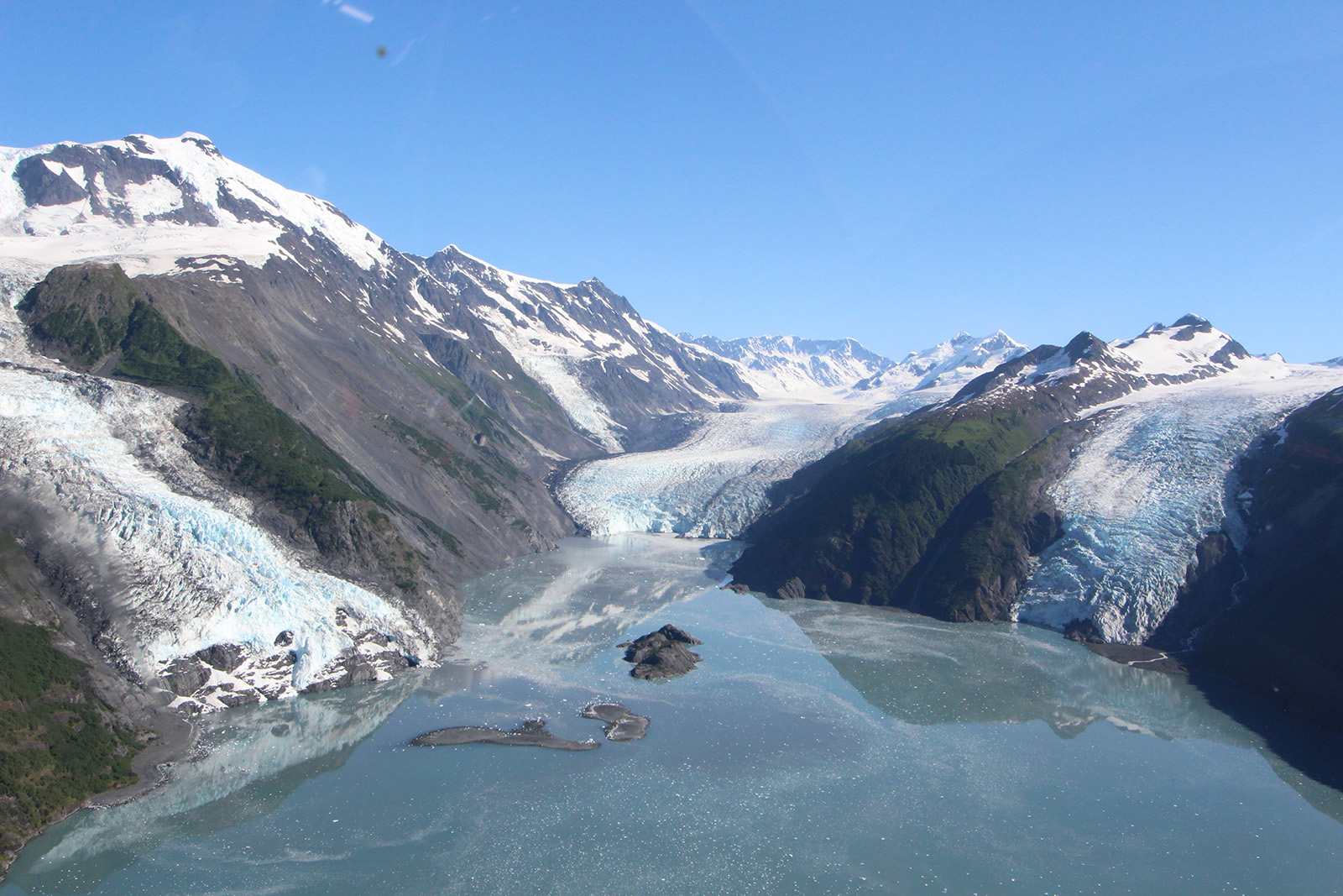


A cascade of rock — 180 million tons of it — poured into Alaska’s Taan Fjord near the head of a retreating glacier on a mid-October’s night in 2015 (Figure 1). The landslide from the collapse of a hillside once supported by the glacier created a dirty and rocky tsunami that rolled hundreds of feet up the fjord’s shoreline in places.
The landslide generated seismic waves equivalent to those of a magnitude 4.9 earthquake, but the event wasn’t identified as a landslide for several hours. Evidence of a tsunami came later from visual observation.
No system currently exists to rapidly detect large landslides and determine whether they are close to open water and present a tsunami hazard.
Two Alaska Earthquake Center researchers have devised a way to do just that.
“The warming climate is causing glaciers to retreat, leaving behind valleys whose mountainsides and hillsides have lost their support,” said research seismologist Ezgi Karasözen. “This is important, especially in regions like southern coastal Alaska, because huge masses of land can and do spill into water and cause tsunamis.”
Karasözen and Michael West, director of the Alaska Earthquake Center at the Geophysical Institute, detailed their method in a paper published Feb. 9 in the journal The Seismic Record.
The two scientists write that their method of determining a landslide’s location, volume and potential impact is rapid enough to support the National Oceanic and Atmospheric Administration’s goal of issuing a tsunami warning within 5 minutes of a landslide.
Their paper calls attention to the danger of landslide-caused tsunamis by pointing to the Taan Fjord landslide, which created a tsunami that stripped vegetation as high as 620 feet above waterline.
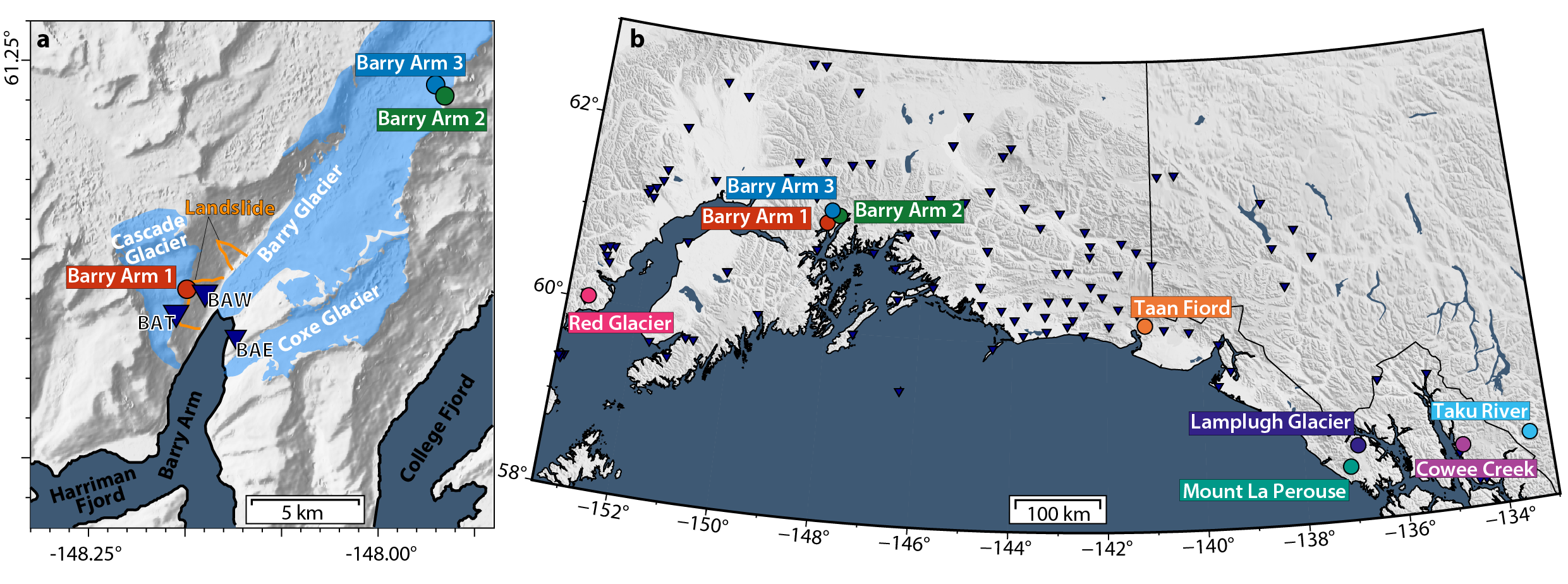
A prototype system by Karasözen and West capable of real-time detection has been in place since August in the area of the Barry Arm of Prince William Sound. It uses data from seismic stations already in the Alaska network.
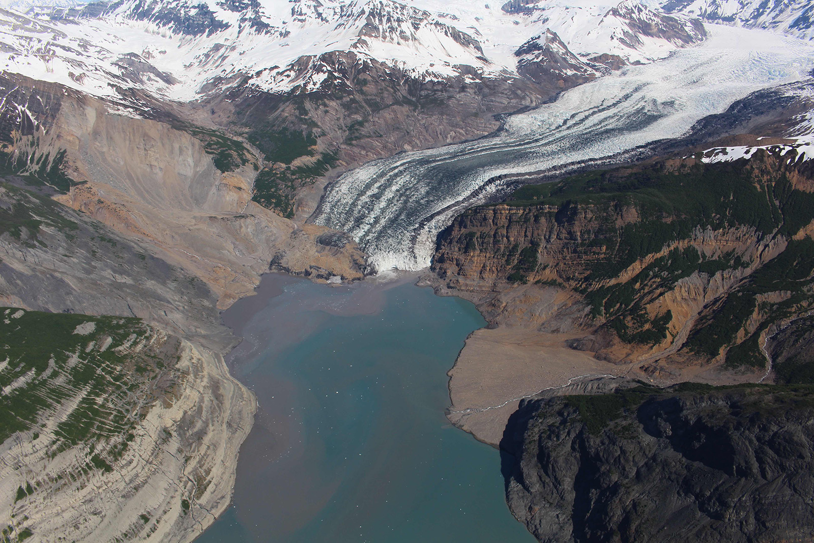
State and federal agencies fear a landslide and tsunami could occur at Barry Arm, where Barry Glacier has retreated and left behind an unsupported fjord wall that has slumped about 650 feet in recent decades. Retrospective analysis of seismic station data at Barry Arm revealed three landslides that occurred in 2020 and 2021 (Figure 2).
Karasözen and West write that the instability “has prompted concerns that a catastrophic failure could generate a tsunami with several meters of peak wave height reaching nearby communities in just 20 minutes.”
The U.S. Geological Survey is leading the multifaceted interagency monitoring of the area.
“With an earthquake, there are instruments that measure ocean wave heights, and tsunami warning centers are on alert after an earthquake,” Karasözen said. “But landslides aren’t systematically monitored in Alaska or elsewhere in the world. If a landslide-triggered tsunami were to happen, we wouldn't know. That’s a major concern.”
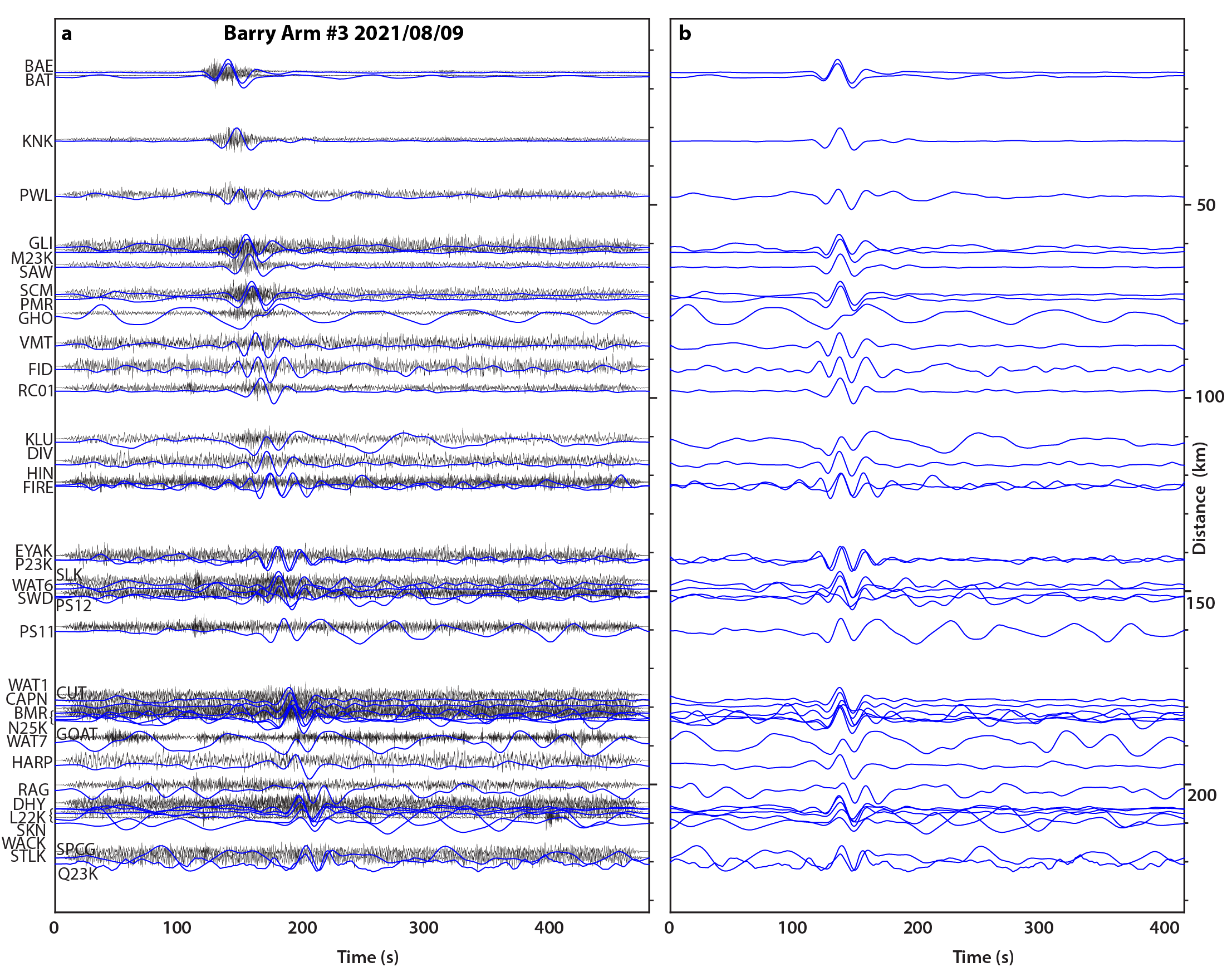
The method by Karasözen and West involves quickly identifying a landslide’s long-period waves amid a seismic record busy with short-period waves created not only by a landslide but also by nearby earthquakes and glaciers and by human-caused activity.
A landslide’s initial onset generally registers as short-period waves; it isn’t until the slide accelerates that the identifiable long-period waves materialize (Figure 3). Landslides produce disproportionately more long-period energy compared with other sources. Most earthquake ruptures last only seconds, while landslides routinely last a minute or more.
Coastal fjords present a significant challenge for landslide detection because glaciers can create hundreds of prominent seismic events daily, the researchers write.
Karasözen and West created an algorithm to continually scan seismic data from multiple seismic stations to look for a landslide wave signature. Finding a match, their system will estimate the slide’s location and volume. In areas with good seismic station coverage, location can be estimated to within a few miles.
The goal is to have the system alert tsunami and seismology agency personnel, but more work remains before that can occur.
To create the algorithm, the two researchers analyzed data of the three recent Barry Glacier landslides and six additional landslides — five of them in Southeast Alaska and one on the west side of lower Cook Inlet, across from the Kenai Peninsula (Figure 4).
Other efforts have been tried over recent decades. Several researchers have shown that landslide seismograms can be used to estimate location and volume, but those efforts usually were unique to a region, required considerable fine-tuning and were not designed for real-time purposes.
Determining landslide location from distant seismic stations doesn’t allow for real-time assessment, due to the time it would take for the seismic waves to reach those stations.
West said the research augments ongoing monitoring and alert efforts.
“The potential for real-time monitoring of large landslides is one important component of the interagency effort underway to address Alaska’s landslide challenge,” he said.