


Offshore Kodiak Magnitude 7.9 Earthquake
January 23, 2018
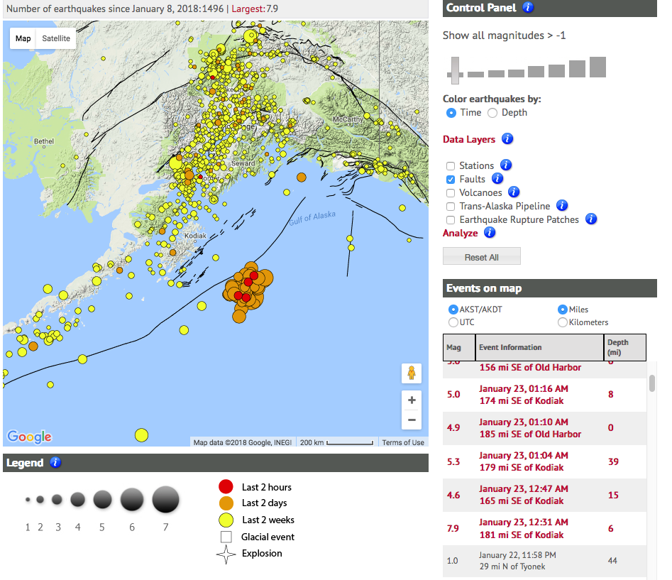
Alaska was rocked by a magnitude 7.9 earthquake just after midnight on Tuesday, January 23, 2018. The location of the quake was off the coast of Kodiak Island in the Gulf of Alaska, and shaking was felt strongly throughout southcentral communities and as far away as Washington state. It was all hands on deck at the Alaska Earthquake Center - pinning down the exact location, making calls, and checking on our systems. To make matters more interesting, this earthquake happened in a place that we didn't really expect it to, and as a result it didn't rupture in the same way that subduction zone earthquakes (earthquakes that happen along the boundary between two plates) usually do. We are still weeding through all of this new information, trying to get a handle on exactly what happened out there beneath the waves. We'll be pushing out new information, new graphics and updated interpretations over the next several days and weeks. They'll appear here, on our evolving content page, and of course on our Facebook page.