


RAG
Ragged Mountain, AK, USA
Operated by: Alaska Earthquake CenterLatitude: 60.3863 N
Longitude: -144.6773 W
Elevation: 2467.2 feet (752 meters)
Installed: 1984
Instrumentation at this station includes:
broadband seismometer
strong motion seismometer
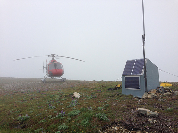
RAG is across the Copper River Valley from Cordova, on a peak north of Ragged Mountain. It was installed in 1984 and upgraded in 2006 as part of the SainT Elias Erosion/tectonics Project (STEEP). Funded by the National Science Foundation, the project ended in 2012. RAG was updated with a borehole seismometer in 2022. RAG also relays data to Cordova from four other remote stations. Located in the Chugach National Forest, RAG is generously hosted by our partners at the USDA Forest Service.
The Last 24-Hours
UTC times are 9 hours ahead of Alaska time (8 hrs during daylight savings). Seismogram view is courtesy of the IRIS Data Management Center. For additional views of this stations data:
4-day seismogramlong-term spectogram
noise PDF viewer