


I21K
Tanana, AK, USA
Operated by: AKLatitude: 65.17998 N
Longitude: -151.98224 W
Elevation: 813.6 feet (248 meters)
Installed:
Instrumentation at this station includes:
broadband seismometer
strong motion seismometer
meteorological package
Infrasound sensor
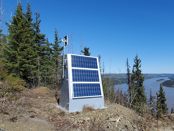
I21K is nestled on a narrow ledge along a steep slope overlooking the confluence of the Yukon and Tanana rivers. The installation team noted the ledge limited the location of the strong motion sensor, "based on where it was possible to dig a sufficiently large hole to bury the canister and within range of the hut so that the sensor cable would reach....The most accessible location that fit these criteria was a small dirt patch just over 6’ north of the hut." The site's small clearing is surrounded by boreal forest in the Yukon-Tanana Uplands. Field teams have noted "Lots of new brush and alders growing up around the site." This station was acquired in 2019 under dedicated support from our partners at the U.S. Geological Survey to strengthen earthquake monitoring across southern Alaska. The site was originally installed as part of the USArray project. I21K is generously hosted by our partners at the Tanana Tribal Council.
The Last 24-Hours
UTC times are 9 hours ahead of Alaska time (8 hrs during daylight savings). Seismogram view is courtesy of the IRIS Data Management Center. For additional views of this stations data:
4-day seismogramlong-term spectogram
noise PDF viewer