


KODIAK ISLAND, Alaska — Alders, alders, everywhere.
When you follow scientists in the Alaska wilderness, you’ll almost certainly get alder-snagged.
In November, near Homer, alders grew considerately on Grewingk Glacier till, with space to maneuver ourselves and our heavy packs.
A few days later, on Kodiak Island, the alders were a bit more rude. My fieldwork companion, University of Alaska Fairbanks doctoral student Cade Quigley, burst through yet another alder thicket and announced that we had arrived:
“Here’s the last mud pie.”
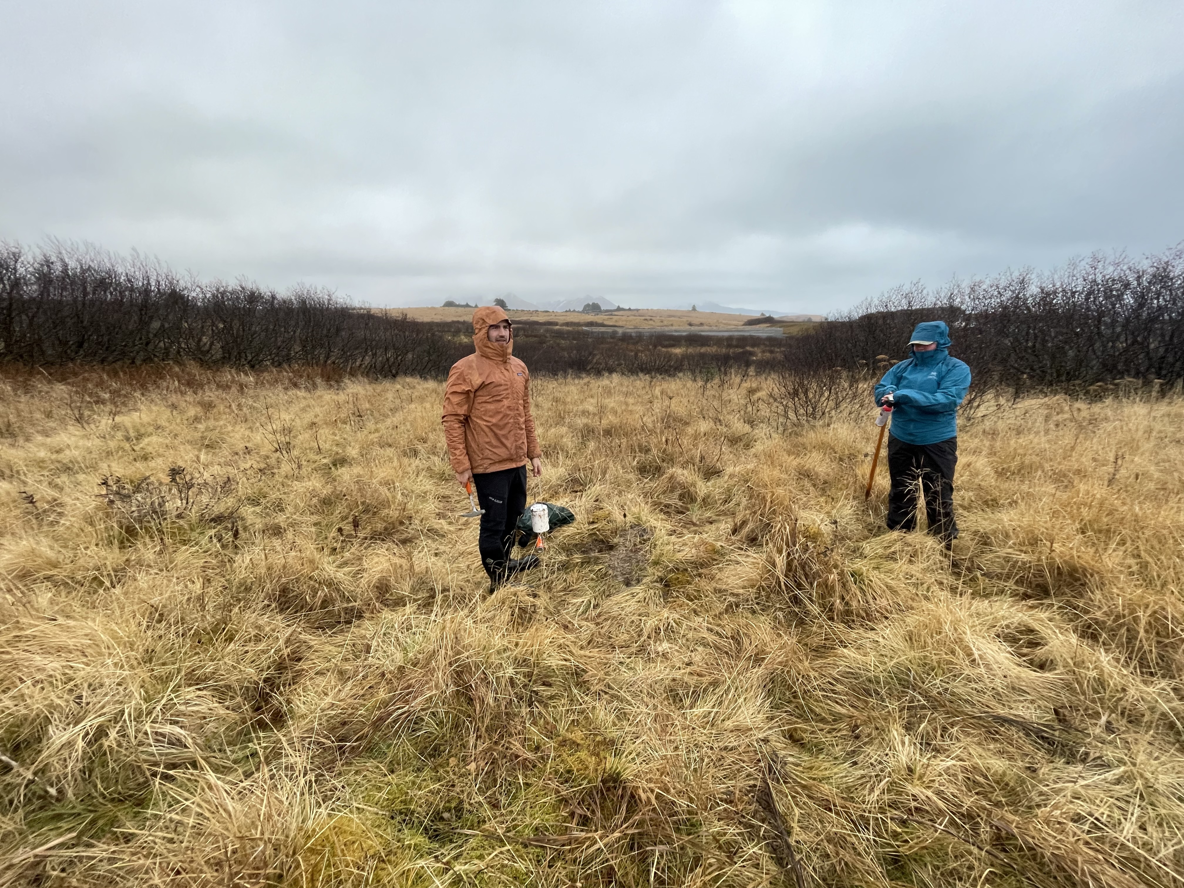
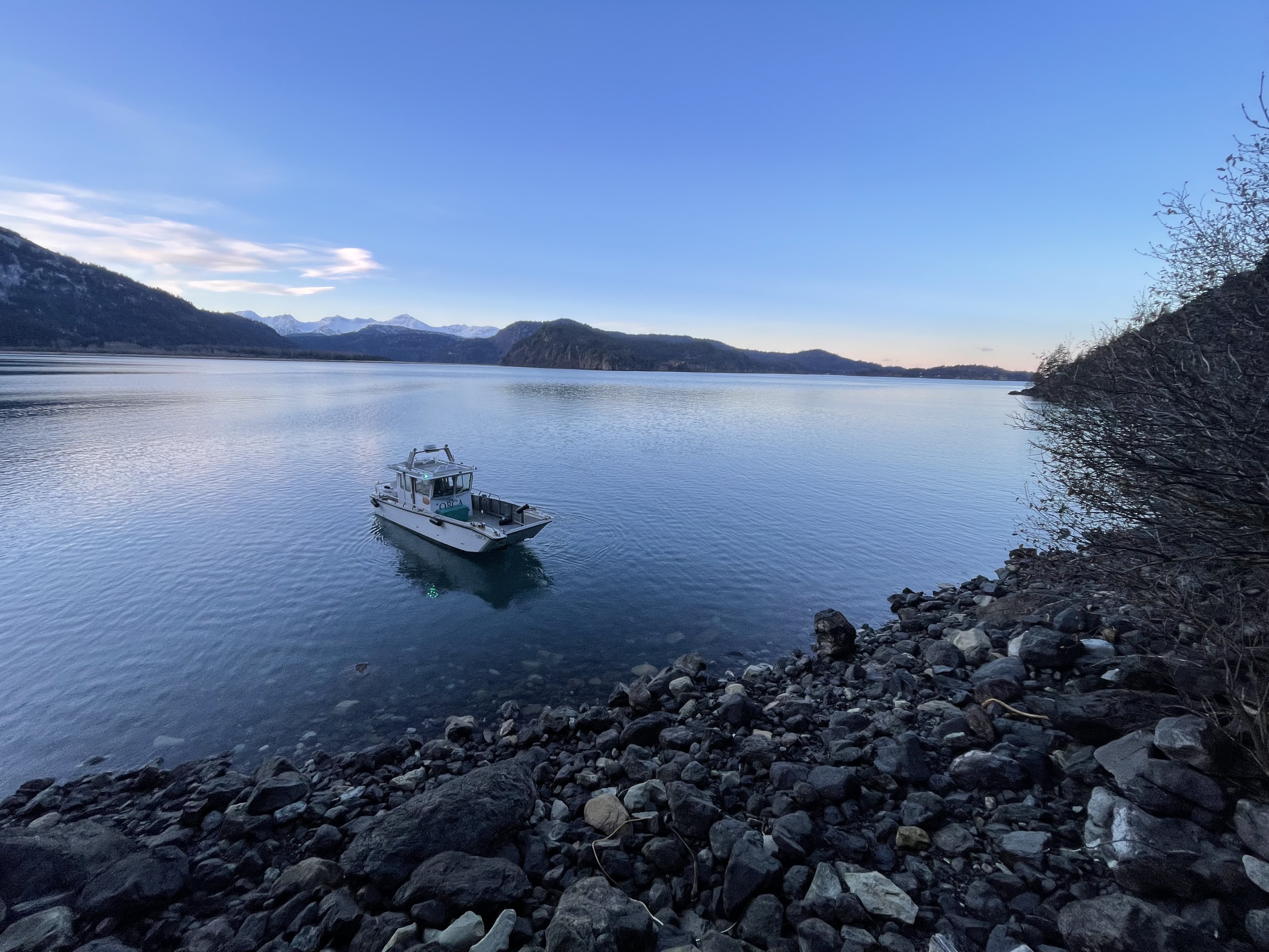
I had been accompanying Quigley and fellow doctoral student Sarah Noel for a few days (Figure 1), collecting story ideas. Along the way, I’d begun to realize there might be two tales worth telling here: one about Alaska’s future earthquake early warning system, and one about the people who are making it possible.
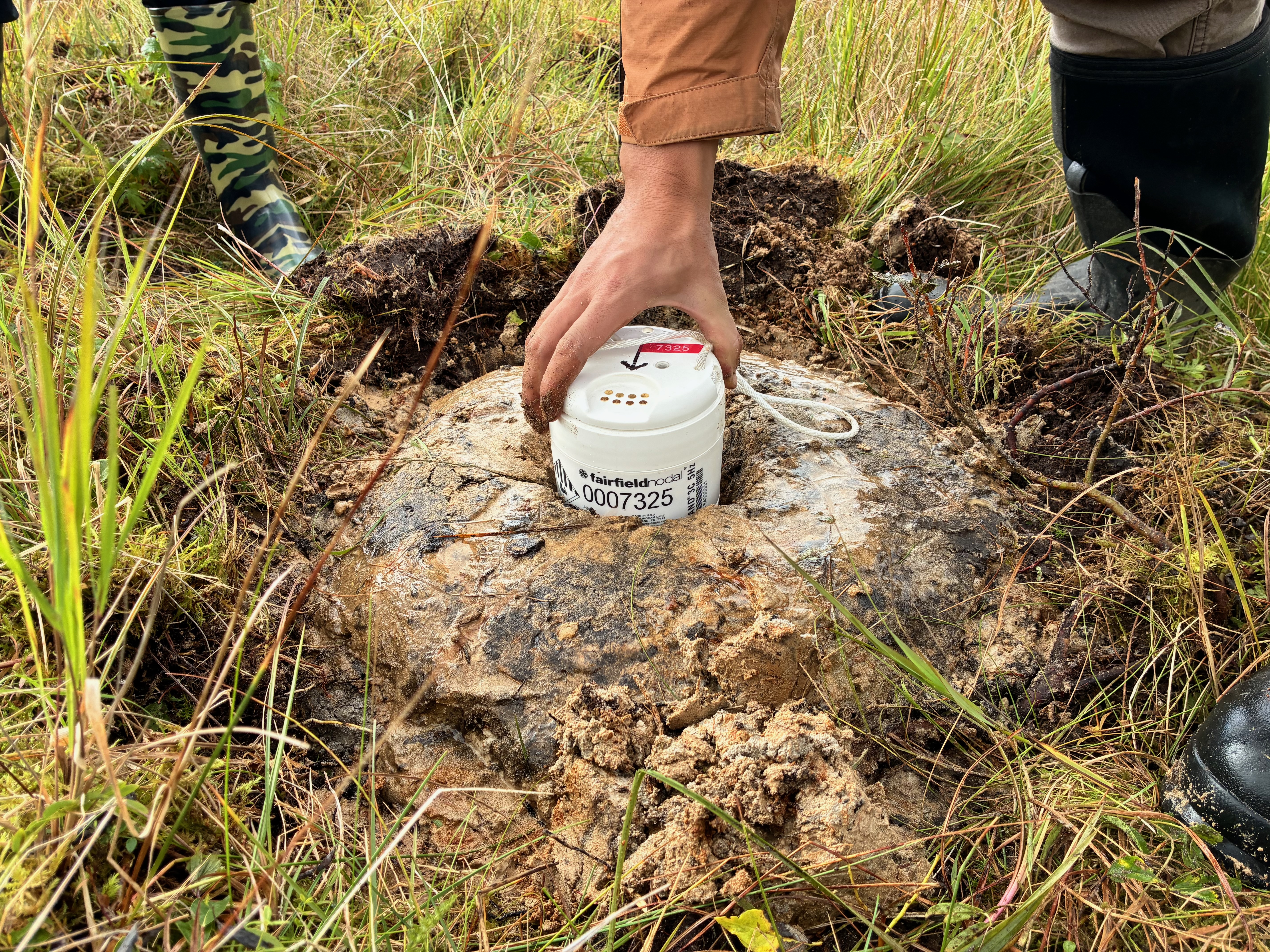
At the alder thicket on Kodiak, Quigley used his rock hammer to pick at a frozen pile of mud clutching a 6-pound seismic sensor (Figure 2), which resembled a marriage between a can of beans and a smoke alarm.
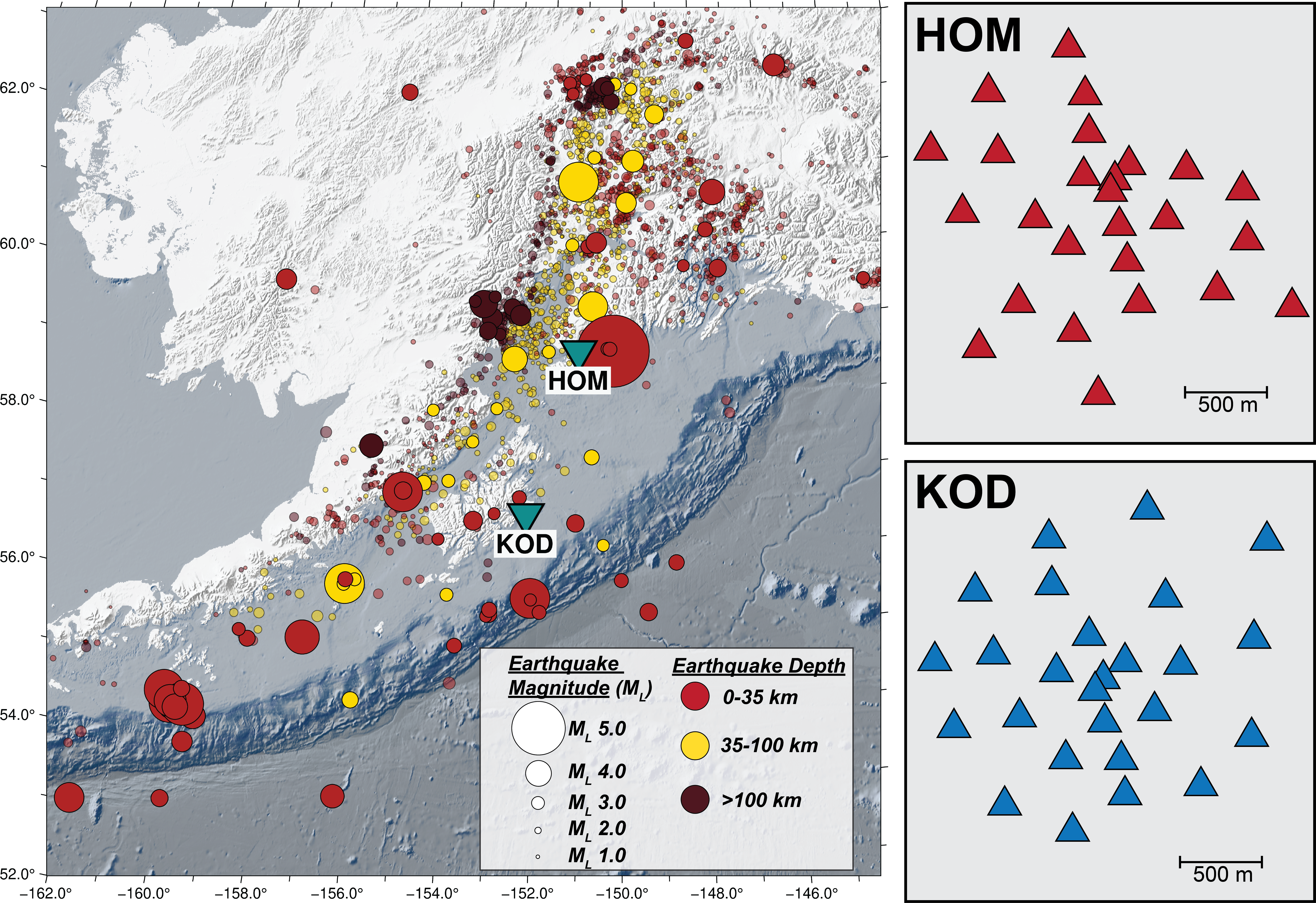
This sensor, one of 52 — half of them in Homer, half in Kodiak — that Quigley and other Alaska Earthquake Center scientists had installed a month earlier, now contained data from the thousand or so Southcentral Alaska earthquakes that occurred from early October to mid-November 2025 (Figure 3).
The Kodiak field site at the Pacific Spaceport Complex was chosen for its logistical ease and proximity to the earthquake-producing offshore subduction zone; however, this also meant that the crew had to wait until the end of the summer rocket launching season to deploy.
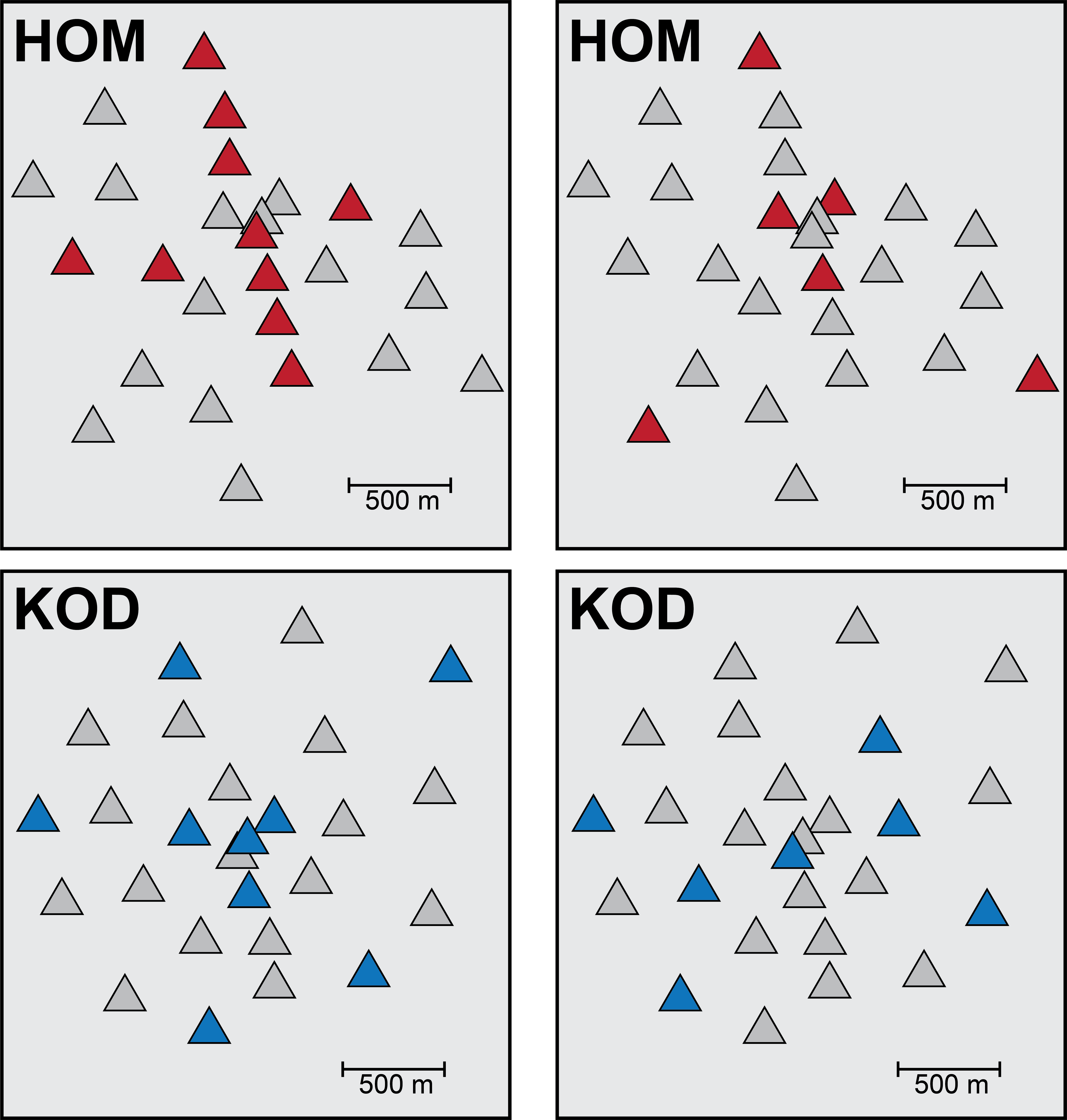
Working with project lead and Alaska Earthquake Center Director Michael West, Quigley had arranged these new sensors into two arrays (Figures 3, 4), specifically laid out to — hopefully — better capture Alaska’s potentially devastating offshore earthquakes. The deployments are part of a U.S. Geological Survey-funded study testing the design and feasibility of small-scale seismic arrays as part of an earthquake early warning system for Alaska.
In the future, Alaskans may receive messages via the ShakeAlert system, which can warn people that an earthquake has occurred and to expect strong shaking in a certain number of seconds. The Alaska implementation plan for ShakeAlert includes a dozen seismic arrays along its coastline.
The system is already available in California, Oregon, and Washington.
Compared to traditional seismometers, an array can more accurately record large earthquakes that occur along Alaska’s portion of the Ring of Fire, a seismically active horseshoe-shaped belt around the Pacific Ocean.
In this zone, “very large earthquakes are not just points on a map. It’s like a very large rupture patch, sometimes several hundred kilometers long,” Quigley said. “Basically, an array can see in real time where the front of that earthquake is moving.”
Such arrays are being tested elsewhere, but the high level of seismicity in Alaska makes it an optimal testing ground. The Alaska Earthquake Center processes on the order of 40,000 earthquakes each year, and typically more than one magnitude 5 or greater per week. “How can we get the most accurate locations with as few stations as possible?” Quigley said this research aims to address that question. The hope is that Alaskans will find a warning system useful to help prevent loss.
But perhaps only a few people will pause to wonder how this hoped-for system is progressing from “mud pie” sensors toward a tidy phone message.
For just this one sliver of the overall warning system effort, Quigley skillfully knitted together months of planning: vehicle rentals, plane tickets, lithium battery shipments, safety plans and many other large and small tasks. The Homer array took the bulk of the planning, aided by seismology colleague Kasey Aderhold, a project manager for EarthScope Consortium who lives in Homer. Aderhold suggested the Grewingk Glacier site and reconned the area to see if it could host the array.
Of course, fieldwork isn’t just logistics. Flying home to Fairbanks, I found myself thinking about small, shared human moments: laughing over Quigley eating clam chowder with chopsticks, smiling through a day of sideways rain in Kodiak and a bluebird-sky celebration after the last sensor was pulled (Figure 5). Collectively, these moments became a counterpoint to Quigley’s logistical work — a reminder that the path to earthquake early warning runs through real people.
What’s next for Quigley now that the fieldwork is over? He will spend the next few months analyzing his sensor data with the goal of determining the optimal number and configuration of these sensors for detecting offshore earthquakes (Figure 4). And perhaps, from the comfort of his dry, warm office, he’ll even look back fondly on sideways rain.
This insight into Alaska Earthquake Center field work was contributed by Sara Wilbur, Communications Coordinator with the University of Alaska Fairbanks Geophysical Institute, who joined Alaska Earthquake Center graduate students on their last stint of the season. The story is slightly modified from the original published December 4, 2025.