

Tsunamis can arrive within minutes in Alaska’s coastal communities. Do you know where to go?
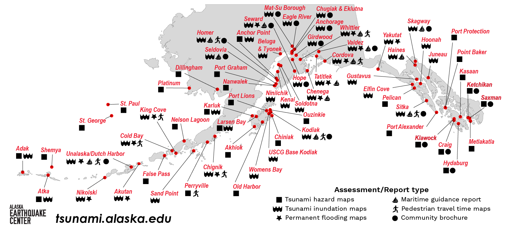
With this question in mind, the Alaska Earthquake Center has developed a wide range of products, from scientific reports to handy brochures, to help share vital tsunami hazard information. Our aim is to provide science-based resources to help community decision-makers and individuals be prepared. We offer various publications for nearly 70 coastal communities, from Alaska's largest urban area of Anchorage to smaller, rural communities such as Hydaburg in Southeast Alaska (Figure 1).
The first step in developing tsunami preparedness products for each community is mapping the tsunami hazard. To achieve this, we collaborate with the Alaska Division of Geological and Geophysical Surveys (DGGS) and the Alaska Division of Homeland Security and Emergency Management to evaluate and map potential flooding. Communities are selected with consideration given to their tsunami hazard exposure, location, infrastructure, availability of data, and willingness to incorporate the results into a hazard mitigation plan. The maps reflect the best tsunami science available at the time of publication.
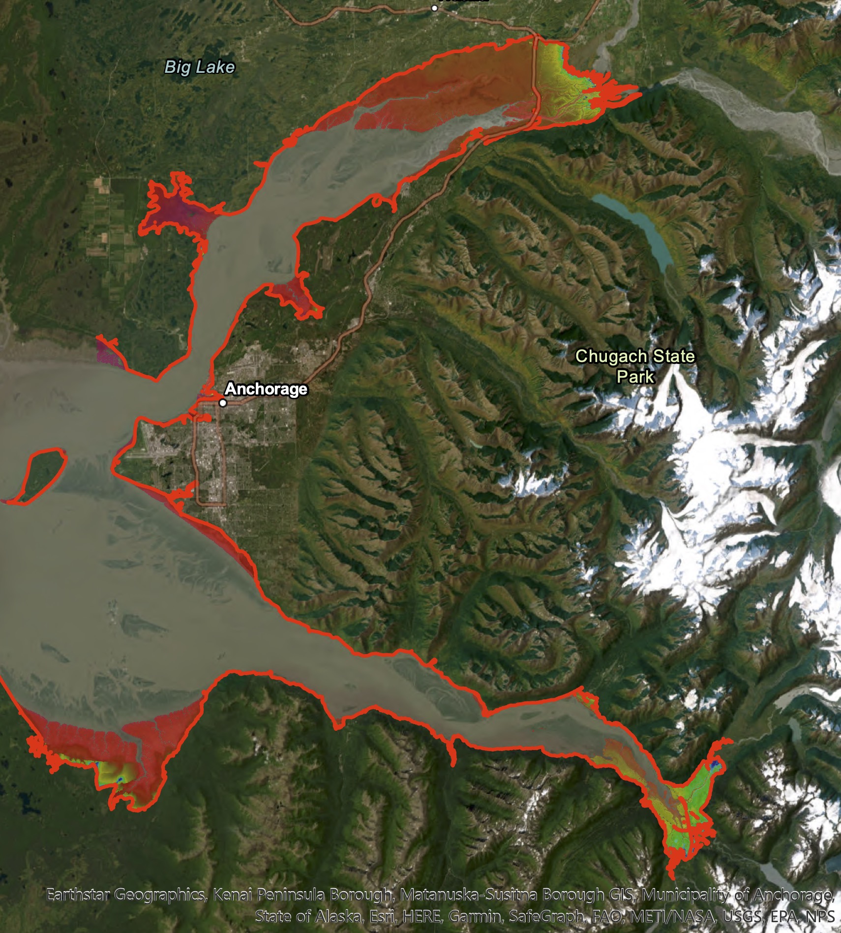
First, our tsunami scientists Elena Troshina and Dmitry Nicolsky generate a range of mathematical models, or scenarios, of tsunami dynamics. The scenarios are run using the supercomputer at the UAF Geophysical Institute. We use a combination of the modeling results to create inundation maps for a worst-case scenario. Many factors affect the flooding extent shown on the map, including vertical land changes (uplift or subsidence) from an offshore earthquake, tides, landslides, and local topography reveals the potential flooding extent for a worse-case scenario.
“We never know 100 percent how a tsunami will interact with tides, underwater landslides, and other factors, but tools like this, that use the best science available, help emergency managers create plans for their community,” saidTroshina. These maps can help emergency managers answer questions such as, Where should they set up an assembly area for people to evacuate to? Are critical facilities, such as hospitals, fire stations, or airports, in the potential flooding zone? (Figure 2.) The maps also show people which areas are safe and evacuation is unnecessary. This can cut down on potential traffic congestion in an emergency situation.
In 2023, the Earthquake Center and DGGS released the upper Cook Inlet inundation report, the first scientific report that examined the tsunami hazard for the Anchorage and Mat-Su areas. The authors discovered that a tsunami could reach upper Cook Inlet, countering a long-held public belief that the region has no exposure to tsunami hazard. In addition to the report, the Earthquake Center and our partners published A Hidden Wave Emerges storymap, about the science and history of tsunamis in the upper Cook Inlet area.
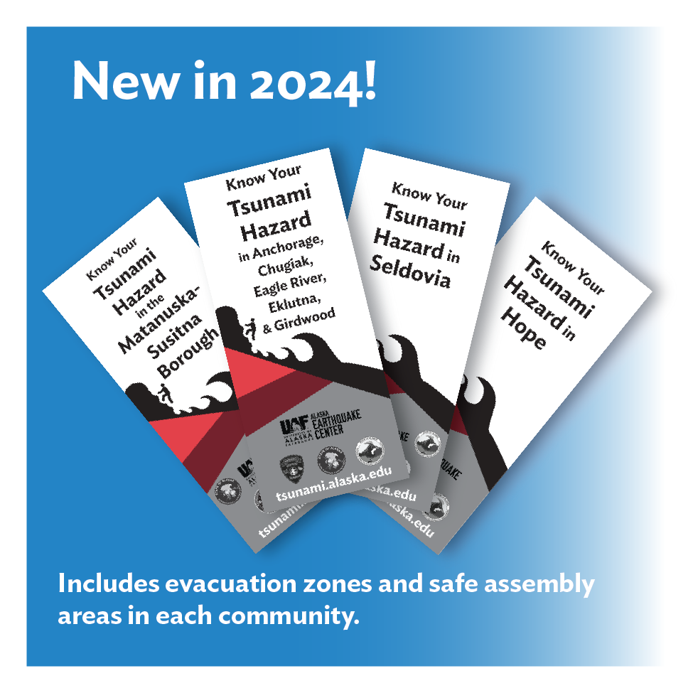
One of our newer projects is the “Know Your Tsunami Hazard” series of community-specific brochures. Our most recent set of brochures, published in fall 2024 (Figure 3), include the Anchorage area, Matanuska-Susitna Borough, Hope, and Seldovia. Publishing the Cook Inlet brochures this year was spurred by interest generated by the inundation report.
We coordinate with emergency managers in each community to create the brochures. A compilation of the data available, the brochures feature a map of tsunami hazards, including estimated flooding, potential underwater landslide zones, locations with long pedestrian evacuation times, and dangerous currents in harbors and waterways. We work with each community to help them develop an evacuation line based on the inundation report information. The text of the brochure includes safety information, historical tsunamis in the community, and local emergency information sources and contacts. Data files for each community-generated evacuation line are available on our website, so that communities can produce other publications as needed.
Want to check if your home, school, workplace, or weekend trip destination is in a tsunami hazard area? The interactive map at tsunami.alaska.edu allows you to select a community and zoom in to view an area. The map shows hazard areas and estimated water depths (where detailed landscape data is available).
For those who spend time out on the water, the Earthquake Center has written Maritime Response Guidance reports for about a dozen communities. These reports provide tsunami response guidance for small vessels, such as recreational sailing and motor vessels, or commercial fishing vessels. The reports follow the draft guidance developed by the National Tsunami Hazard Mitigation Program and are based on anticipated effects from potential worst-case scenarios involving distant or local tsunamis. Tsunamis can cause dangerous currents in waterways and harbors, so it’s important for vessel operators to be aware of what to do in case of a tsunami. Even if there isn’t a maritime report for a community you are interested in, the general safety information for vessel operators is worth a look.
For any community that had a tsunami inundation study completed, it is possible to estimate the amount of time required to evacuate to high ground. These estimates are shown in our pedestrian travel time maps. The models assume evacuation by foot and include complications such as ground cover (pavement, trails, brush, etc.), steep terrain, and other barriers identified by the community. By flagging which areas of a community may take too long to reach on foot, this report gives emergency managers a tool to generate alternate plans, such as designating multiple assembly points.
Whether you live, work, or play in a coastal community in Alaska, be prepared by learning about tsunami hazards in your area. You can find a full list of tsunami products by community at https://earthquake.alaska.edu/tsunami/community


