
(credit: Alex Fozkos)

(credit: Cade Quigley)


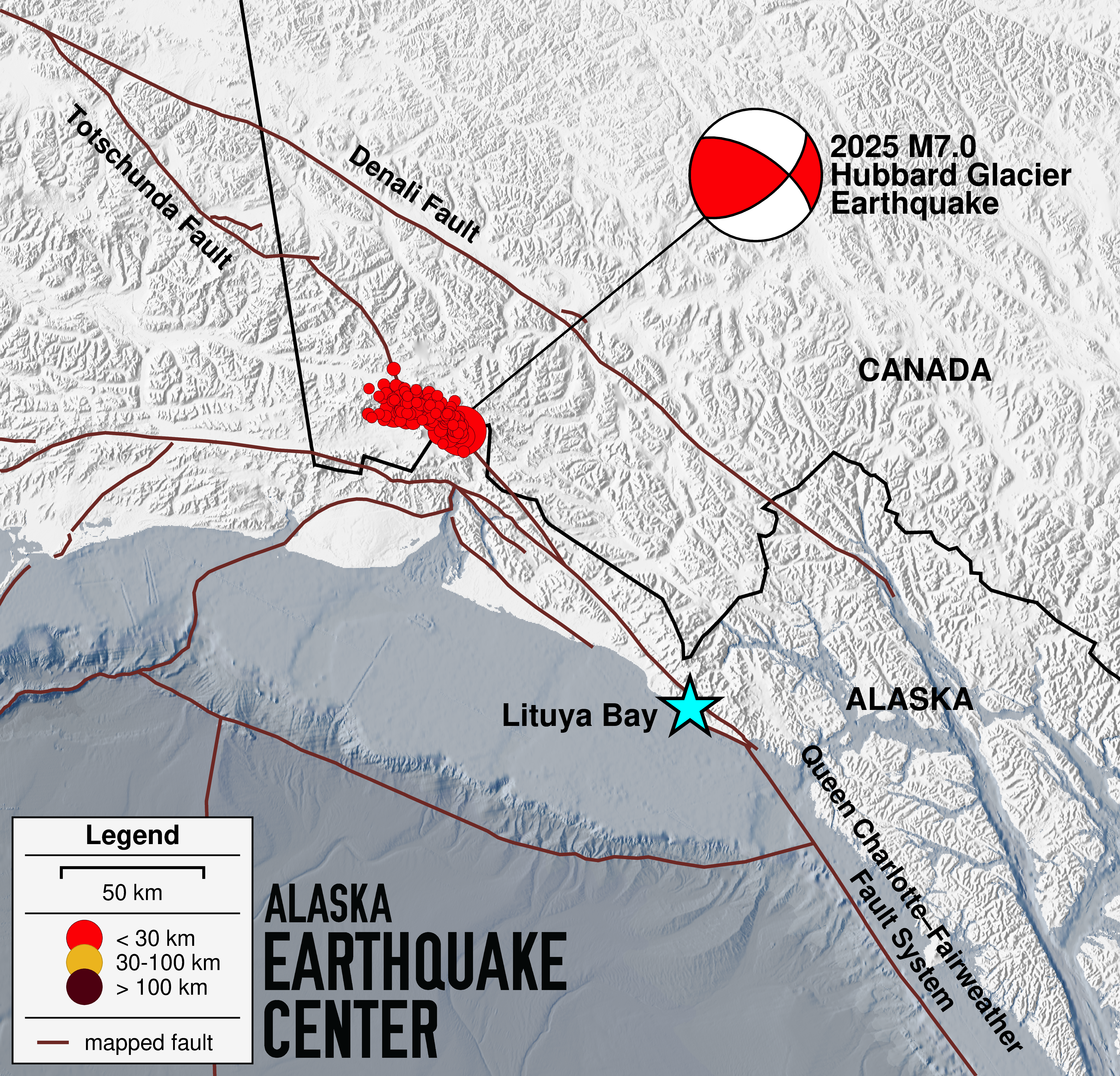
On Saturday, December 6, just before noon, a magnitude 7 earthquake was felt across a 500-mile radius around the epicenter, near Hubbard Glacier, about 60 miles north of Yakutat, Alaska. At about three-quarters of a mile into Canada (Figure 1), this event technically lies outside of Alaska. Coming on the heels of a magnitude 6 near Susitna on Thanksgiving Day, and not overly long since the Sand Point magnitude 7.3 in July, the year 2025 seems determined to remind Alaskans that we live amongst an array of active faults.
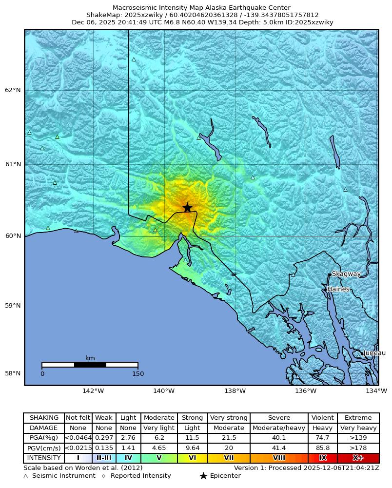
The Saturday earthquake was quite shallow, so ground shaking was very strong in a 50-mile radius of the epicenter (Figures 2, 3), and we expect to hear reports of damage to building foundations and of objects flying off of shelves. The closest station to record shaking (PNL, Figure 3) experienced 21 seconds of strong shaking, and 59 seconds of perceptible shaking.
This earthquake location thus far appears to be between the Fairweather Fault in Canada and the Totschunda Fault in Alaska (Figure 1). While we are currently calling it a rupture on one of the northern strands of the Fairweather Fault System, it’s worth noting that in 2010, then-graduate student Julie Elliott at the University of Alaska Fairbanks called the section that ruptured today the Connector Fault. The National Seismic Hazard Model picked up this name in 2023.
The direction of the earthquake rupture aligns with the northwest–southeast orientation of the faults mapped in this area (Figure 1). The vigorous aftershocks—two above magnitude 5 in the first 10 minutes, and about 180 above magnitude 3 by the following morning—are mapping out the fault (Figure 1). Additionally, stations northwest of the epicenter experienced longer shaking (Figure 3), which supports the interpretation that the fault ruptured in that direction. At this time, the rupture appears to extend tens of miles. As our analysts review aftershock epicenters in the coming hours and days, we expect the picture of this fault to sharpen considerably. Aftershocks will continue, and their locations will help scientists better understand this segment of the fault.
While no tsunami warning was issued after this earthquake, it’s worth noting that the largest tsunami runup in the world, the July 1958 Lituya Bay tsunami, started with a M7.8 earthquake on the Fairweather Fault. No landslides were reported after today’s earthquake, either. Still, the event is a reminder that large earthquakes, landslides, and tsunamis often go hand-in-hand in coastal Alaska.
We will place additional content related to the earthquake as it emerges under the Details tab on the event page.