


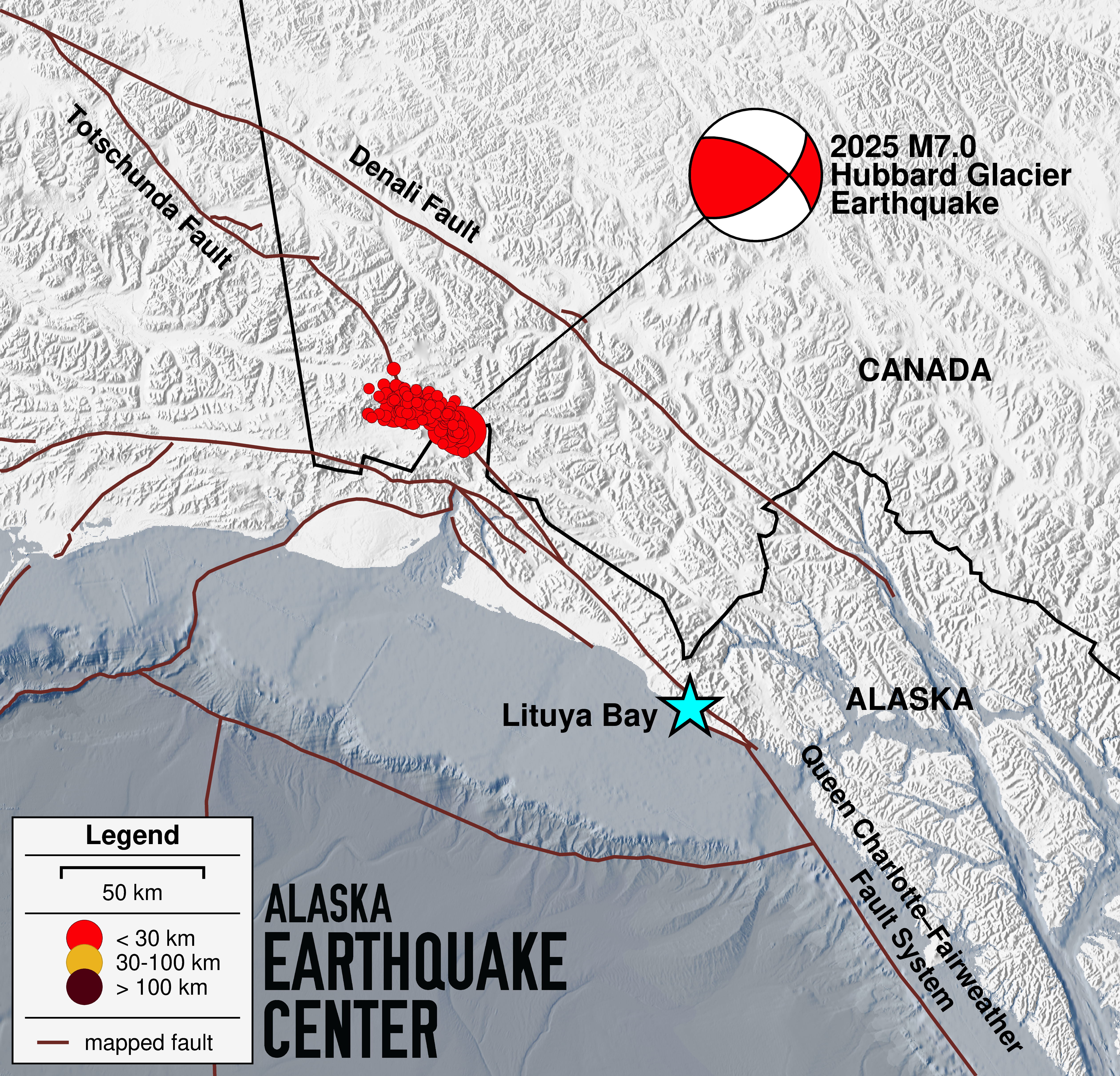
2025 M7.0 Hubbard Glacier Earthquake
This magnitude 7.0 earthquake occurred on December 6, 2025 at 11:41 AM AK time (the initial magnitude was 6.8, which was then updated). This event was located 57 miles NNE of Yakutat and 3 miles deep.
This event was felt throughout southeastern and southcentral Alaska.
The National Tsunami Warning Center announced there was no tsunami danger for Alaska, the US West Coast, or British Columbia.
This map of southeast Alaska shows active faults and the location of the December 6 magnitude 7 main shock at the northern tip of the Fairweather Fault System. As of the morning of December 7, there have been about 180 aftershocks above magnitude 3.
(figure credit: Sarah Noel; fault locations from the 2023 U.S. Geological Survey National Seismic Hazard Model)
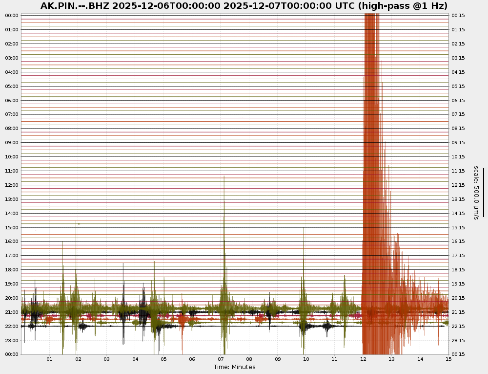
The past 24 hours of seismic data at station PIN. Each line is 15 minutes of data. The mainshock is is clear (in orange). The next 15 minutes (in green) shows multiple magnitude 4 and 5 aftershocks. Figure courtesy of EarthScope Data Management Center.
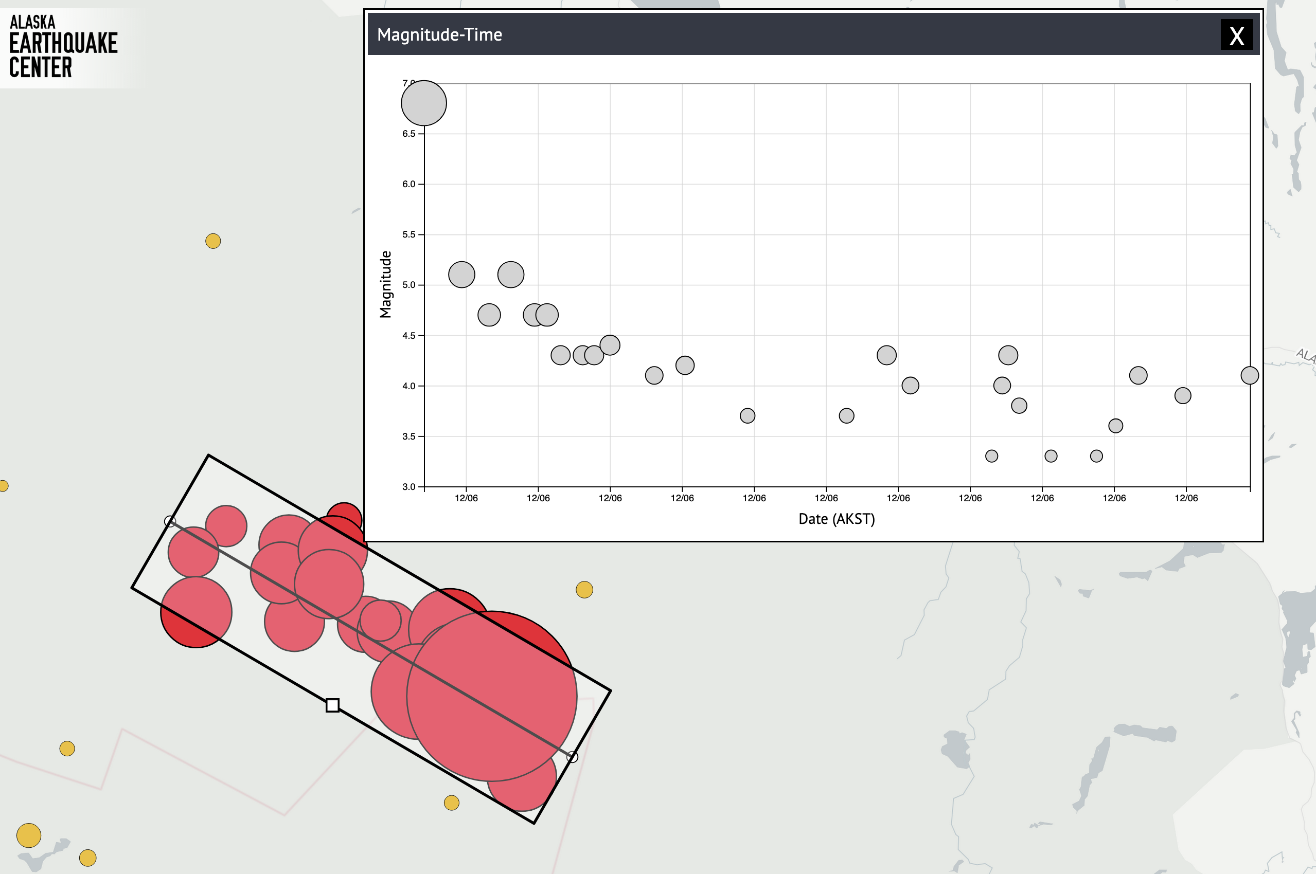
This earthquake spurred a highly active aftershock sequence. Within the first two hours, there were more than 20 aftershocks over a magnitude 3, with the largest ranging from M4 to M5.1. The chart below shows magnitude over time for the first 2 hours after the mainshock, showing the M7.0 mainshock and aftershocks, with largest a pair of M5.1 events.
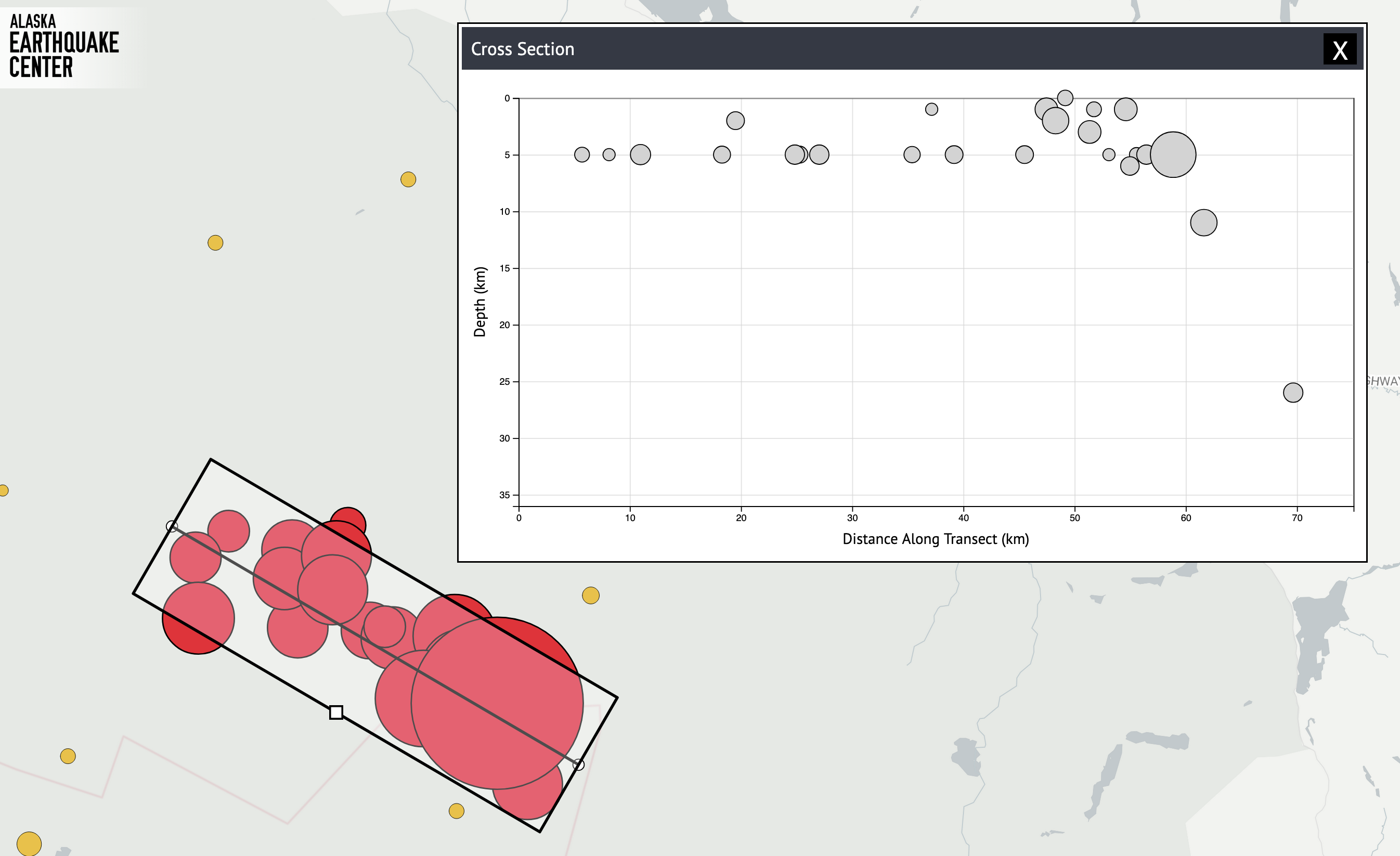
Cross section showing the shallow depth of the Hubbard Glacier Earthquake series, with the largest dot the M7.0 mainshock, taken ~2 hours after the mainshock.
As of two hours after the mainshock, it seems pretty clear that this earthquake occurred on one of the northern strands of Fairweather Fault System. The shallow strike-slip focal mechanism (in other words, the direction of the rupture) aligns with the NW-SE orientation of the faults mapped in this area. The vigorous aftershocks are slowly mapping out the extent of the fault. Most of the epicenters in our maps are fully automatic at this early stage, so there is some scatter in the locations. However, the rupture appears to extend several tens of miles in the same NW-SE direction as the mapped faults. As our analysts review these epicenters in the coming hours and days, we expect the picture of these fault to sharpen considerably.
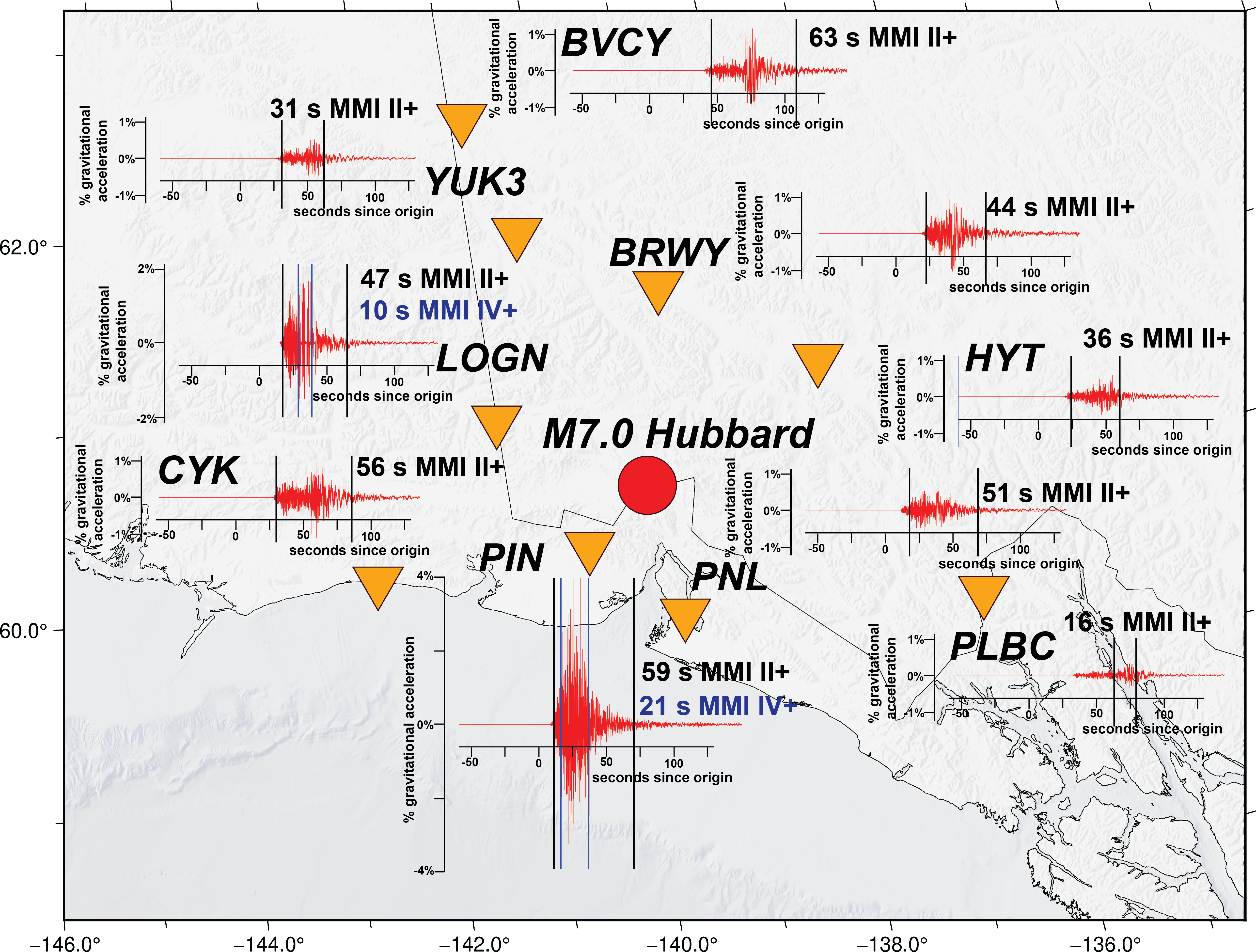
Seismic stations around the epicenter of the December 6, magnitude 7 earthquake indicate that shaking was strongest and longest at station PNL, ~50 miles away. Strong shaking lasted 21 seconds, and perceptible shaking lasted 59 seconds. Additionally, shaking seems to have lasted longer at stations northwest of the epicenter, supporting the idea that the fault ruptured in that direction.
(credit: Cade Quigley)
Learn More
December 6 Magnitude 7 Near the Canadian Border (Alaska Earthquake Center story)