


On Sunday morning at 6:58 Alaska time, we recorded a magnitude 6.4 earthquake 52 miles southwest of Kaktovik. It was, by a wide margin, the largest earthquake ever recorded north of the Brooks Range in Alaska. This earthquake started a vigorous aftershock sequence, including a magnitude 6.0 earthquake at 1:15pm—the second largest ever recorded north of the Brooks Range.
We will keep this summary updated as the sequence develops. Our significant event page, where we collect new figures, maps, and analysis, is here.
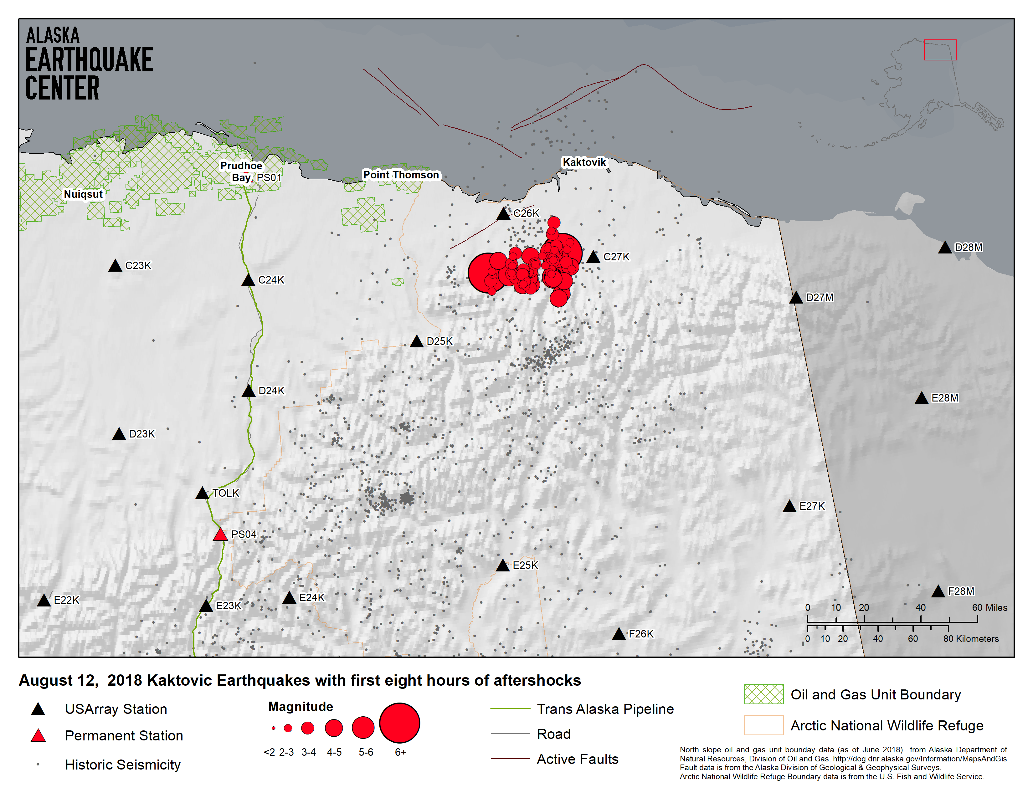
The epicenter was in the remote Sadlerochit Mountains, about 25 miles south of the Beaufort Sea coast. We have received no reports of damage or injuries, and Alyeska reports there was no impact on pipeline operations. The earthquake was felt widely, though, with reports coming in from Kaktovik west to Nuiqsut and as far south as Fairbanks.
Because of its location on the North Slope, we immediately began to field questions about possible induced seismicity. Everything we know about this earthquake is consistent with natural earthquake activity. The orientation of the strike-slip mechanism aligns perfectly with known tectonics and previous earthquakes in the region.
Seismicity in the eastern Brooks Range follows a zone of earthquake activity about 240 miles long and 120 miles wide, from the Beaufort Sea in the north to the Tintina fault in the south. We have recorded over 4,400 earthquakes in this area since 1970, though none as large as this one.
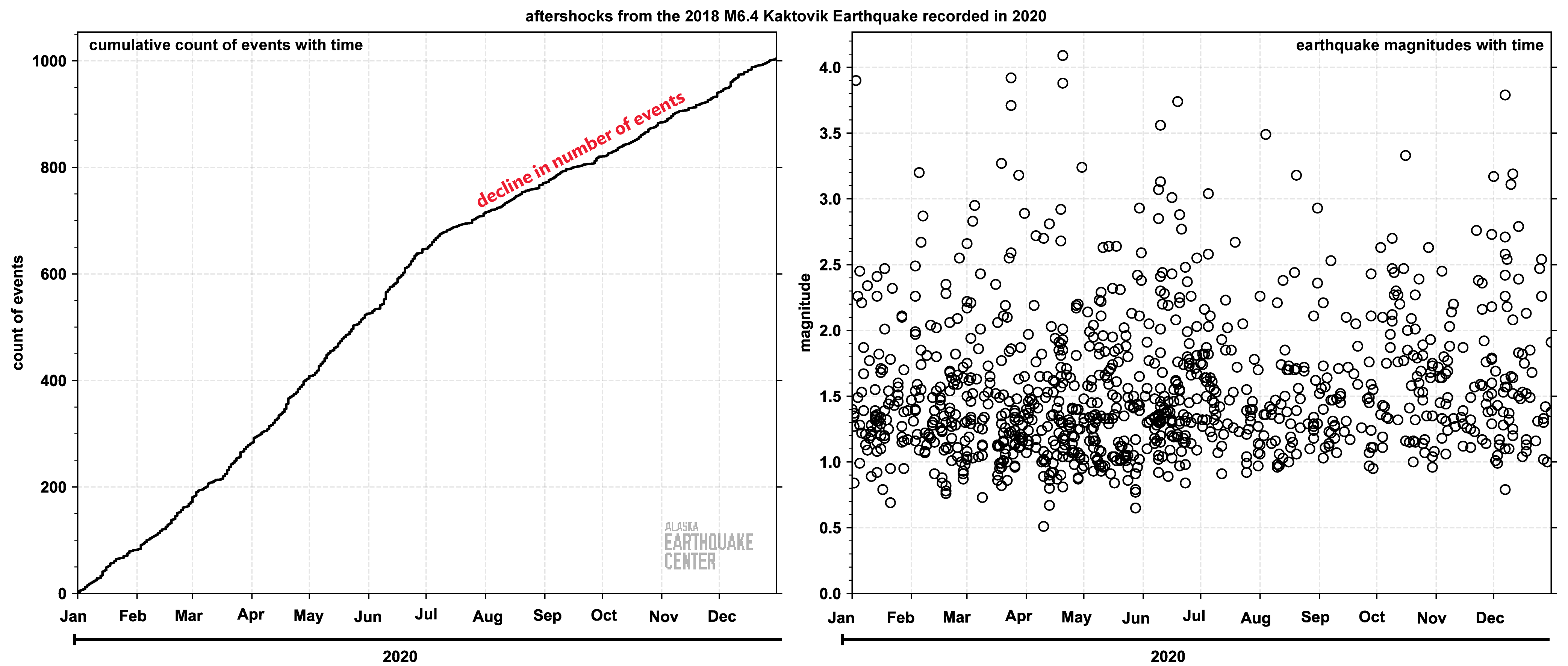
We anticipate a very active aftershock sequence. In the first hour or so after the mainshock there were seven aftershocks exceeding M4, including one M5.6. Then, at 1:15pm, a magnitude 6.0 aftershock struck about 20 miles east of the mainshock. We expect this rate of aftershocks to slowly decline but remain active for many weeks or months. At present there is no evidence to suggest subsequent earthquakes larger than the M6.4 mainshock. Scientifically, however, this region is poorly understood, and the behavior of the fault or faults responsible for today’s earthquake are not known.
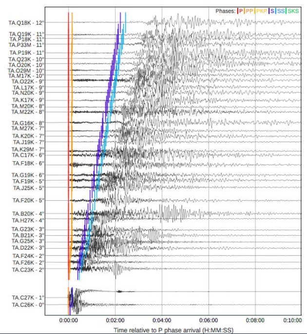
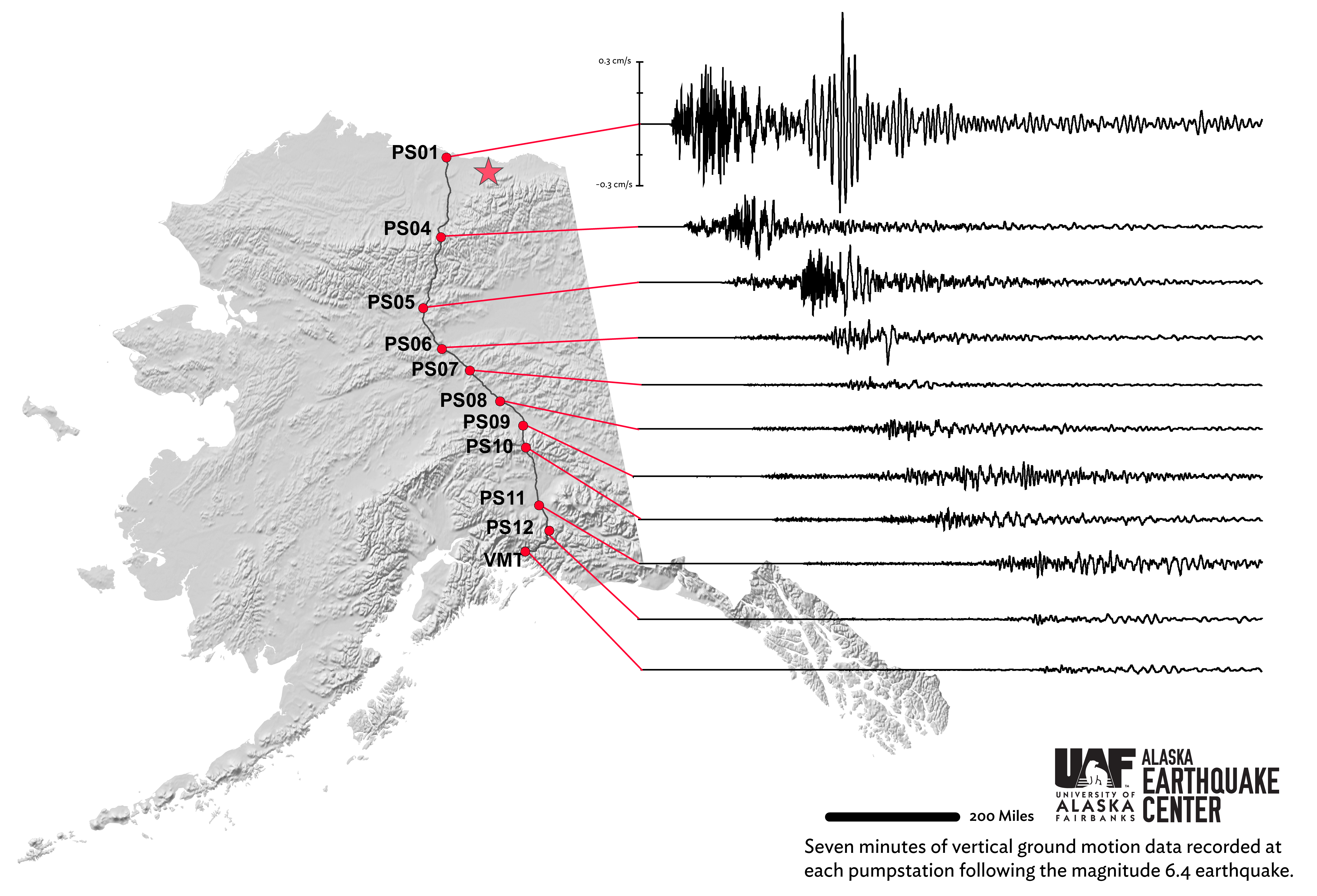
This earthquake will be extremely important for understanding North Slope seismicity and, more generally, how seismic waves travel throughout Alaska. We are very fortunate that this earthquake happened during the Transportable Array deployment in Alaska. Before 2013, the nearest stations would have been at Pump Station 1 and Pump Station 4. Instead, we have high quality recordings from a number of research-grade stations fairly close to the source.
Learn more here about this earthquake.