
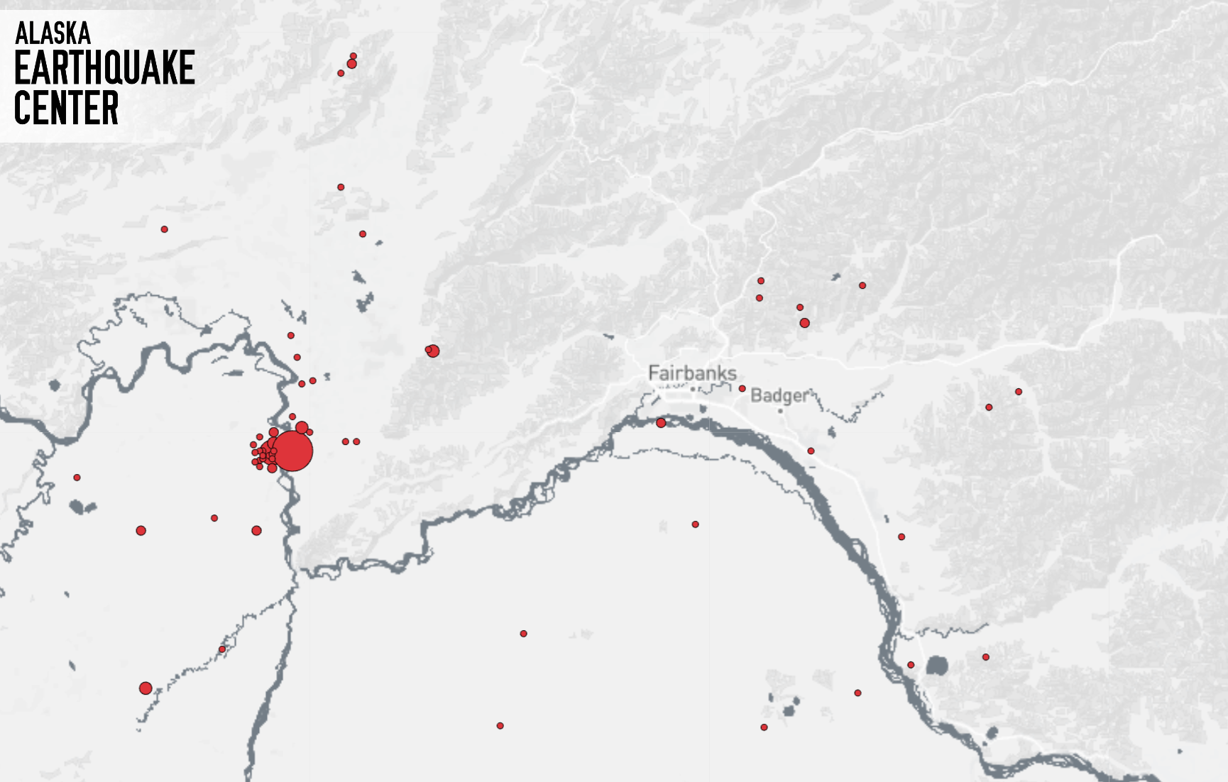
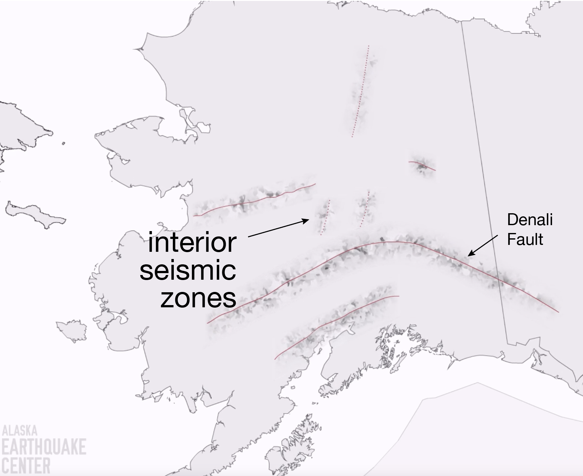


The M4.8 earthquake that was felt widely on Sunday evening (September 18, 2022) occurred along a well-known fault system about 40 miles west of Fairbanks (Fig. 1). The Minto Seismic Zone is the source of many (though certainly not all) of the modest shakers felt in the greater Fairbanks region. The Minto Zone is one of a few swaths of earthquake activity that align as north-easterly “stripes” across the region (Fig. 2). The exact cause of these zones is still somewhat debated. However, scientists generally agree that they are ultimately driven by the slow north-south squeezing of Alaska as the Pacific tectonic plate collides with Alaska along our southern coast. You can find an excellent explainer of this process here. We track hundreds of small earthquakes every year along these seismic zones. It is important to note that on rare occasions these zones spawn much larger and more damaging earthquakes. The 1937 earthquake on the similar Salcha Seismic Zone exceeded magnitude 7 and likely passed directly through what is now Eielson Air Force Base. You can read fascinating Fairbanks Daily News Miner articles from this earthquake here.
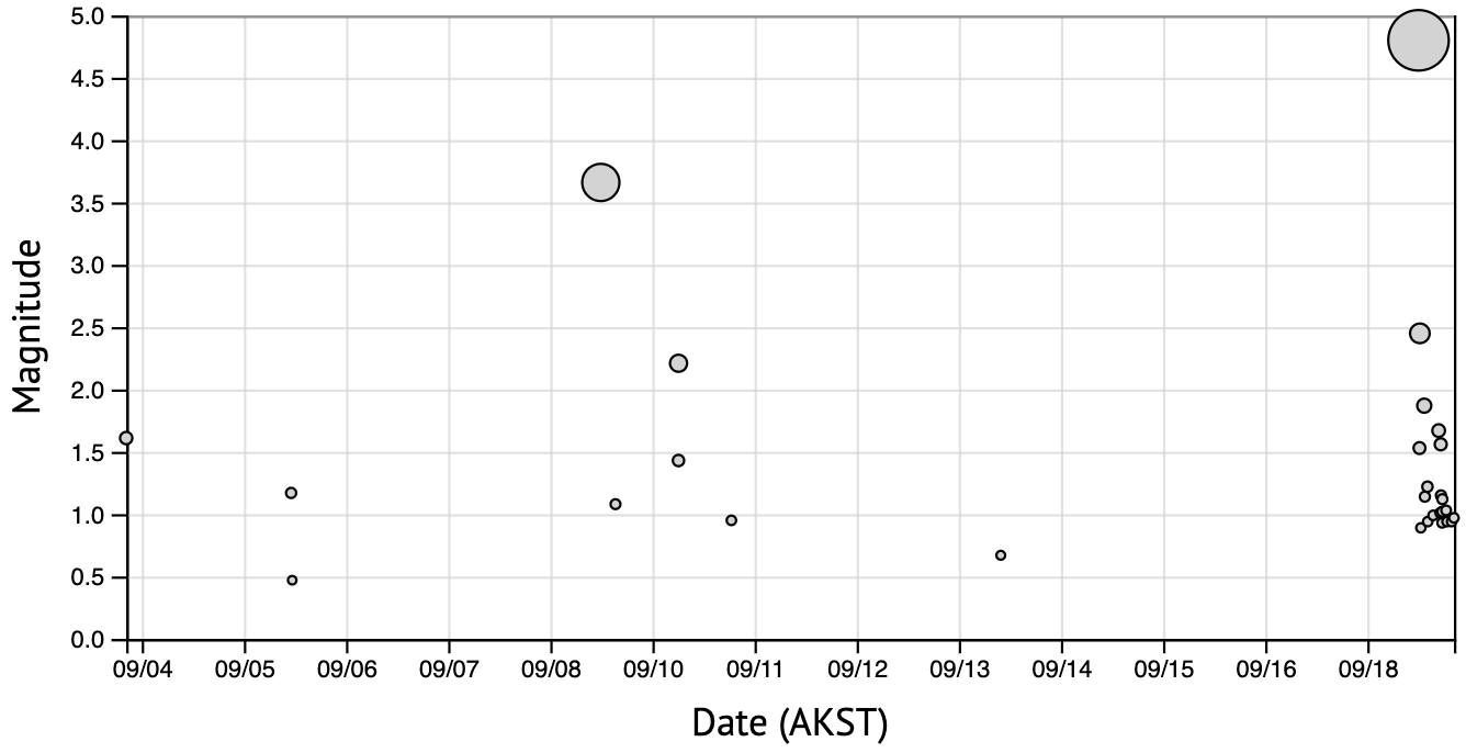
Interestingly, Sunday’s earthquake was preceded on Sept. 8 by a M3.7 in nearly the same spot. One could choose to call this a foreshock. Realistically, however, in an area where small earthquakes are happening every day, there are all sorts of patterns and links between nearby earthquakes, only some of which we fully appreciate. In the first 16 hours or so, we have noted about 20 aftershocks, so far all less than M2.5 (Fig. 3)
The strength of the shaking (or “ground motion” as we say) had an intensity near the earthquake of about 5. Across the Fairbanks-North Pole region, the intensity was in the 3-4 range. This is generally not enough to cause damage, but can on occasion move objects. It is absolutely enough to make cracking and other noises in buildings—a phenomenon people routinely report hearing. We know the intensity of the shaking (and the details of the earthquake itself) from monitoring stations we operate across the region. Our site in Manley is one of the closer stations to this earthquake (Fig. 5). The earthquake is very clear on this station at 1:15 (the plot is in UTC time). Perhaps more interesting, however, are all of the small aftershocks in the hours thereafter. These little quakes will probably continue for the next few days.
Perhaps I am feeling philosophic on a Monday morning, but I am going to propose that we consider ourselves lucky to have felt this quake. Much like seeing a bear in the distance while hiking, experiencing a modest earthquake is a special opportunity. On one hand it is a great chance to simply appreciate the active forces of nature that surround us. And on the other hand, it is a reminder that we need to respect what these forces can do because, on occasion, they are much more powerful than we are.
Visitors to our website Sunday evening noticed significant issues. The Alaska Earthquake Center operates a substantial software environment that ingests raw seismic data, like the Manley example in Fig. 5, and analyze it for patterns consistent with earthquakes. This is a significant set of computations that is running 24/7 and produces the first pass at earthquake reporting. We made behind-the-scenes upgrades to this system in recent days and learned the hard way on Sunday of some things that were not tuned as we thought. The problem caused significant issues with our website as well—a fact noted by many many people. Our team worked into the night to mitigate the issues and we will be pursuing long-term fixes in the coming days.