


At 9:10am on April 8, 2021 Alaskans from the Kenai Peninsula to Fairbanks had a little shakeup to start their day when a magnitude 5.5 earthquake hit. (As of the time this article was posted, there were no damage reports.) Several Earthquake Center staff felt it in Fairbanks. Some people reported feeling a small first shake followed by a rolling wave. The earthquake originated 16 miles southeast of Cantwell, nearly 100 miles from Fairbanks, so why was it felt so far across the state?
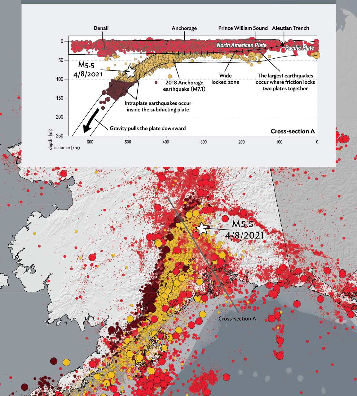
Alaska lies on a subduction zone, where the Pacific Plate thrusts below the North American Plate. The Aleutian Megathrust, the zone where the two plates grind against each other as the Pacific Plate descends, starts offshore of Southcentral Alaska and the Aleutian Islands. This is where the M9.2 1964 Great Alaska Earthquake ruptured. But the sinking Pacific Plate extends far beneath Alaska (see figure 1). The 2018 M7.1 Anchorage Earthquake occurred in the subducting Pacific Plate at a depth of about 35 miles. The depth and fault mechanism of the April 8 M5.5 earthquake reveals it to be a smaller sibling of the Anchorage Earthquake—it also originated in the subducting Pacific Plate, although even deeper than the Anchorage Earthquake. “It’s such a huge feature, the subduction zone really drives everything. It’s all connected,” said Stephen Holtkamp, a seismologist at the center.
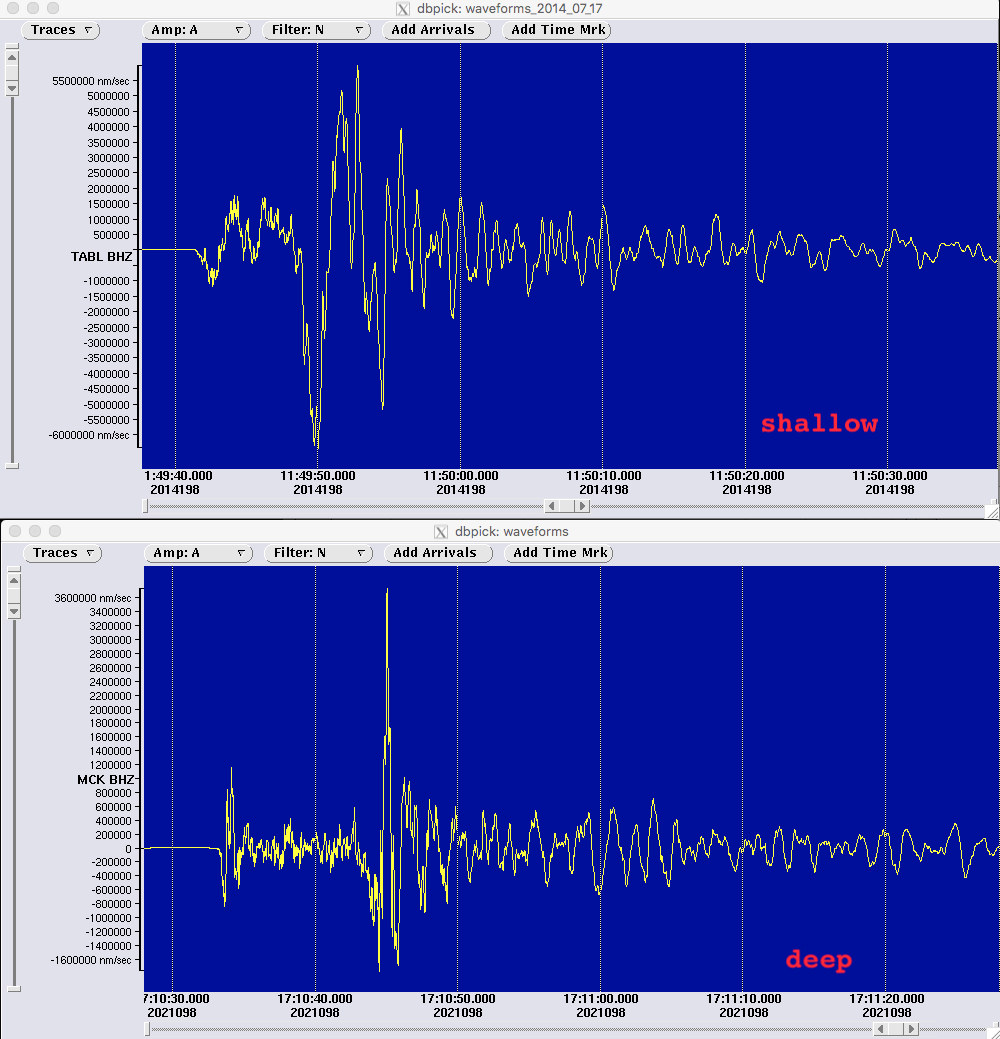
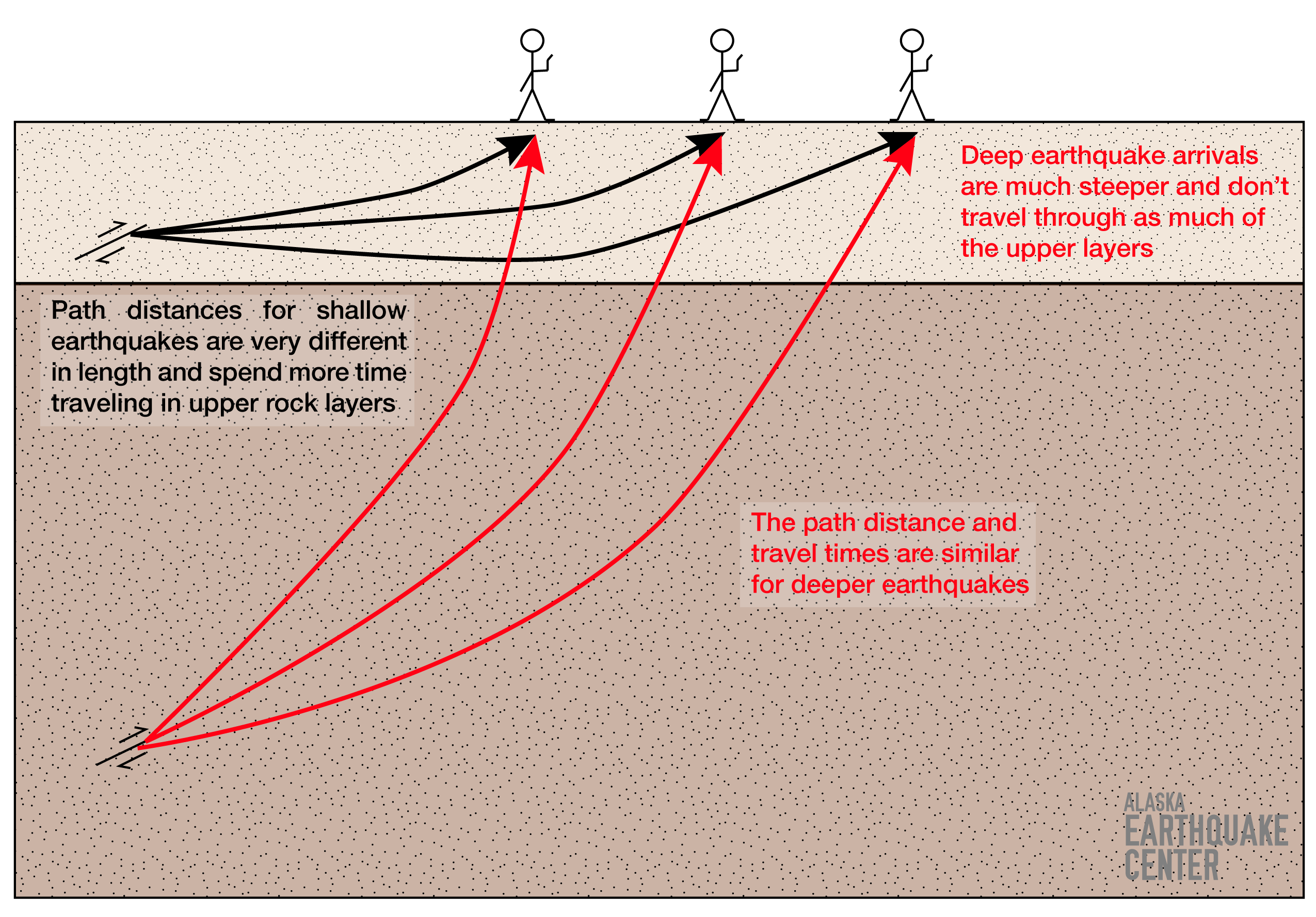
At 48 miles deep, the waves from this earthquake traveled through Earth’s mantle, the dense layer beneath the surface crust. “The mantle is more uniform and dense because of pressure, so seismic waves travel really efficiently through it,” said Holtkamp. “In contrast, seismic waves from shallower earthquakes spend more time in the crust where they bounce around as they travel through a greater variety of rocks, so you can feel them reverberate longer.” Seismic waves from the April 8 M5.5 earthquake traveled undisturbed through the mantle and reached the surface without much time for reflection or refraction in the crust (see figures 2 & 3). So although observers felt the earthquake a long distance from the source, the shaking didn’t last very long and lacked the more vigorous shaking of a shallower earthquake. This phenomenon is described in more detail here.
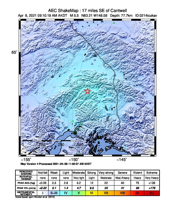
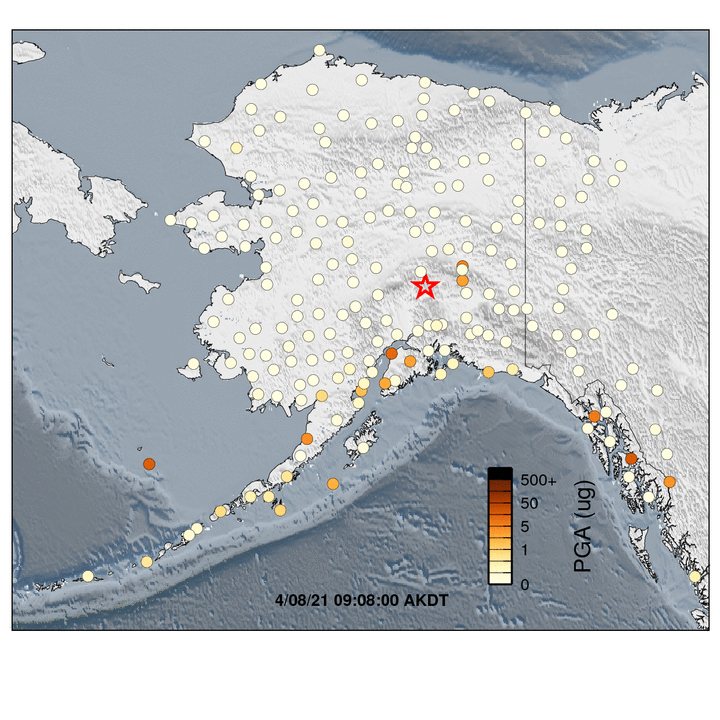
The ShakeMap from the April 8 earthquake also shows another characteristic of a deep earthquake (see figure 4). The colors representing the intensity of shaking are fairly uniform over a large distance. This is because even directly above the earthquake’s origin, you are still at least 48 miles from where it ruptured. A shallow earthquake would show much stronger shaking close to the source, rapidly decreasing as you get farther away.
This type of event is not surprising. While they are not frequent, it’s been a decade since a comparable M5.4 earthquake occurred in Sept. 2010, they have a straightforward source. This event was not an aftershock of any previous earthquake but a result of the Pacific Plate fracturing during the subduction process.
Superficially, the Denali Fault lies nearby, but the April 8 M5.5 earthquake is not linked to the fault. The Denali Fault is shallow, with earthquakes occurring to about 15 miles deep. The Earth’s crust in this region is about 18-25 miles thick. Below that is the mantle, which has no faults. Then below that is the subducting Pacific Plate, where the M5.5 earthquake originated. The animation below developed for Denali National Park has an overview of the tectonics in the region.
And that’s the deeper story behind this morning’s earthquake.