


1964 M9.2 Great Alaska Earthquake
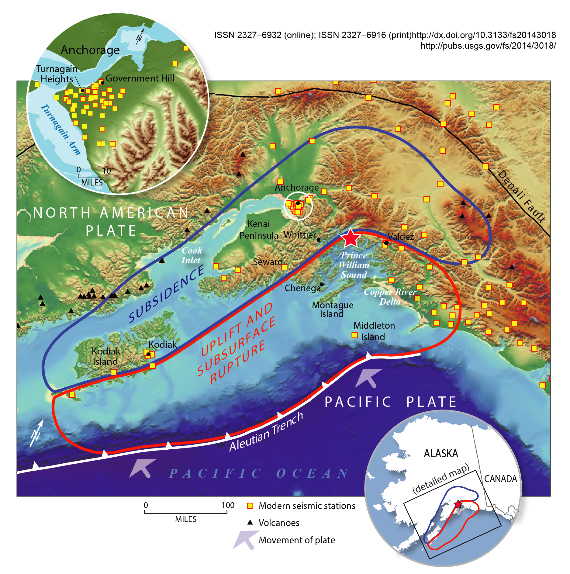
The duration of rupture lasted approximately 4 minutes (240 seconds). The aftershock zone of this earthquake, which is used to determine the rupture area of the event, was about 250 km wide and extended about 800 km from Prince William Sound to the southwestern end of Kodiak Island.
The mainshock ruptured the Aleutian Megathrust. The megathrust is the interface, or boundary, between the Pacific and North American plates.
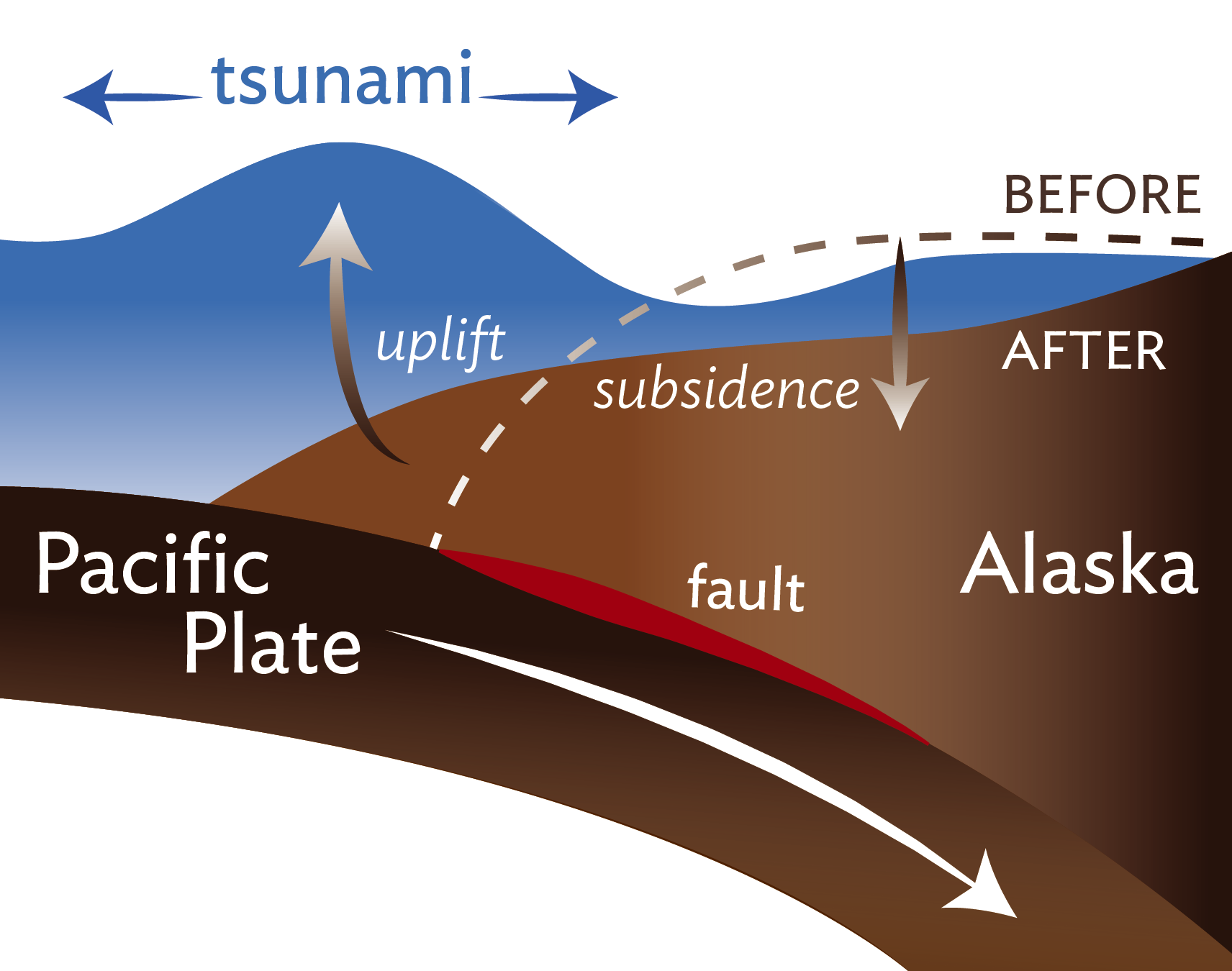
Widespread uplift occurred south of Kodiak Island and the Kenai Peninsula. Some areas experienced uplift of nearly 38 feet. Areas to the north (inland) experienced subsidence, or a dropping of the land. Some areas experienced subsidence of nearly 8 feet. The map below from a USGS Fact Sheet shows the approximate boundary between areas that were uplifted and subsided.
In addition to damage in the epicentral region immediately following the quake, long period seismic waves traveled around the earth for several weeks. Basically, the whole earth vibrated (rang) like a bell during this time. States as far away as Texas and Florida were affected with vertical motions of up to 5 to 10 cm.