
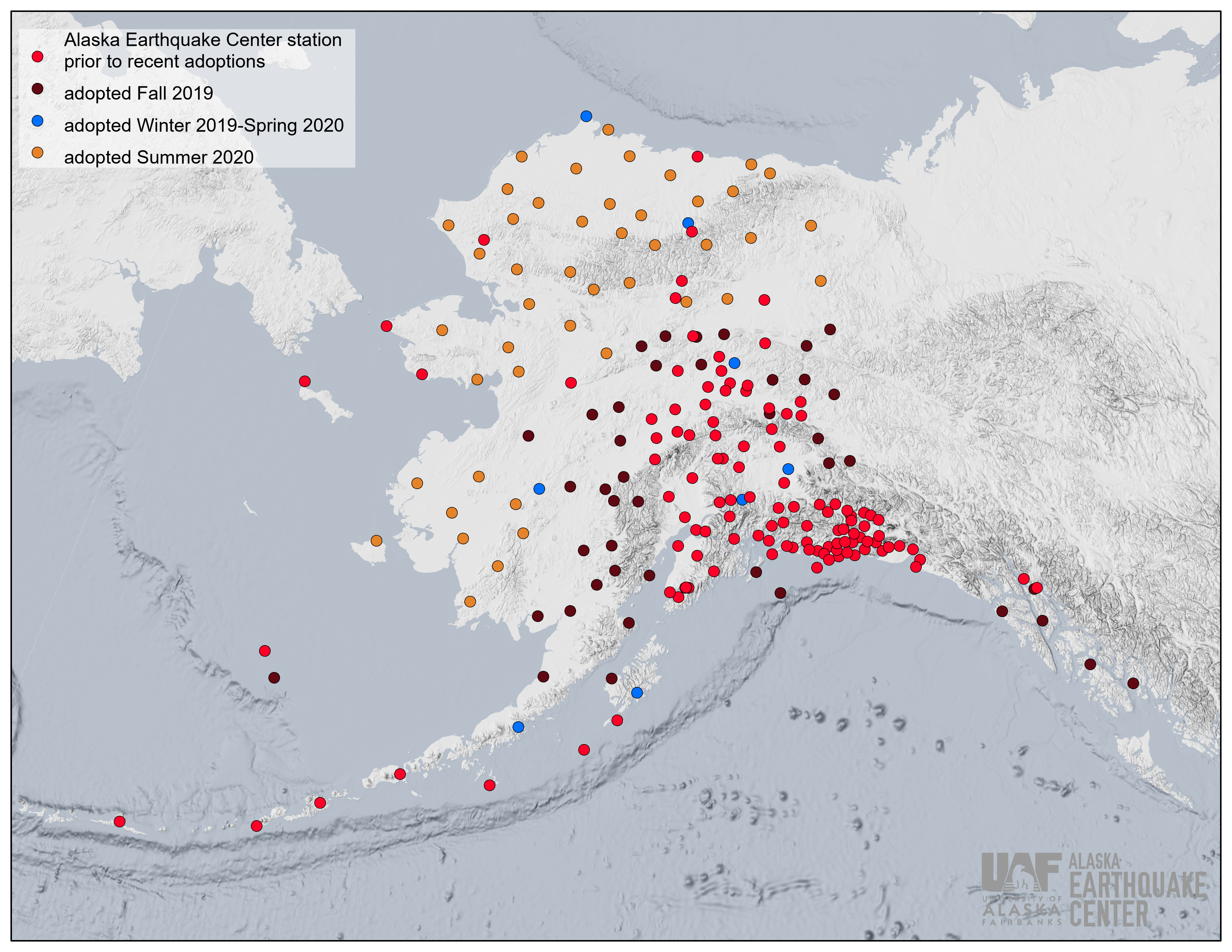


During 2019-2020, the Alaska Earthquake Center underwent an unprecedented expansion of our permanent seismic monitoring network. We were able to achieve it by acquiring 96 of 158 temporary USArray sites in Alaska. These sites were originally installed as part of the USArray portion of the multi-year, multi-million-dollar EarthScope Project funded by the National Science Foundation. The project, however, had a limited time span: all seismic sites were scheduled to be removed in 2020-21 if no agency or organization came forward to take over its equipment and carry on with maintenance and operations. We had our eyes on this project since its early initiation in Alaska in 2014 and were proactive in working with the State of Alaska and the US Congress in identifying key partners and allies in our bid to retain the seismic sites. We also had the advantage of being the last state on the USArray deployment list after it rolled through the Lower 48 from the west to east coast over the course of about 10 years. Sometimes it pays to be last. We learned from other states’ efforts, their successes and failures, and started our adoption efforts early on.
The adoption process began in the fall of 2019 with 43 sites located in Southcentral and Southeast Alaska. This effort was made possible through strong support from the U.S. Geological Survey and backing from Alaska's congressional delegation. This included a buy-out fee to assume ownership for the equipment and a line of support to maintain the equipment, keep data flowing, and use it for earthquake analysis. After this initial adoption, eight more sites were added in the winter of 2019 and spring of 2020. Four of these sites were co-located with larger geophysical observatories and were given to us free of charge to enhance the existing facilities. The final 45 sites, located across the northern and western portions of the state, formally transitioned over this past summer through the program affiliated with the National Science Foundation Arctic Observing Network Program.
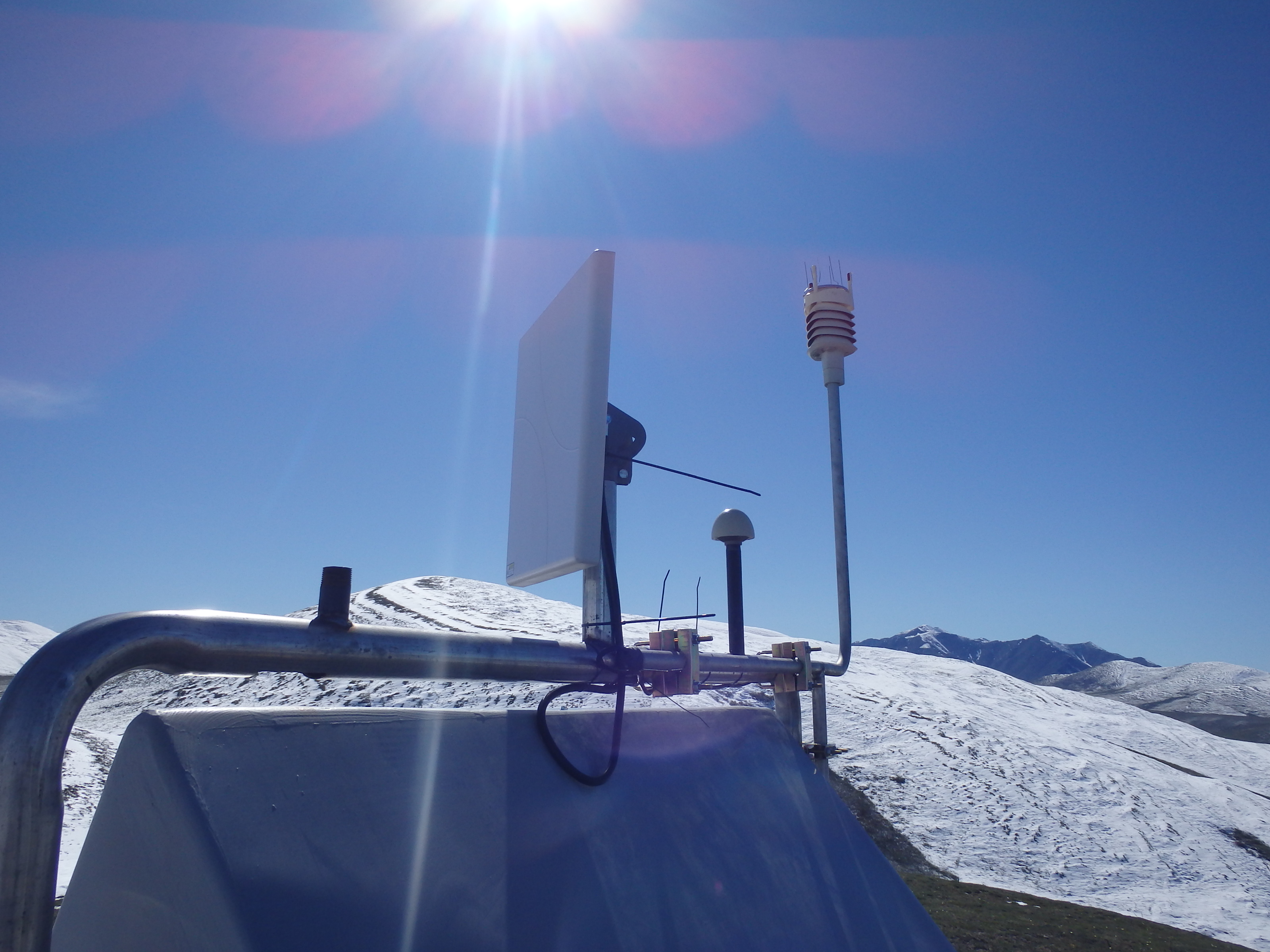
While the original EarthScope goals were focused on investigating the earth’s structure through seismic data, by the time the USArray reached Alaska the instrumentation package had expanded to include meteorological sensors, soil temperature probes, and infrasound sensors. The additional instrumentation allowed researchers and agencies to stretch across different fields and combine efforts to better understand the dynamic and unique Alaska system in new ways and new locations. Looking at the aurora as recorded on USArray sites, using the meteorological data to forecast forest fire behavior, monitoring changes in North Slope permafrost, and better recording of seismic sequences (such as the August 12, 2018 magnitude 6.4 earthquake and its aftershock sequence on the North Slope) are just some of the ways these stations have already benefited the state.
It is through the well-established multi-agency dynamic and the tireless efforts of state and federal agencies and researchers that Alaska has been able to retain an unprecedented and once-in-a-lifetime expansion of 107 new state-of-the-art stations (96 adopted by the Alaska Earthquake Center and 11 by the Alaska Volcano Observatory). This is more than 60% of all Alaska-based USArray sites, the largest state acquisition success story of the 20-year USArray project. This is a fitting new chapter for the instruments, expanding the reach of science across Alaska and creating new opportunities for cross-disciplinary research and long-term seismic, climate, and landscape monitoring.
To read more about our efforts to adopt these stations and their impacts thus far visit:
New multidisciplinary project will boost understanding of earthquakes and Arctic change in Alaska
Checking in on Alaska's swarms and aftershocks
Alaska could soon lose dozens of earthquake sensors if funding isn’t secured