


2021 M8.2 Chignik Earthquake
The M8.2 Chignik earthquake occured in the subduction zone offshore of the Alaska Peninsula, 65 miles to the SE of Perryville, Alaska. It was felt widely across the Alaska and Kenai peninsulas, with felt reports spanning from Milkovo Kamčatka, Russia to Cloverdale, Oregon and places in between. The most up-to-date felt report information can be found on the USGS event page.
As of 2:30 p.m. AKDT on July 30, there are no reports of injuries and minimal damage. A few residents reported a change in color to their well water after the event.
A tsunami warning was issued at 10:15 p.m. AKDT for communities between Samalga Pass, Alaska and the Hinchinbrook Entrance. The communities of Sand Point, Chignik Bay, Chignik Lagoon, Nelson Lagoon, False Pass, King Cove, Old Harbor, Homer, Seward, and Kodiak all promptly evacuated to higher ground until the warning was lifted by an advisory at 00:32 AKDT on July 29. A 10" tsunami wave was recorded on a tide gauge in Sand Point, and other sequential measurements in other locations show a wave under 1' in height.
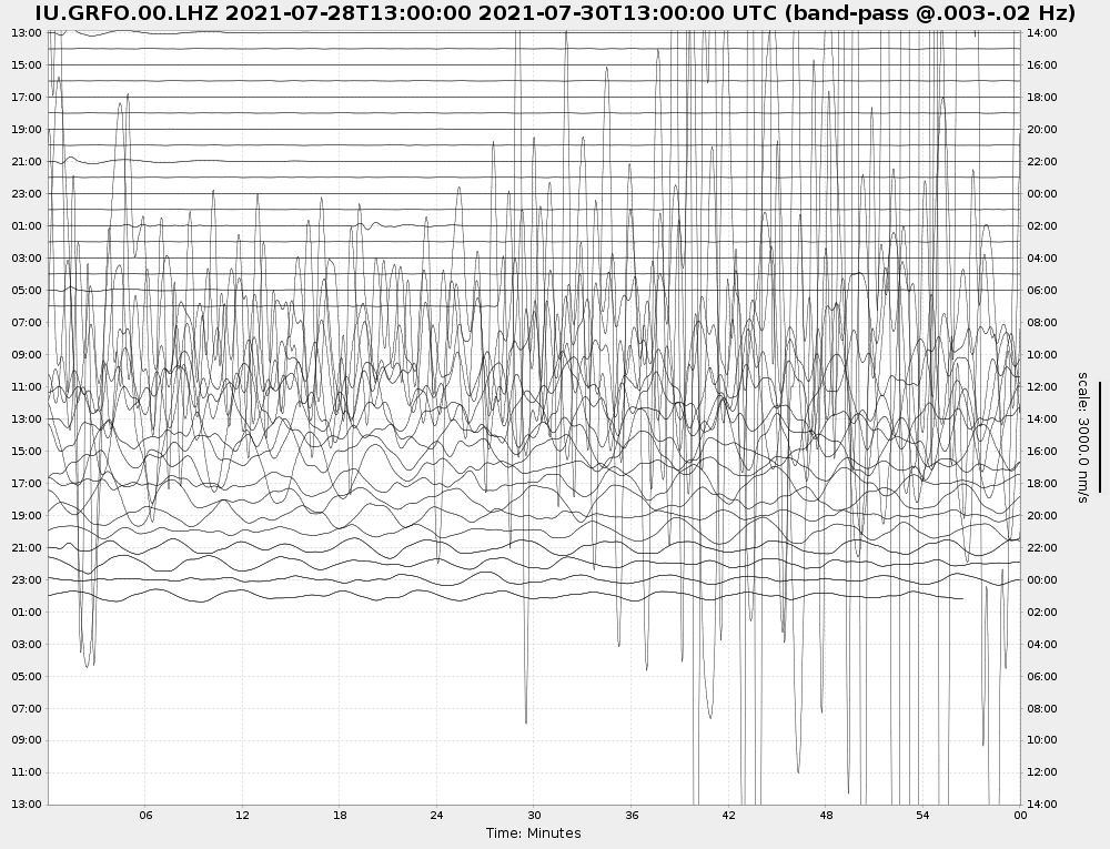
The earthquake also produced so much energy, massive surface waves continued to travel the globe (like how a bell tolls and echos afterwards). The figure below was from station GRFO in Germany, filtered at long periods (30-300 s) and pulled about 19 hours after the event.
We will update this page with more information as the sequence unfolds.