2018 M7.9 Offshore Kodiak Earthquake
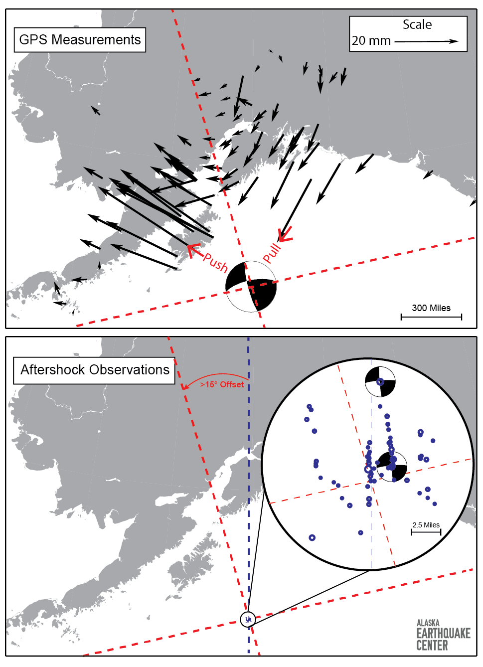
This figure shows some basic observations following the Offshore Kodiak Earthquake. The top panel shows GPS displacement, or change in ground position, observations. These displacements are calculated from GPS positions taken immediately before and after the earthquake and show how the ground beneath each recording station has moved in response to this earthquake. The beachball shows the USGS focal mechanism (double couple component only). The red dashed lines separate the focal mechanism quadrants, which correspond well with GPS displacement arrow changes from compressive (pushed away) to tensional (pulled towards) regimes.

These arrows show a rotation, from pointing towards the earthquake in the east to pointing away from the earthquake in the west, as is typical in strike-slip earthquakes. The boundary between these zones clearly trends NNW-SSE (shown by red dashed line in the top panel).
Seismic observations, however, suggest north-south trending structures. The bottom panel shows a close-up of some of the aftershock locations (expanded in inset with the focal mechanisms of two of the larger aftershocks), which map out the location and orientation of some of the faults that were active during the earthquake. These show that north-south trending faults were at least partially responsible for the earthquake, which appears to be at odds with the GPS observations, since the GPS arrows are not separated by a north-south oriented line. There is a more than 15-degree offset between the two lines. Initial ground motion data from seismic observations of the mainshock (not shown here) also suggest that the earthquake started on a north-south oriented fault.

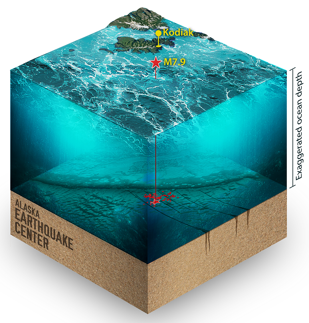
This is an artistic rendering of the seafloor where the Offshore Kodiak M7.9 occurred. You can see that the aftershocks (the red dots on the ocean floor) are spread across several cracks, along which the earthquake is believed to have ruptured.
Website news stories
Offshore Kodiak Magnitude 7.9 Earthquake
Overview of the Offshore Kodiak M7.9 earthquake
Seismology vs. Geodesy: Competing observations from the Offshore Kodiak Earthquake
Tsunami observations from the Offshore Kodiak earthquake
Scientific publications
Ruppert, N. A., Rollins, C., Zhang, A., Meng, L., Holtkamp, S. G., West, M. E., and Freymueller, J. T. (2018). Complex faulting and triggered rupture during the 2018 Mw7.9 offshore Kodiak, Alaska, earthquake. Geophysical Research Letters, 45, 7533–7541. https://doi.org/10.1029/2018GL078931


